Because by being faster, it keeps a much more easterly component vs turning more northerly.wouldnt slightly faster mean a slight jump ? Why would there be a big jump, if its only slightly faster ?
-
Hello, please take a minute to check out our awesome content, contributed by the wonderful members of our community. We hope you'll add your own thoughts and opinions by making a free account!
You are using an out of date browser. It may not display this or other websites correctly.
You should upgrade or use an alternative browser.
You should upgrade or use an alternative browser.
Tropical Hurricane Ian
- Thread starter severestorm
- Start date
-
- Tags
- tropical
Henry2326
Member
The official track forecast is adjusted just slightly east of the previous NHC prediction based on the latest multi-model consensus aid, TVCN.
FORECAST POSITIONS AND MAX WINDS
INIT 27/0300Z 21.3N 83.4W 90 KT 105 MPH
12H 27/1200Z 22.8N 83.7W 105 KT 120 MPH
24H 28/0000Z 24.5N 83.7W 120 KT 140 MPH
36H 28/1200Z 26.1N 83.5W 115 KT 130 MPH
48H 29/0000Z 27.2N 83.1W 105 KT 120 MPH
60H 29/1200Z 27.9N 82.7W 95 KT 110 MPH...INLAND
72H 30/0000Z 28.6N 82.4W 65 KT 75 MPH...INLAND
96H 01/0000Z 31.3N 82.2W 30 KT 35 MPH...INLAND
120H 02/0000Z 35.0N 81.5W 25 KT 30 MPH...INLAND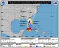

Last edited:
iGRXY
Member
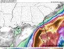
Icon is probably about 50 miles west of the 18Z run. Running parallel to the Florida coast at 39. Makes LF just south of Tampa at 51
That's the 8 PM graphic.View attachment 122220
The official track forecast is adjusted just slightly east of the previous NHC prediction based on the latest multi-model consensus aid, TVCN.
FORECAST POSITIONS AND MAX WINDS
INIT 27/0300Z 21.3N 83.4W 90 KT 105 MPH
12H 27/1200Z 22.8N 83.7W 105 KT 120 MPH
24H 28/0000Z 24.5N 83.7W 120 KT 140 MPH
36H 28/1200Z 26.1N 83.5W 115 KT 130 MPH
48H 29/0000Z 27.2N 83.1W 105 KT 120 MPH
60H 29/1200Z 27.9N 82.7W 95 KT 110 MPH...INLAND
72H 30/0000Z 28.6N 82.4W 65 KT 75 MPH...INLAND
96H 01/0000Z 31.3N 82.2W 30 KT 35 MPH...INLAND
120H 02/0000Z 35.0N 81.5W 25 KT 30 MPH...INLAND
Stormsfury
Member
Still the 8pm graphic. still waiting on the 11pm graphic update.View attachment 122220
The official track forecast is adjusted just slightly east of the previous NHC prediction based on the latest multi-model consensus aid, TVCN.
FORECAST POSITIONS AND MAX WINDS
INIT 27/0300Z 21.3N 83.4W 90 KT 105 MPH
12H 27/1200Z 22.8N 83.7W 105 KT 120 MPH
24H 28/0000Z 24.5N 83.7W 120 KT 140 MPH
36H 28/1200Z 26.1N 83.5W 115 KT 130 MPH
48H 29/0000Z 27.2N 83.1W 105 KT 120 MPH
60H 29/1200Z 27.9N 82.7W 95 KT 110 MPH...INLAND
72H 30/0000Z 28.6N 82.4W 65 KT 75 MPH...INLAND
96H 01/0000Z 31.3N 82.2W 30 KT 35 MPH...INLAND
120H 02/0000Z 35.0N 81.5W 25 KT 30 MPH...INLAND
Here's the 11 PM graphic.


Brent
Member
This is not good.
It’s sped up in the model to the point that the trough doesn’t leave it behind. Also the trough is somewhat deeper and sharper which is why you see it get pushed back NW into the SC once it crosses FL.wouldnt slightly faster mean a slight jump ? Why would there be a big jump, if its only slightly faster ?
iGRXY
Member
Icon is slower and SW through 57 but we will see if it continues a track of the 18z out to sea and a 2nd LF in SC or if it starts that turn to the N
Shaggy
Member
slower so id imagine a tighter run up the coast and less re-strengtheningIcon is slower and SW through 57 but we will see if it continues a track of the 18z out to sea and a 2nd LF in SC or if it starts that turn to the N
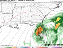
Especially because it stalls offshore near Tampa. That's just not good at all.Right over Tampa at 110 mph ? this would be the worst case scenario for them View attachment 122222
iGRXY
Member
Icon still goes offshore but is much further west and is hugging the Georgia coast. Looks like a 2nd LF will be around Savannah or Hilton Head
Shaggy
Member
Big change on the ICON is the high was back over the norther great lakes region at 18z but is over NY state at 90 hours so that slows it down and forces it right along the coast instead of giving it some breathing room.
What worries me is the ICON is showing strengthening in the ATL 
iGRXY
Member
2nd LF in Savannah as potentially a cat 1 again. Huge rainfall all over SC, NC, Georgia. This track would really increase the winds even more over our area.
Stormsfury
Member
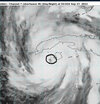
no longer concentric eyewalls. One consolidated circular closed 32 NM wide eye. (965mb)
F. CLOSED
G. C32
F. CLOSED
G. C32
iGRXY
Member
You’re really going to see it start deepening now and with a more easterly track this thing may not weaken nearly as much on approach. A cat 4 right offshore and LF as a Cat 3 is a real possibility right now around Tampa.no longer concentric eyewalls. One consolidated circular closed 32 NM wide eye. (965mb)
F. CLOSED
G. C32
There was a 101kt unflagged.. it's probably already or will be a major by 2 am. my guess 115-120mph and 958-960mb or so by morning
Shaggy
Member
Clearly its how fast the high slides into the blocking position on the icon. A faster storm or slower H building in is what would make it shift back to its 18Z run positions.
iGRXY
Member
I highly doubt you see any weakening over that small portion of Cuba. If anything the friction from land looks to be helping consolidated the eyewall and form the eye now.
iGRXY
Member
If you want to see just how serious the rainfall with this thing is going to get. Just look at the current radar over Florida. Huge bands already rolling in from the interaction between Ian and the stalled front over central Florida. This trough is serious business and you can bet there’s going to be some big totals all along that from as it moves north.
I’m not sure when the last time that a hurricane made landfall in GA…it’s obviously rare due to the shape of the coastline, but this would certainly be a rare track2nd LF in Savannah as potentially a cat 1 again. Huge rainfall all over SC, NC, Georgia. This track would really increase the winds even more over our area.
Geeze, 00z GFS is already 10mb weaker and slower vs 18z at hour 24.
Wait, how does this work? Friction from land helping consolidate, I’m interested in that….(Sorry if banter).I highly doubt you see any weakening over that small portion of Cuba. If anything the friction from land looks to be helping consolidated the eyewall and form the eye now.
Agreed and this is why I would not be suprised at all if the rain spread much further north in advance than what models are showing now. Remember what the radar looked like when Floyd’s eye was still east of Jacksonville, there was rain spread all the way up the east coast into New EnglandIf you want to see just how serious the rainfall with this thing is going to get. Just look at the current radar over Florida. Huge bands already rolling in from the interaction between Ian and the stalled front over central Florida. This trough is serious business and you can bet there’s going to be some big totals all along that from as it moves north.
Eh, GFS crazy nvm. It initialized the storm way too weak vs recon. 977mb lolz
GFS ticks SE at 42 from 18z. All models closing in on Tampa.
Wouldn't the GFS being weaker than reality miscalculate speed/direction though?
Shaggy
Member
Are we really expecting a 1035mb high over NY in September?Wouldn't the GFS being weaker than reality miscalculate speed/direction though?
iGRXY
Member
Yeah GFS too weak but still LF over Tampa
Are we really expecting a 1035mb high over NY in September?
Well the trough is over performing a bit/deeper so maybe idk.
Bruh, it is STILL sitting over tampa at hour 72. that 29 inch map is only going up + surge. ruh roh
Probably not that much. The GFS is still seeing it as a deep system.Wouldn't the GFS being weaker than reality miscalculate speed/direction though?
thanksgivingbrown
Member
Holy cow! If this latest run comes to fruition this is gonna be really bad for Tampa.
iGRXY
Member
you’re playing Russian roulette staying in Tampa at this point. They’re going to be pushing 3 FEET of rainfall on top of 10-12 feet of storm surge for 24 hours. You need to get out ASAP if you’re thinking of riding this out.
And then. And THEN it decides to slowly crawl up the west coast of Florida after walloping Tampa just to make emergency response an absolute nightmare

