Blue_Ridge_Escarpment
Member
NW trend applicable here? Or only December-March?
There ain’t no way that this is suddenly going out to see after all this. I can’t believe it.
It's not exactly out to sea, S. Fl still very much in play on the eps. Also, still longs way to go but with a trough that deep, ots is certainly a possibilityThere ain’t no way that this is suddenly going out to see after all this. I can’t believe it.
Was the trough not that deep in previous models? Any chance they are overdoing the trough?It's not exactly out to sea, S. Fl still very much in play on the eps. Also, still longs way to go but with a trough that deep, ots is certainly a possibility
No it wasn't and yes it's possible.Was the trough not that deep in previous models? Any chance they are overdoing the trough?
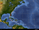
Key will be along with strength of storm, strength of the trough and also orientation. This all can affect the track in huge ways that can still change a lot in 6+ days. The trend is east but I still think a correction west could still be in order over the next couple days.No it wasn't and yes it's possible.
It wouldn’t take much to get it tracking into the gulf againKey will be along with strength of storm, strength of the trough and also orientation. This all can affect the track in huge ways that can still change a lot in 6+ days. The trend is east but I still think a correction west could still be in order over the next couple days.
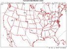
This is Charley all over again.The trend today on the EPS is for a much deeper/south trough which really helps keep the ts away from the coast…except for FL. That is one cold air mass.
View attachment 121804View attachment 121803


That is the EPS mean at just beyond day 5. It probably isn’t wrong by much.Absolutely no chance in hell that cold of an airmass and that deep of a trough happens…classic timeframe for globals to lose their minds, only to come back to previous solutions.
I think this is a rare case where a deeper storm will drift more southerly to start actually, since Fiona is still imparting a ton of northerlies (what’s shearing the storm) on 98L. The more it deepens the more it will feel these northerlies.Really firing deep convection tonight, if this starts to develop quickly, more northern early and increases those far eastern tracks.
Very good point indeedI think this is a rare case where a deeper storm will drift more southerly to start actually, since Fiona is still imparting a ton of northerlies (what’s shearing the storm) on 98L. The more it deepens the more it will feel these northerlies.
Unnerving part is how intense this blow up is. Just imagine if it wasn't sheared!!Some convection firing right over what may be a "center" of circulation and yes still sheared but looking much better
View attachment 121820
Honestly with that convective plume and the some banding, it’s probably near TD status.Unnerving part is how intense this blow up is. Just imagine if it wasn't sheared!!
Honestly with that convective plume and the some banding, it’s probably near TD status.
I could see a Charley type track as well.This is Charley all over again.
Edit: looking at 500mb there are similarities, although the trough next week is definitely farther East.
View attachment 121821
Charley also came from almost scraping SA.
View attachment 121822
Idk why we even watch the gfs. It always caves.GFS has trended to the Euro. View attachment 121825
It just stalls out on the eastern Florida coast.The 00z GFS floods central FL
View attachment 121827
Meanwhile Tallahassee gets no rain.The 00z GFS stalls and puts the entire I-4 corridor under water.

Sent from my iPhone using Tapatalk
