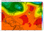
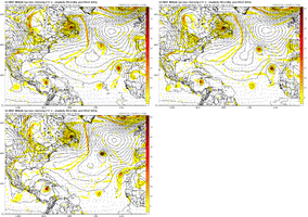
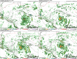
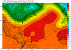
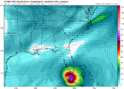
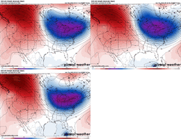
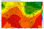
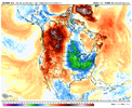
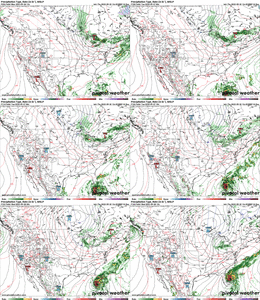
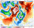
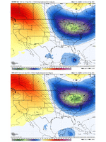
This is a nice little analogy. While not always the case, I think if we have a well defined low pressure moving into this region over the next week the modeled environment is very supportive of a period of rapid intensification if not just modest intensification. Divergence aloft is amazing in the wake of Fiona’s shear leaving an area that could well ventilate this systems outflow. On top of waters untouched from cyclones this year that are quite warm. Recipe for an explosionOne thing I do know is to never underestimate the west Caribbean. If the east side is the graveyard, the west is the nursery.
-
Hello, please take a minute to check out our awesome content, contributed by the wonderful members of our community. We hope you'll add your own thoughts and opinions by making a free account!
You are using an out of date browser. It may not display this or other websites correctly.
You should upgrade or use an alternative browser.
You should upgrade or use an alternative browser.
Tropical Hurricane Ian
- Thread starter severestorm
- Start date
-
- Tags
- tropical
LickWx
Member
I spent spring break at Edisto. I loved that place, very quiet and secluded. Perfect.Yep, Edisto is kind of a one way in and out deal too. I believe it was Matthew that wreaked havoc along that area which they had to rebuild the beaches over. Took a couple houses out into the ocean too.
Cary_Snow95
Member
Cary_Snow95
Member
The good news is conditions along the northern gulf still look pretty hostile as the hurricane approaches which would take a decent chunk out of some the bite. Surge would probably still be a big issue if we get a few RIC before hand.
Cary_Snow95
Member
Watch it get thrown OTS after hitting Cuba.View attachment 121761
Cmc may be onto something
Hate sounding provocative but strength/pressure is the probably the thing I'm most sure about, ocean heat content and upper air pattern scream RI and this becoming an elite hurricane. tracking this thing once it gets into the NW Caribbean is going to be a tripOn the bright side, pressure isn't in the 920s like the runs from Yesterday.
Cary_Snow95
Member
Cary_Snow95
Member
Looks like it’s been cleared for takeoff
So the Canadian, Euro, and Icon heading to the southern tip of Florida. The GFS is literally in left field with the UK splitting the difference. Going to be a fun model battle coming up folks.
I agree with this as well. Eastern GOM and this could ignite quickly all the way to the coastHate sounding provocative but strength/pressure is the probably the thing I'm most sure about, ocean heat content and upper air pattern scream RI and this becoming an elite hurricane. tracking this thing once it gets into the NW Caribbean is going to be a trip
Cary_Snow95
Member
iGRXY
Member
Crazy because previous runs have had temps in the low 50s in my neck of the woods while the hurricane is rolling through which is insane to think about.
The euro is going to be close to hooking it back west into the mid Atlantic/NE but a punt OTS seems more likely
iGRXY
Member
I think the GFS is too west and the Euro Op is too far east. Still think the eastern gulf between Panama city and Tampa is the most likely location for landfall right now.
The first 96 hours are so critical to the outcome. Having the models come together minus the gfs is nice but an error and a weaker system early flips this back to west of FL. Given this thing looks like ---- right now I'm not sure it's off the table
On to the EPS for a reality check.
iGRXY
Member
Exactly. To me this thing still has at least another 36-48 hours before it can truly even get off the ground much less become a sub 1000mb low pressure and while I do think RI is going to happen the best bet is going to be in the waters west of Cuba and into the Gulf itself. The Euro really has this thing going bonkers within the next 72 hours which just doesn't look all that plausible based on current satellite and the fact that it's fighting of the outflow from FionaEuro strengthens the ts quicker and thus further north early which is all it takes to get a whiff, outside of FL.
View attachment 121769
Crazy because previous runs have had temps in the low 50s in my neck of the woods while the hurricane is rolling through which is insane to think about.
Its the October Cane: Flavor: Hazel did the same thing

GOES-19 - Sector view: Caribbean - Band 13 - NOAA / NESDIS / STAR
Near real-time publication of GOES-East and GOES-West images from NOAA/NESDIS/STAR
There are going to be some wild solutions in this suite with the trough in the NEOn to the EPS for a reality check.
iGRXY
Member
I agree. All of the models that wanting to bring it up further east are also the ones that want to develop it much quicker in the short term. Just simply from the eye test and the current environment, it just seems unlikely that we have much more than a TD or minimum TS in the next 48-72 hours. Still a lot of dry air to contend with to inhibit development.Exactly. To me this thing still has at least another 36-48 hours before it can truly even get off the ground much less become a sub 1000mb low pressure and while I do think RI is going to happen the best bet is going to be in the waters west of Cuba and into the Gulf itself. The Euro really has this thing going bonkers within the next 72 hours which just doesn't look all that plausible based on current satellite and the fact that it's fighting of the outflow from Fiona
Fewer Yucatan solutions on the 12z EPS. Overall trend is clearly northeast
iGRXY
Member
If you look at the latest run of the Hurricane spaghetti plots I posted above, the EURO is easily the east outlier while the GFS is the furthest west outlier. Even the western tracks of the spaghetti models have it starting it's NE turn pretty soon after reentering the Gulf.I agree. All of the models that wanting to bring it up further east are also the ones that want to develop it much quicker in the short term. Just simply from the eye test and the current environment, it just seems unlikely that we have much more than a TD or minimum TS in the next 48-72 hours. Still a lot of dry air to contend with to inhibit development.
DadOfJax
Member
Stays weak, shoots the gap, misses the trough, creates its on path to the northern Gulf.....seen this story too many times.
Edit: At least everyone on this board better hope so...if not, this will almost guarantee another week of dry conditions
Edit: At least everyone on this board better hope so...if not, this will almost guarantee another week of dry conditions
Brent
Member
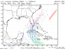
12z EPS tracks. Big shift East
View attachment 121771
If we go anymore east OTS may be a realistic possiblity ?
iGRXY
Member

Still further west vs the Euro and EPS and East of the GFS.
JHS
Member
2 Weeks of dry weather if this misses us. Euro is bone dry for the entire board outside of FLA through day 10 and the GFS has very little precip either, if you take off the stuff from the possible tropical system.Stays weak, shoots the gap, misses the trough, creates its on path to the northern Gulf.....seen this story too many times.
Edit: At least everyone on this board better hope so...if not, this will almost guarantee another week of dry conditions
Interesting. Euro and eps I think are a bit too far east.
ForsythSnow
Moderator
Looks to be about 3 days before we can tell which model is completely off its rocker on where it goes. I'm not exactly buying anything yet nor would I be quick to just go euro for the sake of going euro. Once this thing takes off I'd definitely pool some chips into the hurricane models since they perform best with existing systems.

