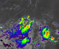
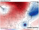
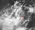
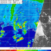
I think this is accurate, little west of your arrows now, but vis loop sure would indicate this is where there is some slight turning.... but yeah shear is brutal. Still seems as if land interaction is helping or may help with the spin upMy best quess of where the wave pocket is, but it's really hard to tell. This is not very defined at the moment and still getting blasted with northerly shear. Fiona needs to get on before this has a change to lift north more over water and organize.
View attachment 121734
-
Hello, please take a minute to check out our awesome content, contributed by the wonderful members of our community. We hope you'll add your own thoughts and opinions by making a free account!
You are using an out of date browser. It may not display this or other websites correctly.
You should upgrade or use an alternative browser.
You should upgrade or use an alternative browser.
Tropical Hurricane Ian
- Thread starter severestorm
- Start date
-
- Tags
- tropical
severestorm
Member
NWMSGuy
Member
Any recon flights scheduled to investigate soon?
Henry2326
Member
It was yesterday afternoonAny recon flights scheduled to investigate soon?
Hmmm I spy with my little eyeMy best quess of where the wave pocket is, but it's really hard to tell. This is not very defined at the moment and still getting blasted with northerly shear. Fiona needs to get on before this has a change to lift north more over water and organize.
View attachment 121734
accu35
Member
It’s hard to believe we are now tracking a possible hurricane maybe powerful in the gulf after a calm season so far.
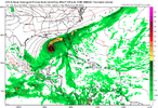
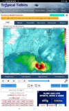
FWIW, first up, ICON into S. Fl and then off the coast, it's way east...
It seems like we will start to see more organization of the system by 12z tomorrow morning, which (if it happens at all) will give us a lot more details even versus today's data.
From my understanding the weaker a storm, the more it kind of "meanders" around slowly and needs more influence to steer around and on the other hand, the stronger the system, the easier it is influenced in it's steering.
If the above is true, I'd assume the stronger solutions would be quicker and on the Eastern side of guidance.
Edit: 12z GFS is coming in with a faster system versus previous run and it may even miss the Yucatan on future frames.
Cary_Snow95
Member
Gfs is east so far. Looking like it’s going to shoot the gap
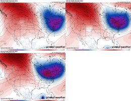
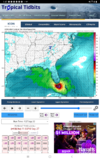
Yeah eastern GOM seems likely but as all have mentioned really, too early for that since we still waiting on development lolGFS a nod to the Euro...they will ultimately probably blend but...
View attachment 121747
Stormsfury
Member
I agree, this would split the 2, but favor EURO
GFS a nod to the Euro...they will ultimately probably blend but...
View attachment 121747
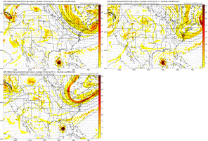
Trending slower with the deep trough (more time to grab 98L)
Cary_Snow95
Member
Nothing to impede rapid development of 98L on this GFS run. ?
Cary_Snow95
Member
On the bright side, pressure isn't in the 920s like the runs from Yesterday.Nothing to impede rapid development of 98L on this GFS run. ?
Cary_Snow95
Member
Gfs has essentially completely folded to other guidance
On the bright side, pressure isn't in the 920s like the runs from Yesterday.
GFS is questionable always with it's pressure forecasts, thankfully. It's Cat 3 and strengtehning based off current run though, just chillin' off the Gulf coast. Cat 4 forecast incoming? Time will tell.
Looks like its still gonna try to slow it way down over the gulf barely moves from hr150-168
Edit- hr150-180
Edit- hr150-180
Avalanche
Member
Is that a deepening EC trough or a retreating one?
The amount of time this run keeps this thing over water.... eyeing down the big bend.. whew
Is that a deepening EC trough or a retreating one?
It's lifting out and GFS becomes trapped
ForsythSnow
Moderator
Yeah, it's just meandering north there and what's worse is that it keeps it over water longer because there's nothing to pick it up yet. It just misses the trough so all it has is that slow northward component. Hopefully that doesn't end up happening because the storm surge with that is going to be terribleIt's lifting out and GFS becomes trapped
ForsythSnow
Moderator
Pensicola-bound this time it seems


12z Canadian second landfall for Stormsfurry


As that ASCAT pass showed earlier and you can clearly see it on vis sat now, there is a definitive vigorous spin over water off the South American coast... once the outflow from Fiona starts to subside might see this develop fairly quick. @Shawn 12Z guesstimate seems very plausible. Tomorrow at this time we may actually be tracking something or tomorrow evening
Cary_Snow95
Member
One thing seems fairly certain.. there’s going to be some serious rainfall associated with this storm well inland
Hey, who you callin' an ASCAT? ?As that ASCAT pass showed earlier and you can clearly see it on vis sat now, there is a definitive vigorous spin over water off the South American coast... once the outflow from Fiona starts to subside might see this develop fairly quick. @Shawn 12Z guesstimate seems very plausible. Tomorrow at this time we may actually be tracking something or tomorrow evening
- Joined
- Jan 23, 2021
- Messages
- 4,602
- Reaction score
- 15,196
- Location
- Lebanon Township, Durham County NC
Imagine the strength the canadian would've shown had it bent back over water another 100 miles east. Looks like landfall directly over Edisto. Beach. If I remember correctly, a land falling cane down around Edisto or just further north is a worst case scenario for storm surge and the peninsula.
DadOfJax
Member
While not ideal for the central gulf coast, the fact that the trough completely whiffs on picking up the storm, this is going to allow for much needed rain inland from MS through NC. Would not want to be anywhere near NOLA to the western panhandle when it comes through.
UKIE eastern GOM although a much weaker system but again still a ways to go...
Imagine the strength the canadian would've shown had it bent back over water another 100 miles east. Looks like landfall directly over Edisto. Beach. If I remember correctly, a land falling cane down around Edisto or just further north is a worst case scenario for storm surge and the peninsula.
Yep, Edisto is kind of a one way in and out deal too. I believe it was Matthew that wreaked havoc along that area which they had to rebuild the beaches over. Took a couple houses out into the ocean too.
severestorm
Member
Henry2326
Member
Like clockwork.Trending slower with the deep trough (more time to grab 98L)
Something else to bring up. I know we like to get caught up in the exact pressure on global models but when a global model computes for a strengthening system like this, they usually tend to underestimate the strength. This is why we use hurricane models to bring the scale size down to the hurricane or storm itself and therefor you get a much better read on pressure fluctuations along the path. Plus we know from a general sense that hurricane strength is very hard to predict vs path. I would focus more on where the storm is headed in global models and then look to mesoscale hurricane models to pin point potentials in strength more accurately.
One thing I do know is to never underestimate the west Caribbean. If the east side is the graveyard, the west is the nursery.As that ASCAT pass showed earlier and you can clearly see it on vis sat now, there is a definitive vigorous spin over water off the South American coast... once the outflow from Fiona starts to subside might see this develop fairly quick. @Shawn 12Z guesstimate seems very plausible. Tomorrow at this time we may actually be tracking something or tomorrow evening

