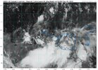
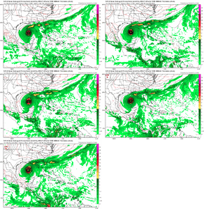
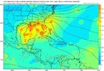
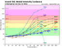
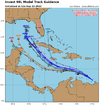
That’s a weird track.Wait, now it's taking a hard right into Pensacola...
-
Hello, please take a minute to check out our awesome content, contributed by the wonderful members of our community. We hope you'll add your own thoughts and opinions by making a free account!
You are using an out of date browser. It may not display this or other websites correctly.
You should upgrade or use an alternative browser.
You should upgrade or use an alternative browser.
Tropical Hurricane Ian
- Thread starter severestorm
- Start date
-
- Tags
- tropical
Avalanche
Member
This!! Its been like gasoline for a while!!The last few years we have seen canes strengthen quickly when they get into the Gulf, too.
- Joined
- Jan 5, 2017
- Messages
- 3,769
- Reaction score
- 5,966
The general idea is that somewhere in the Gulf of Mexico there will be a tropical storm around the first of October. It will likely take the very common parabolic path to the right as it moves out of the Caribbean Sea. How soon can we pin down the path to a meaningful strike zone? Probably another 7 days. If I was on the gulf coast, I'd go ahead and prepare now, especially with supply chain issues. Get your plywood and book your hotel inland.
Agreed
severestorm
Member
This should clear up the model differences somewhat.1. Southeastern Caribbean Sea:
Showers and thunderstorms associated with a tropical wave located
over the far southeastern Caribbean Sea have changed little in
organization since this morning. Environmental conditions are
forecast to become more conducive for development, and a tropical
depression is likely to form within the next couple of days. The
disturbance is forecast to move west-northwestward across the
eastern Caribbean Sea during the next day or two, and be over the
central Caribbean Sea this weekend. Regardless of development,
locally heavy rainfall and gusty winds are likely to affect the
Windward Islands tonight, and northern Venezuela, northeastern
Colombia, and the ABC island chain during the next couple of days.
An Air Force Reserve reconnaissance aircraft is currently surveying
the system, and data from this mission will be assimilated into
tonight's forecast models.
* Formation chance through 48 hours...high...70 percent.
* Formation chance through 5 days...high...90 percent.
Shaggy
Member
Looks like most of the ens members are east of the Yucatan so the op appears to he the western outlier
Z
Zander98al
Guest
Latest GFS run has landfall in the same approximate area as hurricane Michael a few years ago. That'd be a doozy to still recovering areas, although giving credit to the GFS 200+ hours out on landfall area is hardly recommended at this point.
accu35
Member
definitely a S&W shift on the 18z Euro compared to the 12z
Can’t wait for a storm to actually form and see the responses to each individual model run!?
lizajane
Member
Whaat! Is this a pop up?
Taylor C
Member
A strengthening and northwest turn all taking place from now through this time tomorrow. Interesting short term things to watch. Long term seems like things are consolidating on western Cuba taking a hit.
GFS now has it making landfall in Louisiana.


accu35
Member
?GFS now has it making landfall in Louisiana.
Katrina-esque, ont that GFS runGFS now has it making landfall in Louisiana.
Brent
Member
Lol CMC after having the most west track is now the most east, south FL, off EC and very little impact for SE. Euro consistent around Tampa area. Thing still a mess right now with no discernable vort.
Yeah I’m going to have to put more eggs in the euro model basket. Stayed the most consistent, initially has a stronger system in the Caribbean which helps that more right turn track to put it over Cuba and then up the East coast in some fashion. With the CMC most East and the Gfs most west it just makes sense to split the difference with the euro right down the middle.. also it would be realllyyyy helpful for models to get an actual area of low pressure to initialize to help out so we need that piece first for much greater accuracy. let’s see how todays 12z goes
BHS1975
Member
Looks like the broad center is near Trinidad.
DadOfJax
Member
Very favorable trend for AL….much needed rain appears to be on the way. Not so favorable if you are on the coast however. Anywhere from NOLA to PCB looks to be in the zone. Should slowly begin to narrow from here on out.
iGRXY
Member
Still think the eastern panhandle is the most favorable track and then up the 85 corridor. If you look at the upper dynamics and with a trough rolling through that just makes the most sense.
This has tightened up a good bit and really not huge spread for that far out. Euro really hasn't wavered


Yeah, until there is an actual low pressure center, I still think we’re gonna see a wide variety in what we see models do. The overall theme from the H5 look still leads me to believe the biggest threat is the eastern Gulf coast. The latest CMC wants to develop the system too quickly IMO… still a good deal dry air from Fiona’s outflow to deal with in the next day or two. The GFS looks to be too slow as I think once the dry air is overcome development should take off in a hurry. The Euro appears to be a good mean to follow.Yeah I’m going to have to put more eggs in the euro model basket. Stayed the most consistent, initially has a stronger system in the Caribbean which helps that more right turn track to put it over Cuba and then up the East coast in some fashion. With the CMC most East and the Gfs most west it just makes sense to split the difference with the euro right down the middle.. also it would be realllyyyy helpful for models to get an actual area of low pressure to initialize to help out so we need that piece first for much greater accuracy. let’s see how todays 12z goes
The GEFS however showing the Shetley rain shield doing work....


With the potential interaction with the trough as it comes in, much of the southeast could be in for heavy rain as moisture get pulled well north and northeast of the system. Opal in 1995 is good example of that.Very favorable trend for AL….much needed rain appears to be on the way. Not so favorable if you are on the coast however. Anywhere from NOLA to PCB looks to be in the zone. Should slowly begin to narrow from here on out.
UK pretty much agrees with the Euro, might not be quite as deep with the EC trough but still eastern GOM with our system


Yep, doubt seriously the models have a good handle on totals at this point. TC interacting with a trough can lead to some massive qpf that models will struggle with initiallyWith the potential interaction with the trough as it comes in, much of the southeast could be in for heavy rain as moisture get pulled well north and northeast of the system. Opal in 1995 is good example of that.
This is an unsatisfying answer but I’m not really paying attention to models until Saturday when there should be a little more substance with our invest.
This is wise, it's just the rest of us have nothing better to do lolThis is an unsatisfying answer but I’m not really paying attention to models until Saturday when there should be a little more substance with our invest.
ForsythSnow
Moderator
Truly all we can do is look at the possibilities. Sure, there's a strong indicator that this system that has yet to form will hit the US, but where and how strong has yet to even be determined. Too many fine factors that we need to just wait on. Sure the Euro has a tight consensus and consistency but there's been past cases where modeling is consistent and wrong because some monkey wrench shows up and suddenly throws the entire thing into a new path. Too early to make any calls as to where it'll go.This is an unsatisfying answer but I’m not really paying attention to models until Saturday when there should be a little more substance with our invest.
One thing that I’ve seen trip up both hobbyists and seasoned mets alike over the years is overweighting model consensus and consistency. Which don’t get me wrong, are two great things to have. But when those two factors are there people are liable to treat a forecast like a stone cold lock, and almost all of us know better than that lol. Humans crave order. At this point it’s smart to factor in a wide error range so that those inevitable monkey wrenches are easy pills to swallow and not breaking your entire order of how a storm should go.Truly all we can do is look at the possibilities. Sure, there's a strong indicator that this system that has yet to form will hit the US, but where and how strong has yet to even be determined. Too many fine factors that we need to just wait on. Sure the Euro has a tight consensus and consistency but there's been past cases where modeling is consistent and wrong because some monkey wrench shows up and suddenly throws the entire thing into a new path. Too early to make any calls as to where it'll go.
I have absolutely nothing better to do either I’m cleaning my apt because for some reason I volunteered to host people for Thursday night football, I don’t care about the Steelers or browns, why am I doing this to myselfThis is wise, it's just the rest of us have nothing better to do lol
This a great point and really why I focus more on the H5 set up as opposed to the individual solutions. The caveat right now is that we don’t as of yet have an organized system and we may still be 48 hours or more from having one if we do.Truly all we can do is look at the possibilities. Sure, there's a strong indicator that this system that has yet to form will hit the US, but where and how strong has yet to even be determined. Too many fine factors that we need to just wait on. Sure the Euro has a tight consensus and consistency but there's been past cases where modeling is consistent and wrong because some monkey wrench shows up and suddenly throws the entire thing into a new path. Too early to make any calls as to where it'll go.
One thing we need to keep in mind as well is as has been brought up a 1000 times in the other threads, the GFS loves to over so long term ridging. The wall to wall heat wave showing a week or so ago, turned out to be three days.
Henry2326
Member
That is a really great point. Model consensus and consistency 10 days out (and really, you can substitute 7 days out) for a specific weather feature isn't worth the screen it's printed on. Pattern-wise, you could make a case for consensus. But for a hurricane, not so much.One thing that I’ve seen trip up both hobbyists and seasoned mets alike over the years is overweighting model consensus and consistency. Which don’t get me wrong, are two great things to have. But when those two factors are there people are liable to treat a forecast like a stone cold lock, and almost all of us know better than that lol. Humans crave order. At this point it’s smart to factor in a wide error range so that those inevitable monkey wrenches are easy pills to swallow and not breaking your entire order of how a storm should go.
I have absolutely nothing better to do either I’m cleaning my apt because for some reason I volunteered to host people for Thursday night football, I don’t care about the Steelers or browns, why am I doing this to myself
Right now, I would give the system a high probability of becoming a named system and making it into the Gulf. Based on experience and the pattern to date, I would place the higher probability on it being a little slower to develop. I would also place a lower probability on deep troughing shunting it hard right down the line. I still like east/central-ish Gulf going up west of the apps somewhere. If it stalls or slows to a crawl in the Gulf, then it will probably take a hard right at some point.
Very true it seems with the models of late on specific weather features. However I was looking back at the last few years and I gotta say that the Euro has done really well with the path of tropical systems, especially once there is a actual center to track… the Euro was within 50 miles of the landfall points of both Michael and Laura at 7 days out.That is a really great point. Model consensus and consistency 10 days out (and really, you can substitute 7 days out) for a specific weather feature isn't worth the screen it's printed on. Pattern-wise, you could make a case for consensus. But for a hurricane, not so much.
Right now, I would give the system a high probability of becoming a named system and making it into the Gulf. Based on experience and the pattern to date, I would place the higher probability on it being a little slower to develop. I would also place a lower probability on deep troughing shunting it hard right down the line. I still like east/central-ish Gulf going up west of the apps somewhere. If it stalls or slows to a crawl in the Gulf, then it will probably take a hard right at some point.
smast16
Member


