• Hello, please take a minute to check out our awesome content, contributed by the wonderful members of our community. We hope you'll add your own thoughts and opinions by making a free account!

Tropical Hurricane Dorian

684
URNT15 KNHC 281655
AF309 0905A DORIAN HDOB 45 20190828
164530 1810N 06446W 8424 01516 0023 +180 //// 150037 038 063 007 05
164600 1811N 06445W 8437 01509 0054 +173 +173 146062 076 063 016 00
164630 1812N 06444W 8458 01500 0080 +163 +163 136070 075 062 032 03

164700 1813N 06443W 8421 01552 0092 +158 +158 139065 069 059 037 03
164730 1814N 06441W 8436 01545 0100 +157 //// 140066 069 051 030 05
164800 1816N 06440W 8429 01554 0107 +151 //// 139065 068 049 005 05
164830 1817N 06439W 8434 01558 0118 +144 //// 140060 062 048 006 05
164900 1817N 06438W 8427 01570 0120 +141 //// 141058 059 046 005 01
164930 1818N 06436W 8432 01569 0126 +145 //// 143055 057 046 005 05
165000 1819N 06435W 8429 01575 0126 +150 //// 141055 056 044 005 01
165030 1820N 06433W 8424 01580 0125 +156 //// 143054 057 054 006 05
165100 1820N 06432W 8431 01573 0124 +162 +162 147052 056 051 009 03
165130 1821N 06431W 8441 01569 0133 +161 +161 137051 054 050 019 03
165200 1822N 06429W 8421 01588 0139 +157 +157 138049 050 050 020 03
165230 1823N 06428W 8424 01588 0143 +154 +154 142051 052 047 032 03
165300 1823N 06426W 8435 01579 0140 +151 //// 133056 058 041 006 01
165330 1824N 06425W 8426 01589 0129 +151 //// 129061 061 042 005 01
165400 1825N 06424W 8435 01584 0128 +157 //// 129054 060 040 005 01
165430 1826N 06423W 8429 01588 0132 +156 //// 129052 053 038 006 01
165500 1827N 06422W 8424 01595 0137 +158 +158 135053 054 042 007 03
$$
;
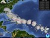
Latest recon pass shows SMFR winds very close to hurricane strength.
 
Gust to 93mph. We may have a Cat 1 now around 80mph. Limestone Beach is taking a beating. Don’t need recon to upgrade this.
 
Last edited:
I have to say no. Ridge is buffing, and this extreme of the cone is going to be eliminated within days is how I feel. I still feel a Frances-like track but a bit north is the way it'll play out.
Regrettably, FS, at this point in time, I very much tend to agree with you.
 
I'm not saying the models are wrong. A lot of people are buying them 100% and that's not really unreasonable but remember last year where florence was modeled for a few days to be a major cat 3 or 4 at landfall and for run after run it plowed into NC.

Then inside even 48 hours the models started sniffing out the slowdown and turn to the SW. Big changes can still happen and I hope people along the entire east coast dont get locked in to the models as though they are absolutely right at 5 days.
 
Hard to bet against King Euro and Queen UKMET. Sorry Florida but the picture is becoming clearer. I would be beating the traffic sooner than later given Labor Day traffic if you don’t like no internet or power.
 
I have to say no. Ridge is buffing, and this extreme of the cone is going to be eliminated within days is how I feel. I still feel a Frances-like track but a bit north is the way it'll play out.
FS, One more item; Frances was 9/5; this one will be 9/1 or 9/2 ...

also...

440px-Hurricane_Frances_radar_mosaic.png

440px-Frances_2004_track.png
 

Attachments

  • th.jpg
    th.jpg
    8.1 KB · Views: 20
Hard to bet against King Euro and Queen UKMET. Sorry Florida but the picture is becoming clearer. I would be beating the traffic sooner than later given Labor Day traffic if you don’t like no internet or power.

Theres also people who boarded up their businesses and homes in PR based on every model run and they have partly cloudy skies
 
Those wanting far inland rains (Charlotte west) need to root for the GEFS, ICON and CMC which are now in the Gulf of Mexico.
 
Granted CMC is a major flood for Georgia, South Carolina and North Carolina. Upslope would be hell. 1-2 feet+.
 
HWRF:
hwrf_ref_05L_32.png
 
CMC is a worst case scenario. Georgia and Carolinas Piedmont are in the north-east quad with tornadoes and flooding. Heavy convection. And mountains foothills start a pre-event of upslope as early as Tuesday.
 
I personally am looking at the models but not putting too much in them as most are initializing too weak, and seeing how bad they have been the past few days but that's my opinion.

Yeah unless one model starts performing very well this storm is going to wind up catching some people way off guard due to the fluctuation.
 
Dorian is now a hurricane.
783
WTNT35 KNHC 281744
TCPAT5

BULLETIN
Hurricane Dorian Intermediate Advisory Number 17A
NWS National Hurricane Center Miami FL AL052019
200 PM AST Wed Aug 28 2019

...DORIAN BECOMES A HURRICANE NEAR ST. THOMAS IN THE U.S. VIRGIN
ISLANDS...
...MULTIPLE OBSERVATIONS OF HURRICANE-FORCE WINDS IN ST. THOMAS...


SUMMARY OF 200 PM AST...1800 UTC...INFORMATION
----------------------------------------------
LOCATION...18.3N 65.0W
ABOUT 0 MI...0 KM W OF ST. THOMAS
MAXIMUM SUSTAINED WINDS...75 MPH...120 KM/H
PRESENT MOVEMENT...NW OR 315 DEGREES AT 13 MPH...20 KM/H
MINIMUM CENTRAL PRESSURE...997 MB...29.44 INCHES


WATCHES AND WARNINGS
--------------------
CHANGES WITH THIS ADVISORY:

The Tropical Storm Watch for the Dominican Republic has been
discontinued.

SUMMARY OF WATCHES AND WARNINGS IN EFFECT:

A Hurricane Warning is in effect for...
* Vieques and Culebra
* U.S. Virgin Islands
* British Virgin Islands

A Hurricane Watch is in effect for...
* Puerto Rico

A Tropical Storm Warning is in effect for...
* Puerto Rico

A Hurricane Warning means that hurricane conditions are expected
somewhere within the warning area, in this case within the next 6 to
12 hours.

A Hurricane Watch means that hurricane conditions are possible
within the watch area, in this case within the next 6 to 12 hours.

For storm information specific to your area in the United States,
including possible inland watches and warnings, please monitor
products issued by your local National Weather Service forecast
office. For storm information specific to your area outside of the
United States, please monitor products issued by your national
meteorological service.
 
I agree with this. Once it gets near the US its going to be a stall and crawl scenario for a couple of days until its either pushed east back into the Atlantic or gets tugged NE .

So, you think it makes landfall in FL, further north, or not at all?
 
FYI now a hurricane:
: ...DORIAN BECOMES A HURRICANE NEAR ST. THOMAS IN THE U.S. VIRGIN ISLANDS... ...MULTIPLE OBSERVATIONS OF HURRICANE-FORCE WINDS IN ST. THOMAS...

2:00 PM AST Wed Aug 28
Location: 18.3°N 65.0°W
Moving: NW at 13 mph
Min pressure: 997 mb
Max sustained: 75 mph
 
Tidbits crashed


Sent from my iPhone using Tapatalk
It's up for me.

And yeah the HWRF is a worst case scenario. Blows it back into a cat 3 as soon as it leaves land and would devastate Tampa Bay as well with the surge until it pulls away. By then it could possibly blow back up into a 4 with the gulf aiding it.
 
Back
Top