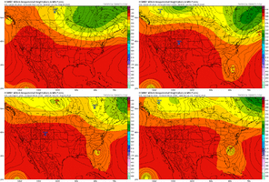
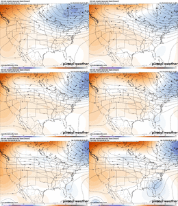
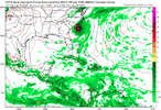
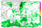
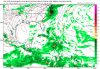
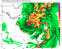
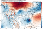
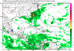
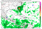
Pretty clear why the EURO hooked it back NW. High pressure centered over interior New England instead of Quebec blocks off the escape to the northeast. However I don’t really see anything on that map that would steer it that far inland. If something like this were to happen, unfortunately I think the result would be the center sitting and spinning out over SC. I wonder if the EPS will give any support for what the EURO just showedIm not sure i have ever seen such a massive change in 12 hours so close to the event
View attachment 149195
View attachment 149196
-
Hello, please take a minute to check out our awesome content, contributed by the wonderful members of our community. We hope you'll add your own thoughts and opinions by making a free account!
You are using an out of date browser. It may not display this or other websites correctly.
You should upgrade or use an alternative browser.
You should upgrade or use an alternative browser.
Hurricane Debby
- Thread starter Brent
- Start date
Henry2326
Member
Henry2326
Member
It's always within 3 days, which is no time for a majority to evacuate.Im not sure i have ever seen such a massive change in 12 hours so close to the event
View attachment 149195
View attachment 149196
They do for the most part, the timing of the left hook and how far west it goes spreads lows from like Norfolk to Mobile up to Huntsville at one point. Its such a big jump in one suite that it seems questionable but the real changes in the Euro suite are happening across the northern tier of the US which expands the central US ridge out. Most other modeling gets some degree of troughing back into the east.Pretty clear why the EURO hooked it back NW. High pressure centered over interior New England instead of Quebec blocks off the escape to the northeast. However I don’t really see anything on that map that would steer it that far inland. If something like this were to happen, unfortunately I think the result would be the center sitting and spinning out over SC. I wonder if the EPS will give any support for what the EURO just showed
Henry2326
Member
Yeah it definitely a big change which is why I would want to see some support for it on the EPS to buy into it.They do for the most part, the timing of the left hook and how far west it goes spreads lows from like Norfolk to Mobile up to Huntsville at one point. Its such a big jump in one suite that it seems questionable but the real changes in the Euro suite are happening across the northern tier of the US which expands the central US ridge out. Most other modeling gets some degree of troughing back into the east.
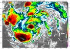
I wonder if that area of convection to the south is starting to take over. If it does then the tracks further west might be closer to the outcome
Shaggy
Member
Yea if the official forecast track is right this will have little wind impacts on the Atlantic side of the track IMOI wonder if that area of convection to the south is starting to take over. If it does then the tracks further west might be closer to the outcome
https://www.nhc.noaa.gov/text/refresh/MIATCDAT4+shtml/022036.shtml
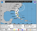
The NHC notes the differences between the GFS and Euro models as far as timing. The NHC is not very bullish with their intensity forecast.
The NHC notes the differences between the GFS and Euro models as far as timing. The NHC is not very bullish with their intensity forecast.
Downeastnc
Member
If the southern center is the one that wins and I think based on sat loops that seems likely and it can for some kind of core before crossing western Cuba that certainly changes things for the Tampa up to Big Bend area....
severestorm
Member
Webber gives a great summary
Webber gives a great summary
and it looks like that area of convection to the north is weakening… if the center develops south of Cuba, not only will it be over water longer, it also won’t be traveling over the tallest mountains
lexxnchloe
Member
lexxnchloe
Member
I could also see that area just off shore south of cuba rotating and looks like the “main” area. IMO
Henry2326
Member
lexxnchloe
Member
Its odd to me that no model develops it much before FLA.I could also see that area just off shore south of cuba rotating and looks like the “main” area. IMO
Henry2326
Member
It doesn't have enough time to consolidate.....at least that's what they think. We will see what it really can do.Its odd to me that no model develops it much before FLA.
Henry2326
Member
I wonder though how much of that has to with the center forecast to stay over land in Cuba and going over tall mountains. If the center is developing south of Cuba like it appears on satellite, then it may very well not be over land except for a short time on the western side of the island with much lower elevationIt doesn't have enough time to consolidate.....at least that's what they think. We will see what it really can do.
I wonder though how much of that has to with the center forecast to stay over land in Cuba and going over tall mountains. If the center is developing south of Cuba like it appears on satellite, then it may very well not be over land except for a short time on the western side of the island with much lower elevation
If consolidates south of Cuba the chances of it getting much farther west increase. Probably still will sling back east toward FL, but the more time passes it may either miss the weakness or have the ridge build back and push it back west.
Downeastnc
Member
I wonder though how much of that has to with the center forecast to stay over land in Cuba and going over tall mountains. If the center is developing south of Cuba like it appears on satellite, then it may very well not be over land except for a short time on the western side of the island with much lower elevation
Its still a large broad area of circulation and even with the center possibly forming south of Cuba the overall effect of Cuba to its organization will be the same for the most part. This is what I am seeing looking at the loops....if this is the eventual center and track it wont organize to much till it gets north of Cuba...
lexxnchloe
Member
^ JB you can’t just say boiling water means RI or CAT5 you have to add more to post cause they didn’t like it when I said it awhile back
severestorm
Member
Wanna wager a Bet on your CAT5 prediction? I'm 99.99% sure ill be right.^ JB you can’t just say boiling water means RI or CAT5 you have to add more to post cause they didn’t like it when I said it awhile back
severestorm
Member
JB just wants more weatherbell subs since he raised the prices.^ JB you can’t just say boiling water means RI or CAT5 you have to add more to post cause they didn’t like it when I said it awhile back
Or may not.
lexxnchloe
Member
18z euro is yikes big time flood threat with that north west hook.
Brent
Member
The NHC initialized south of Cuba but it's still a mess. Nothing is gonna happen quickly
Most of the strengthening will probably be Sunday as it moves close to Florida
Most of the strengthening will probably be Sunday as it moves close to Florida
Downeastnc
Member
IF it can get enough time in the GOM the build a actual decent size wind field with an established strong core it will have much bigger impacts in Florida obviously but also up the chances of it being able to recover enough in the ATL to give NC a actual problem other than rain.
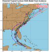
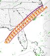
The red track on this would be pretty bad a lot of time over water on that run....would be a red meat cane into MHX/Emerald Isle...
The red track on this would be pretty bad a lot of time over water on that run....would be a red meat cane into MHX/Emerald Isle...
lexxnchloe
Member
Brent
Member
Tropical depression on best track now
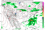
I think if it had gone out further, the EURO would have still turned back to the NW but not as sharply as the 12z run…probably into CHS and then NNW from there. At this frame, the high is building into New England.Euro a bit more east and 9mb stronger at 18z for 12z Tues
12z today
View attachment 149235
18Z today
View attachment 149236
I kinda trust the euro when it comes to hard north west hooks on the east coast from storms in the Caribbean. (Sandy) So I’m not fully on board for a hurricane into eastern NC at all.
Brent
Member
In fact, the
SHIPS guidance and all of the regional hurricane models show the
cyclone reaching hurricane strength before reaching land in the Big
Bend region of Florida in 2 to 3 days
SHIPS guidance and all of the regional hurricane models show the
cyclone reaching hurricane strength before reaching land in the Big
Bend region of Florida in 2 to 3 days

