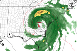
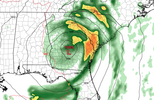
2NWS National Hurricane Center Miami FL AL042024
1100 AM EDT Sat Aug 03 2024
Tropical Depression Four has become somewhat better organized this
morning, with the circulation becoming better defined over western
Cuba and curved convective bands forming close to the center in the
southern semicircle. However, the circulation is still somewhat
elongated with multiple low-level vorticity centers rotating around
the mean center. The initial intensity has been increased to 30 kt
based on surface observations in the Florida Keys and a satellite
intensity estimate from TAFB.
The depression appears to be starting its northwestward turn with
the initial motion now 300/13 kt. A large mid- to upper-level
trough over the central United States is creating a break in the
subtropical ridge, and the cyclone is expected to turn northward
into this break by 24-36 h. This should be followed by a gradual
turn toward the northeast through 60 h. This motion should bring
the center near or over the northern Gulf coast in roughly 48 h.
After landfall, weakening steering currents should cause the cyclone
to slow down while it moves northeastward over parts of northern
Florida and Georgia. The uncertainty in the forecast increases
significantly after 72 h as the cyclone interacts with a portion of
the U.S. trough. The current GFS and ECMWF forecast the system to
move into the Atlantic, and then turn back toward the southeastern
U.S. coast by 120 h. On the other hand, the Canadian model moves
the cyclone slowly northeastward across the southeastern states and
does not bring it over the Atlantic. This portion of the new
forecast track shows a slower forward motion than the previous track
due to changes in the GFS forecast since the previous advisory.
After the system crosses Cuba and emerges over the eastern Gulf of
Mexico, the environmental and oceanic conditions appear favorable
for intensification. Due to the lack of internal organization, the
initial intensification is likely to be slow. However, a faster
rate of development is likely once the system gets better
organized, and the cyclone is likely to be near or at hurricane
strength when it reaches to the northern Gulf coast. Weakening is
forecast after landfall while the system moves over the
southeastern United States. Beyond 72 h, the intensity forecast
remains quite uncertain due to uncertainty of whether the center
will reach the Atlantic and how much interaction will occur with
the aforementioned mid-latitude trough interaction.
Key Messages:
1. Heavy rainfall will likely result in locally considerable flash
and urban flooding across portions of Florida and the coastal areas
of the Southeast this weekend through Thursday morning. River
flooding is also expected.
2. Hurricane conditions are possible late Sunday in portions of the
Florida Gulf Coast and Big Bend region where a Hurricane Watch is in
effect. Tropical storm conditions are expected farther south along
Florida’s west coast, including the Tampa Bay area, and in the Dry
Tortugas where Tropical Storm Warnings are in effect.
3. There is a danger of life-threatening storm surge inundation
along portions of the west coast of Florida from Aripeka to the
Aucilla River. Life-threatening storm surge is possible west of
Aucilla River to Indian Pass and south of Aripeka to Bonita Beach,
including Tampa Bay and Charlotte Harbor.
4. Impacts from storm surge, strong winds, and heavy rains are
possible elsewhere in Florida and along the southeast coast of the
United States from Georgia to North Carolina through the middle of
next week, and interests in those areas should continue to monitor
the progress of this system. Additional watches and warnings will
likely be required later today.
FORECAST POSITIONS AND MAX WINDS
INIT 03/1500Z 22.8N 82.0W 30 KT 35 MPH
12H 04/0000Z 24.3N 83.4W 30 KT 35 MPH
24H 04/1200Z 26.3N 84.3W 40 KT 45 MPH
36H 05/0000Z 28.2N 84.3W 50 KT 60 MPH
48H 05/1200Z 29.8N 83.8W 60 KT 70 MPH
60H 06/0000Z 30.7N 83.1W 40 KT 45 MPH...INLAND
72H 06/1200Z 31.4N 82.0W 35 KT 40 MPH...INLAND
96H 07/1200Z 31.5N 80.5W 40 KT 45 MPH...OVER WATER
120H 08/1200Z 32.5N 80.0W 55 KT 65 MPH


