• Hello, please take a minute to check out our awesome content, contributed by the wonderful members of our community. We hope you'll add your own thoughts and opinions by making a free account!

Hurricane Debby

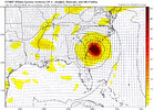
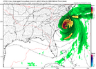
12Z UK: similar to 0Z with LF just E of Apalachicola; then NNE move to WC GA, then ENE/E to CHS, then turns up coast NNE into E NC followed by NE through VA, NE US, SE Can: not as bad flood threat vs other models due to less slowing SE US followed by accel. with it already in NC at 120 vs near GA/SC border GFS/CMC/0Z Euro:

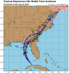
TROPICAL DEPRESSION 04L ANALYSED POSITION : 21.9N 81.3W

ATCF IDENTIFIER : AL042024

LEAD CENTRAL MAXIMUM WIND
VERIFYING TIME TIME POSITION PRESSURE (MB) SPEED (KNOTS)
-------------- ---- -------- ------------- -------------
1200UTC 03.08.2024 0 21.9N 81.3W 1010 27
0000UTC 04.08.2024 12 24.2N 84.0W 1007 31
1200UTC 04.08.2024 24 26.2N 84.7W 1005 40
0000UTC 05.08.2024 36 27.8N 84.9W 1002 46
1200UTC 05.08.2024 48 29.1N 85.1W 1002 45
0000UTC 06.08.2024 60 30.3N 84.6W 1003 30
1200UTC 06.08.2024 72 32.0N 83.9W 1003 37
0000UTC 07.08.2024 84 32.6N 82.4W 997 38
1200UTC 07.08.2024 96 32.6N 80.2W 996 37
0000UTC 08.08.2024 108 33.0N 79.4W 995 40
1200UTC 08.08.2024 120 34.6N 78.8W 996 43
0000UTC 09.08.2024 132 35.8N 78.1W 998 36
1200UTC 09.08.2024 144 37.7N 76.2W 1000 44
0000UTC 10.08.2024 156 42.2N 72.2W 999 36
1200UTC 10.08.2024 168 47.2N 66.3W 996 35
Surprising it cant do anything with such warm water west of FLA but if it keeps moving and never hits water then its just another rainy day in a long list of rainy days we are having.
 
Gotta blame Cuba on this one. They did not allow the US government to survey the storm over land. This led to poor model guidance and center fixes. They have a history of denying us air space.
 
System is still pretty messy and looking at the visible satellite it's quite possible it's elongated SSE to NNW. Given the lack of clouds moving from west to east across the eastern tip of Cuba that vigorous looking area towards key west seems like it's a meso within the larger gyre. That said it could take over but it's not exactly colocated with a ton of vigorous deep convection so I'm not sure
 
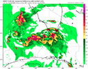
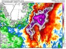
12Z Euro has just about as big a rainfall total for SAV-CHS as 0Z had (15”+) (slightly lower most of corridor but still with insane max ~22” centered on HHI/Beaufort). Also, again a cat 1 H hits CHS.
 
12Z Euro has just about as big a rainfall total for SAV-CHS as 0Z had (15”+) (slightly lower most of corridor but still with insane max ~22” centered on HHI/Beaufort). Also, again a cat 1 H hits CHS.
I’m debating on setting up a live stream at Daffin park at my second home. That area is gonna overspill into historic Savannah.
 
System is still pretty messy and looking at the visible satellite it's quite possible it's elongated SSE to NNW. Given the lack of clouds moving from west to east across the eastern tip of Cuba that vigorous looking area towards key west seems like it's a meso within the larger gyre. That said it could take over but it's not exactly colocated with a ton of vigorous deep convection so I'm not sure
That area just west of key west looking better defined this evening.
 
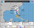
Tropical Storm Debby Discussion Number 6
NWS National Hurricane Center Miami FL AL042024
500 PM EDT Sat Aug 03 2024

The tropical cyclone has become better organized since the last
advisory, with the circulation center becoming better defined over
the southeastern Gulf of Mexico and areas of outer convective
banding to the north and south of the central region. A
combination of earlier scatterometer data, surface observations in
the Florida Keys, and ship reports in the Straits of Florida shows
an area of 30-35 kt winds located about 120 n mi from the center in
the eastern semicircle. Based on this information, Tropical
Depression Four is upgraded to Tropical Storm Debby.

The initial motion is now northwest or 310/13 kt. A large mid- to
upper-level trough over the central United States is creating a
break in the subtropical ridge, and Debby is expected to turn
northward into this break in about 24 h. This should be followed
by a gradual turn toward the northeast at a slower forward speed
through 60 h. This motion should bring the center near or over the
northern Gulf coast in roughly 48 h. After landfall, weakening
steering currents should cause the cyclone to slow down while it
moves northeastward or eastward over parts of northern Florida and
Georgia. The uncertainty in the forecast increases significantly
after 60 h as the cyclone interacts with a portion of the U.S.
trough. The latest GFS and ECMWF models show a slow eastward
motion into the Atlantic, followed by a turn toward the north or
northwest that brings the center back inland. On the other hand,
the Canadian model is still forecasting Debby to move slowly
northeastward across the southeastern states and does not bring it
over the Atlantic. This portion of the new forecast track
continues to show a slow motion and leans toward the GFS/ECMWF
solutions.

Conditions are favorable for strengthening over the Gulf of Mexico
with warm sea surface temperatures and light shear.
Intensification is likely to be slow during the first 12-24 h, then
proceed at a faster rate after the cyclone develops an organized
inner core. The new intensity forecast calls for a peak intensity
of 65 kt at landfall on the Gulf coast of Florida in best agreement
with the HWRF model. Weakening is forecast after landfall while the
system moves over the southeastern United States. Beyond 72 h, the
intensity forecast remains quite uncertain due to the possibility
of land interaction and how much interaction will occur with the
aforementioned mid-latitude trough.


Key Messages:

1. Heavy rainfall will likely result in considerable flash and urban
flooding across portions of Florida and the coastal areas of the
Southeast this weekend through Thursday. Significant river flooding
is also expected.

2. Hurricane conditions are expected on Monday along portions of
the Florida Big Bend region where a Hurricane Warning is in effect,
with tropical storm conditions beginning late Sunday. Tropical storm
conditions are expected through Monday farther south within the
Tropical Storm Warning along Florida's west coast, including the
Tampa Bay area and the Lower Florida Keys.

3. There is a danger of life-threatening storm surge inundation
along portions of the Gulf coast of Florida from Aripeka to Indian
Pass. Life-threatening storm surge is possible south of Aripeka to
Bonita Beach, including Tampa Bay and Charlotte Harbor.

4. Impacts from storm surge, strong winds, and heavy rains are
possible elsewhere in Florida and along the southeast coast of the
United States from Georgia to North Carolina through the middle of
next week, and interests in those areas should continue to monitor
the progress of this system. Additional watches and warnings will
likely be required tonight or on Sunday.


FORECAST POSITIONS AND MAX WINDS

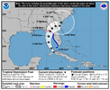
INIT 03/2100Z 23.9N 83.2W 35 KT 40 MPH
12H 04/0600Z 25.3N 84.1W 40 KT 45 MPH
24H 04/1800Z 27.2N 84.6W 45 KT 50 MPH
36H 05/0600Z 28.9N 84.4W 55 KT 65 MPH
48H 05/1800Z 30.2N 83.8W 65 KT 75 MPH...INLAND
60H 06/0600Z 31.0N 83.0W 40 KT 45 MPH...INLAND
72H 06/1800Z 31.3N 82.0W 35 KT 40 MPH...INLAND
96H 07/1800Z 31.5N 80.5W 40 KT 45 MPH...OVER WATER
120H 08/1800Z 33.0N 80.4W 50 KT 60 MPH...INLAND
 
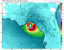
18z icon is wild
Would make for a sporty weather day...about the only way I see any kind of actual winds with this and even then who knows how it's structure would be...I imagine it would be a smaller core with the strong winds limited to the immediate eyewall.
 
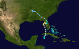
I looked over past tracks of TCs back to 1851. Of those that moved from the GOM inland over W FL N of Tampa through the panhandle, I couldn’t find even one that then moved offshore SE US followed by a curl back NW back into the SE coast like the last few Euro/GFS runs. The closest I could find is Easy of 1950, which could have done it had it first gone offshore FL before curling back:

IMG_0055.png

So, whereas climo doesn’t tell me a curl back NW into the SE coast a la GFS/Euro can’t happen, it does tell me to not be surprised if that ends up not happening and to almost expect it to not.
 
I looked over past tracks of TCs back to 1851. Of those that moved from the GOM inland over W FL N of Tampa through the panhandle, I couldn’t find even one that then moved offshore SE US followed by a curl back NW back into the SE coast like the last few Euro/GFS runs. The closest I could find is Easy of 1950, which could have done it had it first gone offshore FL before curling back:

View attachment 149298

So, whereas climo doesn’t tell me a curl back NW into the SE coast a la GFS/Euro can’t happen, it does tell me to not be surprised if that ends up not happening and to almost expect it to not.
Gives some support to the Icon 18z.
 
Reed Timmer just posted an interesting take. I agree. Anyway, from me, I’m thinking low end CAT 3 but potential for 4/5
 
Back
Top