Henry2326
Member
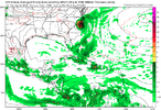
06z HWRF.......has it sitting off south carolina coast at Charleston for 2 days, Tuesday-wednesday.
Alot depends too on how strong it gets before FLA. I would think if it comes off the east coast of FLA mostly intact then a low end cat3 is possible IF it either hits the OBX or just misses. IF it hugs the coast from FLA to here it will just be a sloppy TS.This none is gonna be about angle of exit. Does it move NNE along the coast or N like the icon and euro? Or does it scoot ENE far enough offshore? Pretty sizable impacts to weather depending on which way it trends
Seems a bit over zealous with its deepening and larger wind field as wellIcon is about worst case scenario along and E of 95 wrt to rain
For sure I definitely don't see this dropping nearly 20mb while hugging the SC coast, I hope at least lolSeems a bit over zealous with its deepening and larger wind field as well
Gfs is going to do the same thing just farther north.Seems a bit over zealous with its deepening and larger wind field as well
Potential for a severe event is still there. With all the rain we just had and all the rain we could get a slow moving system with winds to 45-65 over land would tear some trees down easy
Youre right about that, heck last night a tree just decided to fall over and took out the fence around my apartment complex retention pond. I was really hoping July would be as dry as June was to give us as much buffer as possible.Potential for a severe event is still there. With all the rain we just had and all the rain we could get a slow moving system with winds to 45-65 over land would tear some trees down easy
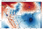
Icon is in decent agreement with the cmc, 6z/0z euro, AI Euro on getting farther north before getting more east movement.How close to the southeast coast is dependent on how far south it enters FL. See difference in 12z ICON and GFS. Icon closer and sometimes on the Atlantic coast. GFS further off.
View attachment 149166View attachment 149167
Ha, it's going to correct toward the GFS scenario. These things love to end up staying just offshore, in the end.
I see three areas of spin but nothing glaring at the moment to make me think every single model is wrong to this point.Could a new center just south of Cuba? Could change things
I will add some future radars have a new area of spin just north of Jamaica later today but idk, I'm not smart enough to predict anything.Could a new center just south of Cuba? Could change things
just under your blue circle 19/77
It may just sit this ring down your way for a few daysThe 12Z Euro is a bit stronger (strongest of all runs into NW FL) and still has a FL Big Bend landfall.
Coming to a consensus with ICON and GFS. I think it will go just west of hatteras at 100 mph.12Z Euro, which is strongest yet into the FL Big Bend, goes offshore at Brunswick and then becomes the strongest in many runs offshore the SE US with a 988 mb H. Then it turns back W and hits CHS, SC, on THU as a 989 mb H before going well inland and weakening.

15 mb stronger than same time frame at 0Z . Trending stronger12Z Euro, which is strongest yet into the FL Big Bend, goes offshore at Brunswick and then becomes the strongest in many runs offshore the SE US with a 988 mb H. Then it turns back W and hits CHS, SC, on THU as a 989 mb H before going well inland and weakening.

Low is too far north a lot of mixing issuesIm not sure i have ever seen such a massive change in 12 hours so close to the event
View attachment 149195
View attachment 149196
