• Hello, please take a minute to check out our awesome content, contributed by the wonderful members of our community. We hope you'll add your own thoughts and opinions by making a free account!

Pattern Freezing Ferocious February

.
fb2e857d817f6e556198654bc585cc65.jpg
31704714178af41e4d3ba0fa5ef501c9.jpg


Sent from my SM-J320VPP using Tapatalk
Give me e11 and/or e18, unless of course it would cost us our souls. Otherwise, SIGN ME UP!!!!
 
Give me e11 and/or e18, unless of course it would cost us our souls. Otherwise, SIGN ME UP!!!!
What about 10,19,20 as well. And actually several more pretty awesome ones. But the first 3 I mentioned are just as good or better for most of middle Tennessee as 11 or 18. The mean is awesome, no doubt them ensembles are great looking for Tennessee.
 
It's just a model run, but not what this Curmudgeon expected to see, or likes to see ... though that's not to say things fall apart ... just something to watch and temper by ...

View attachment 3608
View attachment 3611
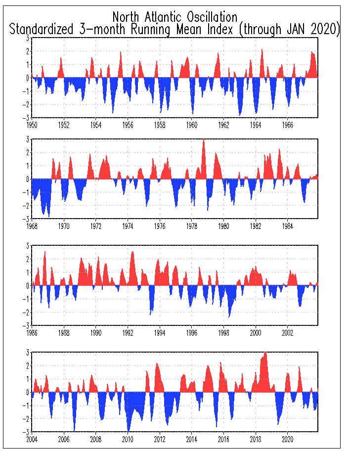
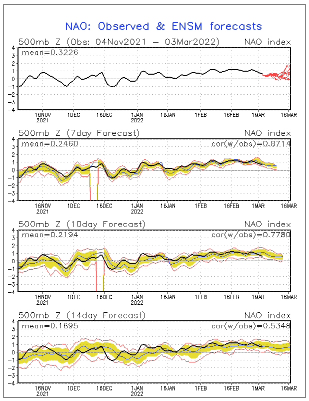
Yea I just found that looked good good good then went the opposite way kinda dramtically tho. Espically on the AO big time negative then it went positive all the sudden. PNA not as drastic tho but still looked like a drastic change
 
Yea I just found that looked good good good then went the opposite way kinda dramtically tho. Espically on the AO big time negative then it went positive all the sudden. PNA not as drastic tho but still looked like a drastic change
Exactly ...
It is just worth watching at this point ...
There is a ghost out there in the models ... and try as one can, there no rhyme or reason to the apparitions ... yet ... :confused:
~~~~~~~~~~~
IMHO only, that ghost is hanging out in the tropics half a world away ...
 
Last edited:
Exactly ...
It is just worth watching at this point ...
There is a ghost out there in the models ... and try as one can, there no rhyme or reason to the apparitions ... yet ... :confused:
~~~~~~~~~~~
IMHO only, that ghost is hanging out in the tropics half a world away ...
And that is why we watch, wait, hold our breath, hold it again, and continue to hold it and see what she do
 
Give me e11 and I'll ride a PooChoo train to Al Gore's house and punch a Man Bear-Pig in the face and make him call me Uncle.
LOL, I'll take nothing less than e1, e4, e11, e14, e15, or e18. The Upstate of SC hasn't cashed in with anything yet. I know for many that an inch or 2 or 3 inches is great, but not so much for us.
 
Good write up by Robert @ WxSouth on his public FB page tonight:

The Thursday into Friday system will be a fast mover, but rain goes to a few hours of snow in eastern Kentucky, eastern TN and the mountains of VA, NC and most of West Virginia, maybe brief flakes east of the mountains Friday. Most accumulations in the mountains. Then that front stalls on the Gulf Coast and here comes a much more potent, interesting system for the Tennessee Valley, the Appalachians , part of NC, SC and VA as well with just barely cold enough air in place as moisture begins breaking out from west to east Saturday evening....significant snowstorm quite possible in or near the Apps region of TN, NC, VA, WV. Its too early to know the exact rain, snow and mixed precip regions just yet though First guess is at my paid site. Thanks to all the new members for your support.
Beyond this, "spokes" of cold air drop into the bowl shaped trough and systems will still be coming in across the western ridge and falling into the mean trough position. Active and changeable are the key words, but our "thaw" is likely over, such as it was. Looks like December through February will end up being below normal temp wise, pretty much a certainty now for most of us in the Southeast and MidAtlantic. Some signals point to extreme cold returning very late month. It may get extremely wild to have such anomalous cold air available with the storm track at it's most active of the entire Winter. If you haven't seen any snow yet, it's not anywhere near over yet.
 
I would love to see a colder version of a storm that occured in March of 2010. It featured a 992mb low that had a perfect track for AL. It also had 850's below 0C and probably an inch and a half of precip. Too bad the boundary layer was too warm or it would have been a top southern snow storm. Looking back, that may have been the most sickening storm ever.
 
I would love to see a colder version of a storm that occured in March of 2010. It featured a 992mb low that had a perfect track for AL. It also had 850's below 0C and probably an inch and a half of precip. Too bad the boundary layer was too warm or it would have been a top southern snow storm. Looking back, that may have been the most sickening storm ever.
Oh yes I remember that storm well...that was the storm when I learned about the boundary layer and that just because the qpf is above the 850MB 0C blue line doesn't mean you'll get snow...no doubt a frustrating storm for me.

18Z ICON has some SN in portions of TN, far N Ga, mountains and into portions of NC 2/4 at the end of it's run, fwiw.
The ICON computer model is a con. Hence the name.
 
The ICON computer model is a con. Hence the name.
I'm hoping it's seeing something. I also swear that if the GFS was 7 to 9 degrees colder, it would be a big storm across the upper SE on the 4th and 5th. The energy is just not pinned down, so anything is on the table still. However, it's slowly narrowing, so it may not happen.
 
Back
Top