SCsnow
Member
That’s OK. I love snow but a skillet load of crappie would taste great.
Ya but for a while he was thinking that it was possible that he would be wrong...but we all got duped by what the teleconnections were looking like, just like "Voldemort" from the old days. Everyone from the intellectuals to the hobbyists. There was only one guy that ended up being right in the shorter term, and that was Shawn. Everyone else had hope because of what the teleconnections were looking like temporarily.
Don't feel like digging it up but he had said that the strong MJO event in phase 7 makes him think that we might have already flipped to a warm-ENSO background.
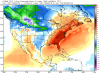
.gif")
Thanks for your honest analysis Webb. Realistic and straight forward as always, even if it's not what some, including myself, want to hear. We'll get over it if it doesn't work outThe stalling of the MJO in phase 7 is likely in one fact attributable to the current NINA background coupled w/ a cool Atlantic MDR which halts further easterly progression into the Western Hemisphere and the current sudden stratospheric warming event/PV split could be perturbing the upper equatorial troposphere and lower stratosphere such that convection is favored over the warm pool yet again in spite of recent MJO passage which also may hinder progression of the MJO into the traditionally less convectively active W Hem (phases 8-1) by inducing large-scale mid-level descent. The evolution of tropical convection and the atmospheric response to this convection the next several will be critical for the development of a potential El Nino this upcoming fall and winter, if the MJO propagates thru the Indian Ocean in the COD w/ little amplitude as advertised by the ECMWF it will do little if anything to stifle/dampen the massive downwelling oceanic Kelvin Wave that's building in the Western Pacific. The suppression of the thermocline all the way down to over 300m well west of the International Dateline is extremely impressive and is about 100m deeper than the previous moderate oceanic KW that roamed across the CP in late December and January. Even if this KW even just maintains its intensity these anomalies will increase a lot as it comes east because the thermocline is much shallower to the east. Thus, it will seem like the KW is "intensifying" as it comes east as the anomalies increase but the reality is it's just not damping as many often do.
View attachment 3976
Everyone here is talking warm weather meanwhile Memphis says significant arctic intrusion possible late next week
Not going to affect many on here at this point but models are trending atm to a battle ground setting up next weekend over Tennessee. The cold air is trending a little further south for a brief period. We have been very close with the two systems this week over this way. We got a solid half inch of snow Sunday on the back end of that system and there is a small band of snow about to move in as I type.LOL,,,I will believe it when we see it...


That's a sad excuse for a happy hour specialHappy hour special! Take it while you can!
 DT! The Man! Calling out Bustardi! LMAO!
very watered down vodka on the rocks; slush ... but it is a Sunday happy hour ...That's a sad excuse for a happy hour special
Sent from my SM-J320VPP using Tapatalk
Lol yep. It's one run and it's happy hour, and if there is blue in states in the SE then it's a special. Even if that special is complete garbage.That's a sad excuse for a happy hour special
Sent from my SM-J320VPP using Tapatalk
Euro has it as well fwiw . But cold chasing moisture does not excite me like it did back in the day .Lol yep. It's one run and it's happy hour, and if there is blue in states in the SE then it's a special. Even if that special is complete garbage.
Hahah good ole DTView attachment 3978 DT! The Man! Calling out Bustardi! LMAO!
hey, at least it's something..no reason to trash that, it's a startThat's a sad excuse for a happy hour special
Sent from my SM-J320VPP using Tapatalk
He's one of the rudest, most hateful ones out there. Goes way overboard with the personal stuff. And he rides the model runs as much as anyone anywhere.View attachment 3978 DT! The Man! Calling out Bustardi! LMAO!
1000+++++++ Likes ...He's one of the rudest, most hateful ones out there. Goes way overboard with the personal stuff. And he rides the model runs as much as anyone anywhere.
")
He's a complete POSHe's one of the rudest, most hateful ones out there. Goes way overboard with the personal stuff. And he rides the model runs as much as anyone anywhere.

Euro has it as well fwiw . But cold chasing moisture does not excite me like it did back in the day .
Sent from my SM-J320VPP using Tapatalk

This is classic. As usual, the stereotypical NINA storm track comes to life late in the winter.
View attachment 3980
Yep you were right 3 months ago ....This is classic. As usual, the stereotypical NINA storm track comes to life late in the winter. I feel so stupid for even considering the cool/Fab February as a legitimate option, I knew sooner or later this would show up and we got lucky this year it didn't happen in January.
View attachment 3980
Yep! You can turnout the lights on the SE. It was just a matter of time before this pattern showed up.
Sent from my iPhone using Tapatalk

No thank you ...Agreed. This large-scale pattern looks primed for severe weather in Dixie Alley/lower TN Valley in general, we obviously need the right triggers and individual systems to take advantage of this but we have the right kind of pattern to produce big early season tornado outbreaks.
View attachment 3981
Yeah, my ground is cracking from the 9” of rain I’ve had the last 3 weeks! Please pray for rain! :weenie:Both of the big models are getting drier for NC and SC outside of the mountains. This area and parts of GA will almost certainly hang on to the drought and see it worsen again over the next few weeks. It would not surprise me at all if everyone east of I-85 in the Carolinas get less than .50 total in rain over the next 2 weeks. So much for the big wet spell here.
 Prepare for cool start to summer and the drought to end soon in TX! He also nailed Fab Feb in October
 been so readyAgreed. This large-scale pattern looks primed for severe weather in Dixie Alley/lower TN Valley in general, we obviously need the right triggers and individual systems to take advantage of this but we have the right kind of pattern to produce big early season tornado outbreaks.
View attachment 3981
We would still possibly get a light coating on the grassy areas verbatim. History indicates we are almost guaranteed at least another dusting before we close the books on the winter.
I think even if it had been a neutral winter the results would have been likewise.This pitiful excuse for a La Niña is able to exert a typical La Niña late winter pattern. What a crock.
DT sux but he’s pretty funny.
Does he not know that analogs aren't exact pattern that repeat exactly the same, but are close instances of past weather to analyze possible future events? A lot has changed since October also, which means they are a lot less reliable.View attachment 3983 Prepare for cool start to summer and the drought to end soon in TX! He also nailed Fab Feb in October
Does he not know that analogs aren't exact pattern that repeat exactly the same, but are close instances of past weather to analyze possible future events? A lot has changed since October also, which means they are a lot less reliable.

Close, but the SER is going way up into KY at the moment. Except for happy hour and the euro today, there isn't much cold support.
Close, but the SER is going way up into KY at the moment. Except for happy hour and the euro today, there isn't much cold support.
So basically you were right all along from December. If even a PV split can't get cold to the South, what can? Pretty sad that it's so hard to get cold down here if you ask me. A PV split of that magnitude and a possible -nao and we still can't get cold, etc? That's pretty pathetic man. What do you think?Agreed. This large-scale pattern looks primed for severe weather in Dixie Alley/lower TN Valley in general, we obviously need the right triggers and individual systems to take advantage of this but we have the right kind of pattern to produce big early season tornado outbreaks.
View attachment 3981
You must have missed the January cold......So basically you were right all along from December. If even a PV split can't get cold to the South, what can? Pretty sad that it's so hard to get cold down here if you ask me. A PV split of that magnitude and a possible -nao and we still can't get cold, etc? That's pretty pathetic man. What do you think?