Round Oak Weather
Member
it's been timeAbout time for one of those isn't it?
it's been timeAbout time for one of those isn't it?
I have progressive lens.Regardless of the type of glasses you have on, next week is active active
Sent from my SM-J320VPP using Tapatalk


A "Ferrocious February" run of the 12z GEFS! I'll cash out with this look. The weatherbell clown maps are going to be off the charts.


Wish that cold would dip down a few hundred miles and a little sooner.

It is really easy to view it on tropicaltidbits. But it’s snow to rainWord on the street is the Canadian looked good for Sunday/Monday.
.Word on the street is the Canadian looked good for Sunday/Monday.


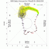
So you're saying it's a knockoutThe Euro continues to move the goal posts on the MJO pulse over the Western Pacific as I expected. The MJO amplitude is likely already above 3.5 sigma, the Australian BOM data already placed the MJO at about 3.4 sigma 2 days ago. It's safe to say the GEFS spanked the EPS in this particular case.
http://www.bom.gov.au/climate/mjo/graphics/rmm.74toRealtime.txt
View attachment 3597
View attachment 3596


.
Need that closed lp out over the water instead of Fayetteville. The Canadian had it off shore yesterday and it went along way in improving the thermals here in NC
Sent from my SM-J320VPP using Tapatalk
Looks like its sending it into the COD.The Euro continues to move the goal posts on the MJO pulse over the Western Pacific as I expected.
Yeah it's pretty safe to say the GEFS took the Euro out to the shed on this one which is why I'm leaning a bit more heavily on the GEFS in the longer term for once (& one of the few times I ever will) over the EPSSo you're saying it's a knockout
Sent from my SM-J320VPP using Tapatalk
Strong signal for sure.A "Ferrocious February" run of the 12z GEFS! I'll cash out with this look. The weatherbell clown maps are going to be off the charts.

Man looking at the gefs members there will be no downtime the 4th-10th on this site
Sent from my SM-J320VPP using Tapatalk
Look at all those pretty green colors over Brick's house!.
Sent from my SM-J320VPP using Tapatalk
Hope it makes it to Phase 8.Yeah it's pretty safe to say the GEFS took the Euro out to the shed on this one which is why I'm leaning a bit more heavily on the GEFS in the longer term for once (& one of the few times I ever will) over the EPS
Yeah it's pretty safe to say the GEFS took the Euro out to the shed on this one which is why I'm leaning a bit more heavily on the GEFS in the longer term for once (& one of the few times I ever will) over the EPS
I'm already questioning whether I should just punt the first half of February as it looks too far away for N GA or hold out and wait and see. Things look like a bunch of cold rain at the moment, but at least the rain is better than the dry.Good then enjoy the present as you have five or so days of the optimist version of me before I decend to the dark corners of negativity.
#whatIdoforsnow
Maybe punt the first 10 days, then it looks like there could be some magic!I'm already questioning whether I should just punt the first half of February as it looks too far away for N GA or hold out and wait and see. Things look like a bunch of cold rain at the moment, but at least the rain is better than the dry.
Punt the first 10 days. But a new rule is in place , if you punt your blocked for those days . Which means when this place is popping middle of next week you won t be able to postI'm already questioning whether I should just punt the first half of February as it looks too far away for N GA or hold out and wait and see. Things look like a bunch of cold rain at the moment, but at least the rain is better than the dry.


Hopefully. However, I have that feeling that I have had all the snow I can this year, having 3 measurable events. A fourth would be great, but I don't think 4 snowfalls up here is all that common. It's likely extremely rare in my opinion.Maybe punt the first 10 days, then it looks like there could be some magic!
Suh-weeet!Holy hell the gefs is banging from Wednesday next week through the following Monday.
Sent from my SM-J320VPP using Tapatalk
Looks like it may suggest a classic Southeast snowstorm as well. I'm just sayin.That suggests Houston and much of the Gulf coast has shot at a THIRD measurable wintry event this winter. I'm educatedly guessing that if that were to actually occur that that would be a record for many along that coast. I'm assuming this map includes ZR but am not sure.

