Touching further on what Phil posted, let's focus on day 14+:
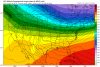
1. PNA: mean looks strongly positive with excellent agreement among the members of the GEFS on day 14 (2/9) with no sign of falling and the model doesn't have a significant bias. So, based on this, I feel pretty confident we'll have a solidly +PNA 2/9 and likely going forward into mid month:
View attachment 3472
2. AO: mean looks strongly negative as of 2/9 (day 14) (sub -2) with most members below -2 and several below -4! So, despite a -0.60 day 14 bias, this still suggests a good chance at a solid -AO (say -2 or lower) day 14 and likely well into mid month.:
View attachment 3471
3. Last but no least, the MJO, which today's Euro monthly (EMON) has going only to ~2.5 for its max in phase 7. More importantly, it then gets much weaker in phase 7. It goes into phase 8 as weak (just outside the circle) and then almost stalls out/moves very slowly. That definitely is a cold signal for mid Feb. and it could be lengthy based on the very slow MJO move then:
View attachment 3473
Conclusion: Despite the NAO likely remaining positive (what's new?), the prospects for the triple combo of a solid +PNA, a solid -AO, and a weak MJO 7-8 and maybe 1 afterward bodes very well for the chance at a very cold SE US mid Feb and beyond.