• Hello, please take a minute to check out our awesome content, contributed by the wonderful members of our community. We hope you'll add your own thoughts and opinions by making a free account!

Pattern Freezing Ferocious February

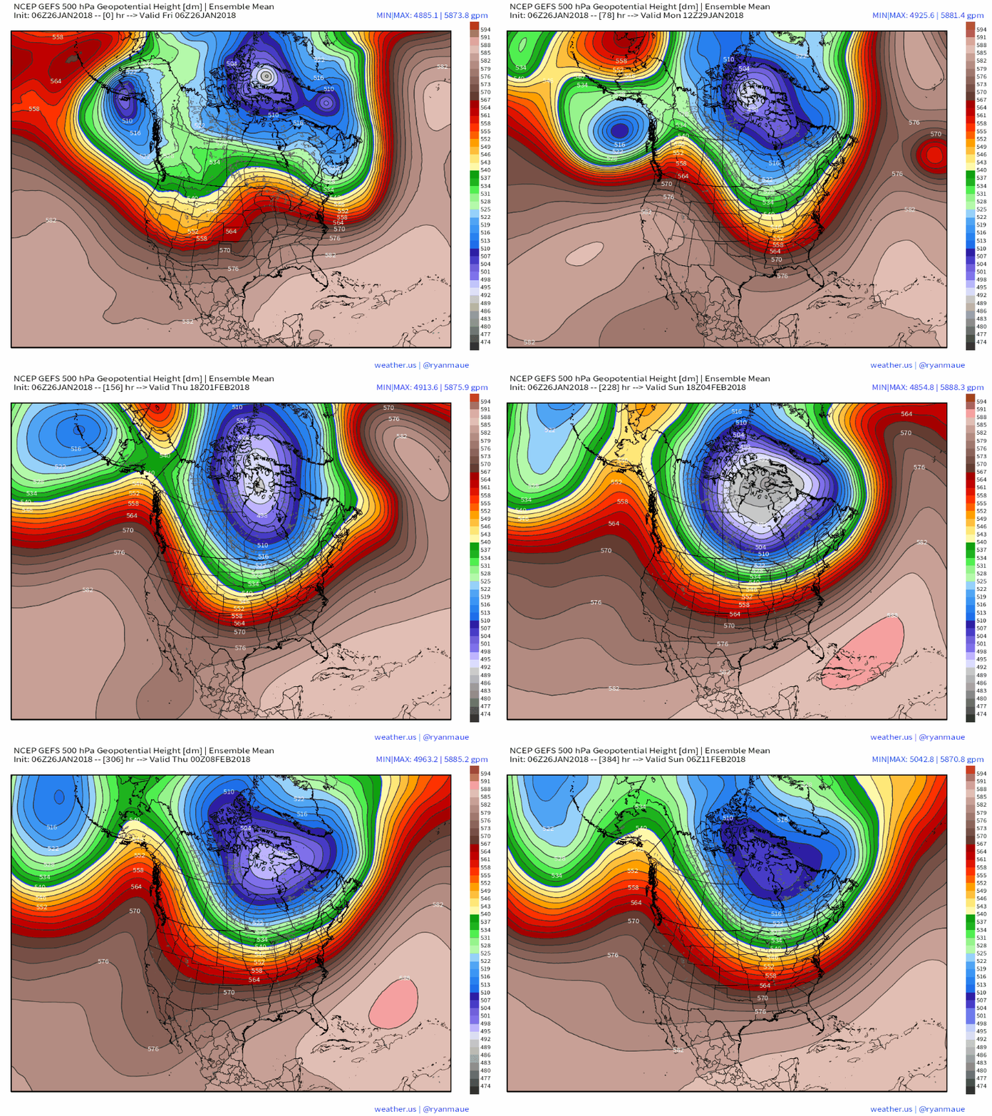
12z gefs looks anemic. However it is improved vs previous runs. This through day ten
fce3696fc86c5ff2543ee4f96cb2c99a.jpg


Sent from my SM-J320VPP using Tapatalk
 
Yep, agreed. I expect the modeling to correct as we move in. Storm opportunities are another matter. Your earlier post about the NAO was interesting. I haven't given any consideration to a -NAO, since it seems they have become so atypical now and usually get lost in the modeling as we close in. It would be nice to get a legit block and the resultant enhanced major winter storm threat.

If we get a nice cyclonic wave break over the eastern seaboard we could produce a temporary -NAO and intraseasonal forcing w/ MJO propagating into the West-Central Pacific favors a negative NAO tendency due to its modulation of the extratropical waveguide and planetary wave juxtaposition, this should at least help destructively interfere with and dampen the background state which wants a strong Greenland/Icelandic Vortex
 
Yep, the GFS in general has been second or third rate at best this season. The last few winter storms (esp the one in early January) it tried to drop a trough into the Rockies in the medium-long range, only to eventually cave to other NWP models and suppress our storm from the midwest & Great Lakes into the SE US
Have you followed the performance of the FV3 or whatever the replacement to the GFS is called? The few times I've looked at it, I haven't been very impressed, but I haven't monitored it's LR 500 performance at all.
 
Pattern isn't going to be good till the 15th anyway. So 10 days away don't matter
 
There's no reason to even think about getting all worked up over a day 9-10+ threat because a particular model suite looks anemic atm. Analogous to when it's stressed to look at the synoptic scale configuration instead of surface precipitation output from NWP models for a particular storm, you should mainly be focusing your attention on the planetary-scale pattern atm and not the details and individual storms for at least another 3 days or more.
 
I expect to see the cold air further south on future runs. Exact timing who knows, but I think winter is going to return to much of the upper and mid-south and perhaps even further south.
 
Have you followed the performance of the FV3 or whatever the replacement to the GFS is called? The few times I've looked at it, I haven't been very impressed, but I haven't monitored it's LR 500 performance at all.
The FV3 is just a tad better than the GFS operational but it's not by much from what I've gleaned it's better with east coast cyclones for sure and it tends to trend more quickly to the "right" solution but it's still inferior to the Euro obviously.
 
The FV3 is just a tad better than the GFS operational but it's not by much from what I've gleaned it's better with east coast cyclones for sure and it tends to trend more quickly to the "right" solution but it's still inferior to the Euro obviously.
Ok, thanks. I hadn't noticed a big difference in accuracy, but I haven't looked very deeply either.
 
If we have a legit shot at a storm it's not going to show up on the models until 5 or fewer days out anyway.
 
12z Euro is much slower with the front late next week vs previous runs

Sent from my SM-J320VPP using Tapatalk
 
Yeah I'm with brick. I don't want snow showing up in MBY 6+ days out.
That's the kiss of death. Last minute trends are all that have worked for me so far this winter
 
So the last storm dictates how future storms will play out ?

Sent from my SM-J320VPP using Tapatalk
It's been like that for at least 90% of the storms we actually get here since I have been on the weather boards.
 
From a model performance framework, I actually completely agree with Brick. A lot of storms in the 7-10 day time frame are dramatically altered once they get into the higher performing time frame of 120 hours inward, which is what I think Brick is basically getting at.
I see the point but You can still frame storm threat ideas outside the day 5 window based on model output . Obviously it's not gonna lock on a solution for a week and keep it the same . To say that a storm won t show up until inside the day 5 window seems kinda silly to me . Details obviously change a million times but you get an idea beyond day 5 based on the overall pattern. So if a model spits out a system at day 8 and the 500mb pattern supports it , it's its not far fetched that a system is possible

Sent from my SM-J320VPP using Tapatalk
 
Last edited:
I have seen plenty of storms show up outside of 5 days, disappear, and reappear. The general gist is that models are going to be less accurate in their depiction of a storm (or whether it exists at all) the farther out you go, which we all already know.

What is common, from my point of view, is that a model will show a storm depicting some form of wintry weather for some part of the SE in the 5-10 day frame. That storm will evolve or disappear for the next several cycles before coming into fairly good focus within 2-3 days. The end result may be A ) a miss (dry), B ) a rainy solution, or C ) wintry weather. Since wintry weather is generally less common than dry or rain, options A and B are the usual outcomes (giving rise to the notion that "we don't get snow from storms that show up 10 days out).

What is not common is that a model will show a major snowstorm 5-10 days out and then carry its depiction of that storm straight through to verification.

It is also common for storms (wintry or not) to pop up inside 5 days. We usually only care about this during the winter anyway. Anecdotally, I think many of our winter storms in recent years have come about in this category due to storm development over or near the area as opposed to long-tracking storm systems (think active STJ with plenty of cold available). I can't remember the last winter that was cold with an active STJ. I would think that would be a pattern where you'd be able to track systems from a farther distance out.

All of this should lead you back to the pattern. Phrases like "I don't believe anything 5 days out" or "Our storms only pop up at the last second" are somewhat misleading, because they are not necessarily in context with the pattern. If the 5-10 day pattern is supportive of wintry weather and the models show a "threat", then the "threat" is valid and shouldn't be discounted because it's outside the magical 5 day cutoff.
 
The ones that actually end up giving us a winter storm here rarely show up on the models the first time outside 5 days.
 
We've tracked many big storms from two weeks out. They don't always go over my backyard, but if the pattern indicates a big storm that shows up on the models, it usually happens somewhere. I believe the big Christmas/Boxing Day storm was like this. Quite a few ended up over DC.

I tend to believe some of the models (like the GFS) more in the 6-10 day period more than I do the day 2-6 period. I'm not sure why they deviate so much during the 2-5 day period. There are known biases that haven't been addressed I guess, along with sorting out all of the new sampled data that gets ingested during that time. Whatever happens, we track and hope for the best! :)
 
Last edited:
Back
Top