WolfpackHomer91
Member
Well, there’s definitely Cold air now 
Sent from my iPhone using Tapatalk

Sent from my iPhone using Tapatalk

Can’t win for nothing lol.Well, there’s definitely Cold air now
Sent from my iPhone using Tapatalk
Give it a model run or two and there will be wholesale changes

Nothing here screams the "February pattern that favors cold and snow" we've heard about since December.
Clover and other types wild grass already starting thick up… mowing is just around the corner
clover, chickweed, and henbit are winter weeds. Nothing new for them to be showing up. They do pop more when there are 60-degree days in the winterClover and other types wild grass already starting thick up… mowing is just around the corner
Seems like there should be a thread for this....
Gonna be covered up in snow by that ULL againClover and other types wild grass already starting thick up… mowing is just around the corner
All depends were the heaviest bands set up… going take some heavy rates to accumulateGonna be covered up in snow by that ULL again
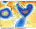
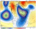
I should have stopped posting right here. If anyone has any ideas or thoughts as to why this same evolution keeps repeating -- long range ensembles show the TPV sliding under the Greenland block and as we move towards D7 always trend away from it -- I'd sincerely like to hear it because frankly I'm at a loss.For years now, we've seen a tendency for the TPV to not fully slide eastward under Greenland blocking when we've had opportunities for it to. If that TPV doesn't fully come under the block and into favorable position in northern New England / southeastern Canada, which the EPS out to 2/19 still isn't showing a definitive signal of, it will likely wreck the pattern and either the Midwest and/or New England will be getting snow while we continue just like we have been. It is hard to break these kind of year-over-year tendencies.
View attachment 145151
At least as of now, it seems like the weaker the TPV is, the more likely it will be to slide east. If it remains very strong, it appears more EPS members keep it further west. Something to consider.
View attachment 145152
Until we can move beyond this multi-year tendency, I think it is wise to continue to look for and assess the signs and indications that it may happen again, while obviously hoping and praying it doesn't.
Poles are moving ( magnetic north) computers are not adjusting far fetched but still possible. Second computer models are being over sampled or have a bias they put on certain Highs or Lows. Just some random idea , who really knows!I should have stopped posting right here. If anyone has any ideas or thoughts as to why this same evolution keeps repeating -- long rang ensembles show the TPV sliding under the Greenland block and as we move towards D7 always trend away from it -- I'd sincerely like to hear it because frankly I'm at a loss.
Basically every other part of the pattern was modeled quite well, including the Greenland blocking, but the TPV is somehow always modeled too far east. This has happened numerous times since 2021 and I really have no explanation for it.
I started watching all that space weather ( Sun ) forecast. Have to say its pretty interesting stuff watching all those ejections, hoping we aint lined up dead square when they happen, which is a lot more than I thought.I should have stopped posting right here. If anyone has any ideas or thoughts as to why this same evolution keeps repeating -- long rang ensembles show the TPV sliding under the Greenland block and as we move towards D7 always trend away from it -- I'd sincerely like to hear it because frankly I'm at a loss.
Basically every other part of the pattern was modeled quite well, including the Greenland blocking, but the TPV is somehow always modeled too far east. This has happened numerous times since 2021 and I really have no explanation for it.
don't have solutions but thank you for posting the evolutions, you've at least pinned down a common thread. i'm at a loss and the only thing i could reasonably think of are faulty sst assumptions in that area but that feels like a brittle argumentI should have stopped posting right here. If anyone has any ideas or thoughts as to why this same evolution keeps repeating -- long rang ensembles show the TPV sliding under the Greenland block and as we move towards D7 always trend away from it -- I'd sincerely like to hear it because frankly I'm at a loss.
Basically every other part of the pattern was modeled quite well, including the Greenland blocking, but the TPV is somehow always modeled too far east. This has happened numerous times since 2021 and I really have no explanation for it.

despite what the pity party would like you to believe, we're not far off from at least a marginal event. i think i'll tone it down some though, i think people are probably tired of the "wahh we are so close" genre of posts. horses and hand grenades, etc
I'm with you on both ends. That didn't sound right. It's close, it's been close, we're always close, it's time to put up or shut up though haha.despite what the pity party would like you to believe, we're not far off from at least a marginal event. i think i'll tone it down some though, i think people are probably tired of the "wahh we are so close" genre of posts. horses and hand grenades, etc
We going to trend to an anafront & the Mid South going to score again. hahahahaView attachment 146332Interesting
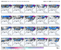
Hopefully we get some truthful trends in the coming days. GEFS did have more of a anafrontal look to it with a few flakes on the backend.CMC ens the best looking model right now. Just like it’s OP many members cutoff from main flow with confluence to the NE View attachment 146333View attachment 146334View attachment 146336
The way that TPV has refused to follow the models east you would think there was a strong WAR that’s effecting things, but that hasn’t been an issue this year. One of the things that’s a bit aggravating is that you can see we will still be prone to a lot of CAD, so we can probably keep looking forward to some 45 degree rains until AprilI should have stopped posting right here. If anyone has any ideas or thoughts as to why this same evolution keeps repeating -- long rang ensembles show the TPV sliding under the Greenland block and as we move towards D7 always trend away from it -- I'd sincerely like to hear it because frankly I'm at a loss.
Basically every other part of the pattern was modeled quite well, including the Greenland blocking, but the TPV is somehow always modeled too far east. This has happened numerous times since 2021 and I really have no explanation for it.
Yep. Definitely some differences between the 2 ens. CMCE with a slightly slower southern wave, better tilt of the northern stream that dives in, and a more dominant feature around the NE that’s not overbearingly squashing anythingHopefully we get some truthful trends in the coming days. GEFS did have more of a anafrontal look to it with a few flakes on the backend.
Sent from my SM-A136U1 using Tapatalk


It's definitely interesting but it looks like basically 3-4 members skewed the mean. If the EPS were to trend this way it would peak my interest a tad.CMC ens the best looking model right now. Just like it’s OP many members cutoff from main flow with confluence to the NE View attachment 146333View attachment 146334View attachment 146336

Ens 17 would be Raleigh’s biggest snow in years… that’s crazy lolIt's definitely interesting but it looks like basically 3-4 members skewed the mean. If the EPS were to trend this way it would peak my interest a tad.
View attachment 146339
Ens 17 would be Raleigh’s biggest snow in years… that’s crazy lol
Gonna find out here shortly if the euro goes that direction imo that’s my only hope is pinching something off
