• Hello, please take a minute to check out our awesome content, contributed by the wonderful members of our community. We hope you'll add your own thoughts and opinions by making a free account!

Pattern February 2024

On the western periphery of the northern vortex is where energy could very easily inject into the strong southern ULL and pull in the needed cold air, and also make precipitation explode over the Carolinas. We want the vortex to be basically exactly where the control has it - further west and it is suppression city as we've seen in past runs.
ecmwf-ensemble-c00-conus-vort500_z500-1706594400-1707112800-1707112800-40.gif
 
Really nice to see the advertised pattern from the weeklies start to show up on the ensembles this morning, specifically the EPS. Western ridge, eastern trough finally, and the active flow undercutting the western ridge. Hope it holds and continues to get closer this week. Verbatim it's warm still, but it's a start. In a few days hopefully it'll cool down quick with that flow.

1706622914615.png
 
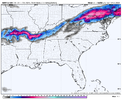
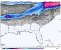
This one is far from over. I think it's pretty clear who's still in the game though. Eastern side of the NC Mountains and especially the escarpment/foothills area back to Charlotte. And possibly Upstate SC.

What we need? The northern vortex to trend a little deeper and further south, while keeping the southern wave robust and in tact enough to get the back axis in to the cold air feed on Monday.

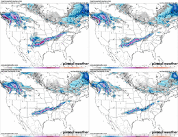
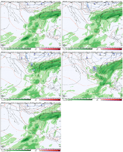
Euro control is pretty much the playbook for this. The GFS/Euro/CMC show the same idea but are just a little too late/too warm to capitalize. (Euro did show some snow around charlotte.)

The dynamics with this storm are strong so there is upside potential if things go right. Also there will be a ripping CAD feed Monday morning so we shouldn't have to fight much of a boundary layer as 925mb temps will crash quick,(assuming the northern lobe drops in hard and heavy beforehand like the Euro control shows)

On the western periphery of the northern vortex is where energy could very easily inject into the strong southern ULL and pull in the needed cold air, and also make precipitation explode over the Carolinas. We want the vortex to be basically exactly where the control has it - further west and it is suppression city as we've seen in past runs.
View attachment 144297
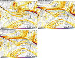
One thing that has bugged me the past few days is how the Euro wants to have this negative tilt to the Canadian ridge. That makes our starting point harder to work with in terms of getting our 50/50 low to torque back to the west a bit.

Jan 30 Euro.png


Also, and this has been discussed, but I feel like we'd want to see the Canadian ridge be tall and have it topple over like a skyscraper falling via the NW Canada low moving east into it (like the Icon - ugh, I said it), which then drops the western side of the 50/50 low due south. The ridge on the Euro C is more of a small hill, so we don't see that type of topple over action (anticyclonic wave break).


Jan 30 Icon.gif


Jan 30 Euro C.gif
 
One thing that has bugged me the past few days is how the Euro wants to have this negative tilt to the Canadian ridge. That makes our starting point harder to work with in terms of getting our 50/50 low to torque back to the west a bit.

View attachment 144303


Also, and this has been discussed, but I feel like we'd want to see the Canadian ridge be tall and have it topple over like a skyscraper falling via the NW Canada low moving east into it (like the Icon - ugh, I said it), which then drops the western side of the 50/50 low due south. The ridge on the Euro C is more of a small hill, so we don't see that type of topple over action (anticyclonic wave break).


View attachment 144305


View attachment 144307
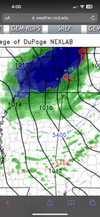
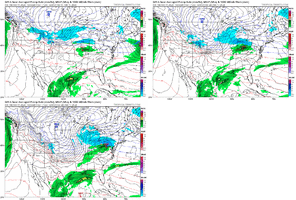
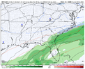
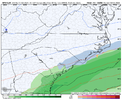
Yes, this is exactly why I posted the end of the 12Z NAM below.
 
One thing that has bugged me the past few days is how the Euro wants to have this negative tilt to the Canadian ridge. That makes our starting point harder to work with in terms of getting our 50/50 low to torque back to the west a bit.

View attachment 144303


Also, and this has been discussed, but I feel like we'd want to see the Canadian ridge be tall and have it topple over like a skyscraper falling via the NW Canada low moving east into it (like the Icon - ugh, I said it), which then drops the western side of the 50/50 low due south. The ridge on the Euro C is more of a small hill, so we don't see that type of topple over action (anticyclonic wave break).


View attachment 144305


View attachment 144307
It’s a fine balance because the change in the orientation is worse for the first digging northern stream piece but better for the second one, the second one is also colder, but the problem is the second one digs in right during the onset or during the storm, we’d need to see slowing trends of the cutoff or continue to tilt that ridge back
 
meh
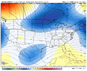
icon_z500_vort_us_29.png
 
bill belichik
I don't mind that run of the ICON at all, past 3 0z/12z runs. I just hope someone gets snow out of this, would be such a waste.

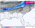
View attachment 144311
they're pretty similar, but mediocre cold press stymied totals some. full view isn't out on TT yet, i do want to see if it kept that northern stream interaction

bill belichick voice we're on to the gfs
 
Back
Top