Avalanche
Member
Well, rain is always appreciated!!!View attachment 146191
Not so great timing
Well, rain is always appreciated!!!View attachment 146191
Not so great timing
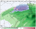
CMC plasters youView attachment 146191
Not so great timing

Understandable but I speak for the board, yall deserve it much more than me.CMC plasters you View attachment 146196
Hilarious View attachment 146215
Beat me to punch. Definitely colder, see how they meet up here in a fewView attachment 146217
looking phaseable
Only way I see this working View attachment 146225
Good just let the frontal boundary swing through in peace so we can enjoy one last freeze this seasonAnyone else notice the southern shortwave trending weaker and weaker? I can’t be the only one who is noticing that
This is when you pull out the "the wave hasn't even come ashore yet" card when the models show a weak wave.Anyone else notice the southern shortwave trending weaker and weaker? I can’t be the only one who is noticing that
I'm actually coming around to the idea of rooting for the shutout now. Statistically speaking, it would argue for increased chances of a reversal next year. Plus, it makes the pity parties more intense.EPS with a jet retraction and NPAC ridge to end met winter !! We are on fire for suckage View attachment 146243
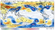
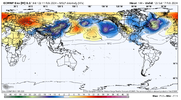
The ENS show a short lived, but big time -EAMT event at day 6-8, and it completely wrecks the pacific afterwards, I guess you can destroy something even further that’s already destroyed. RIPAll the ens now have a big retraction, like a La Niña, in late Feb, jet extension, jet retraction, poleward shifted, equatorward shifted, squidward shifted, it don’t matter, we suck. Weeklies is a fraud model View attachment 146245View attachment 146246View attachment 146247


Oh it changed, it just didn't change like it used to. Warm oceans couple to 500mb in strange ways now.Number of times it was posted the pattern was going to change: 1,236 times
Number of times it changed: 0
Number of times you've been banned from this thread: 1.Number of times it was posted the pattern was going to change: 1,236 times
Number of times it changed: 0
I lifted the ban but folks please make sure that you are putting posts in the right location. The pattern changing or not stuff can go in whammy thread or hell start a new oneNumber of times you've been banned from this thread: 1.
I don't know how many times you guys have to be told to use the threads properly
