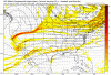
Mean isn’t bad.06z EPS went north with the precip, but not as north as 18z
View attachment 34623View attachment 34624View attachment 34627


Mean isn’t bad.06z EPS went north with the precip, but not as north as 18z
View attachment 34623View attachment 34624View attachment 34627


Funny we had the same thought same time. I do believe more areas could be involved though if the upglide and forcing as Webber alluded to is not being modeled correctlyModels starting to converge on the tidewater and inner coastal plane regions of NC as the sweet spot for wintry wx next week.


Mean isn’t bad.
Gefs has been increasing QPF (more wetter) and has been moving north

Would that be good for the upstateFunny we had the same thought same time. I do believe more areas could be involved though if the upglide and forcing as Webber alluded to is not being modeled correctly

It would mean more precipitation, which could help cool the column but at the same time also bring in warmer air. I think this going to be a storm like last week’s surprise where we don’t know what we are getting until it is falling.Would that be good for the upstate

I still say cold air is being way under modeled here with 2 high pressures in prime locations for the NE Georgia, upstate, through the I85 corridor in NC north to see snow. Globals have been atrocious this winter with temp profiles as well. We will see what mesoscale models say as well before I write this off. This just looks to be modeled wrong quite frankly. That’s not me letting the love for snow talk either. Too many things in prime locations as well as the faults that these models have shown all winter is leading me to believe those particular areas are in for a potential winter storm.


 climate.ncsu.edu
If you go off the globals, this thing is done for anyone not near the VA/NC border. But even the globals are showing things from a Temperature profile even in the column from a high pressure standpoint that would constitute a colder solution. Now CJ does look like he’s got my similar thinking but he can’t just say there’s going to probably be snow in the upstate with something more concrete showing it. That’s why I see he slapped a winter mix here instead.Not in your exact words but sounds like Chris justice thinks the same thing. His scenario probably not a full scale winter storm but a small event none the less. And I have a feeling the nam will do better with picking up cold air more accurately.
Sent from my iPhone using Tapatalk
.png")

Is this good for the upstate
Yea as we move into NAMs range this run seems to have a colder press at the surface from the high pressure out ahead of the system. See if that will continues moving forwardI'm liking the way the Nam ended.


1047 HP running In tandem and you can see the isobars buckle in the CAD regions already. This is also as the sun is going down. The trough also looks west and more consolidation with the energy. That screams lookout down the map.


Yes, the NAM has been very reliable for the thermal profiles this winter, especially inside 36 hours.Nam is 2/2 this year. I’ll get on the nam ship that will take off tonight. Hopefully it’s a snowy cruise. And not a sinking ship. Early indications are the nam will look better then the globals
Sent from my iPhone using Tapatalk


Precip is gaining ground on that 540 line..which doesn’t mean much. The flat orientation of precip/southern stream wave is just a back breaker. I feel like if we had more of SW to NE orientation then temps would respond with that big high pressure sitting up topIcon is moving north but farther away with the highView attachment 34663
Just noticing the same thing. If you look at the past 4 runs, it’s continuing to amp up12z GFS is definitely more amped...trending toward nam at 81hr.. Good to see
Sent from my iPhone using Tapatalk

12z GFS is definitely more amped...trending toward nam at 81hr.. Good to see
Sent from my iPhone using Tapatalk


this a rain storm?View attachment 34668
this a rain storm?View attachment 34668