B
Brick Tamland
Guest
Didn’t the Euro pop a low that tried to run up the coast when it first picked the storm up on Thursday?
Sent from my iPhone using Tapatalk
It sure did.
Didn’t the Euro pop a low that tried to run up the coast when it first picked the storm up on Thursday?
Sent from my iPhone using Tapatalk
I’m just utterly confused. A 1045 high is sitting over the Midwest in an arctic air mass and we can’t break 35 degrees. What’s missing here
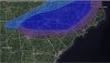
Right this second folks in NE SC through the central coastal plain of NC should be excited. I think folks west and north of there still have a chance.
Oh wow! Yep. Way more amped up. I love seeing the wave losing the flat/progressive nature on multiple models, so the Nam is no longer an outlier. A slight adjustment and a much bigger area of snowfall would be expected....got to love the trends today. 12z Euro is huge to see if the king sticks to his guns.
Sent from my iPhone using Tapatalk
I think Raleigh eastward is golden right now. But it will probably come further NW as usual.I think the models are probably blowing it over nc...soundings certainly show a pretty cold profile where decent precip probably overcomes the shallow warm surface layer. Wetbulb zero heights are at or below 950mb in nc by 12z to 15z...even if surface is 40 it would changeover.
Or, I'm hoping for a more expansive precip field. More amped and that could hurt folks down east and maybe even us.If past experience is any indicator, if we see the models start trending towards an amped up coastal low, that sucker is going to come NW with time.
Is this storm starting to trend away for snow in the upstate north of 85
I wouldn’t be surprised if we see a weak low pop off the coast and enhance things for Eastern NC. A good number of GEFS members and some EPS members are hinting at this and I expect when we get in NAM range it will resolve any features like that far better than the globals.
Looks like the Euro/EPS have screwed the pooch on this one & have been behind the curve from the onset. Everyone that was worried about having this model on board before seriously believing this threat have egg on their face. It was honestly kind of strange to see the EPS and Euro more progressive with the northern stream than the GFS a few days ago, it’s almost always the other way around, this fact certainly left me scratching my head. Moral of the story here: no matter how good a model and its ensemble suite are, they are never infallible & it’s rarely a good idea to put all or even a majority of your eggs into one basket.
This looks like a very legit threat for the I 40 corridor (TN, NC, upstate SC, and VA), Warm advection, isentropic upglide, & frontogenesis will be the primary forcing agents for ascent here, most of the time global models will low ball the magnitude of one, two, or all of the above due to their coarse spatiotemporal resolutions, leading to more widespread and intense precip verifying
To be fair, very early on, the Euro had this while the GFS was showing a lakes cutter through Texarkana. Euro was closest early on but stuck to the suppressed idea for days on end without budging. Which was not helpful if you were trying to make a medium range forecast based on the Euro alone.Yeah it's very odd to see the Euro and EPS catch on so late and suddenly, the GEFS and GFS has led the way surprisingly. I know just yesterday not a single EPS member had anything for NC and then all of a sudden it flipped and now there are 25-30 with snows in NC. NAM is going to be big once it gets in range, especially if we can get a weak coastal to pop like the CMC and some ensemble members are hinting at happening.

Figured that'd happen. SE ridge tends to strengthen as we get closer to event.Also notice that ridge flexing a bit more
The Euro has been very bad with temperature profiles lately. That cold air is coming out ahead of the moisture more and more with each run so far today.Temperatures are a major issue on the Euro..I know I know don’t worry about temp profiles this far out..but I am. It’s cause for concern. Not even close on the Euro verbatim


I don't like it when you have a few ensemble members showing something but not the operational. I know some don't mind not having the Euro onboard, but this is it's money range. If we're talking about missing a phase by a few miles, I could get with the idea that a small change or two leads to a Boom. But in this setup, we're going to need more than one or two baby steps, if the Euro is even close to reality here. I'll be happy to take the egg on my face if I'm wrong. We'll see.Ensembles vs globals Rn, exactly why I’m not freaking out
As far as the overrunning is concerned, we’re hoping for those jet steaks to produce further north and NOT necessarily for a northward jump at this point. Any more of a northward jump on the Euro and we might be in the 50’s..and even with a high approaching 1050 right smack dab in the middle of the country..man, go figure ??I honestly believe the euro will pull further north giving the fact that all the rest of models and Ens have already.
 ??
??It could be that the Canadian and GFS are not very good models. Or maybe the Euro is way out to lunch.I really do not understand how the Euro is so dry compared to CMC and GFS. Comparing them at 500 they look to me quite similar, it even looks like the Euro is further west with the energy we keep watching to help fuel more precipitation. ?

Judging by what I’ve seen here this year, I’d say the latter.It could be that the Canadian and GFS are not very good models. Or maybe the Eiro is way out to lunch.
To be fair, very early on, the Euro had this while the GFS was showing a lakes cutter through Texarkana. Euro was closest early on but stuck to the suppressed idea for days on end without budging. Which was not helpful if you were trying to make a medium range forecast based on the Euro alone.View attachment 34685