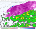
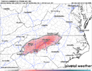
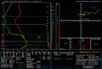
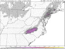
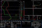
That UHI doing work at CLT rn
-
Hello, please take a minute to check out our awesome content, contributed by the wonderful members of our community. We hope you'll add your own thoughts and opinions by making a free account!
You are using an out of date browser. It may not display this or other websites correctly.
You should upgrade or use an alternative browser.
You should upgrade or use an alternative browser.
Wintry Feb 6-8 2022 Winter Potential
- Thread starter SD
- Start date
rburrel2
Member
Looking like a pretty good chance a few counties will reach warning criteria ice accumulations. Hrr Fram estimates are up to .20+ now.
Tarheelwx
Member
Do Fram estimates usually read on the low side?
TW
TW
rburrel2
Member
Not really, imo... but they're typically somewhat close to reality if you're looking at Fram output on the Hrrr right before the event starts. But the Hrrr keeps playing catch up on surface temps... amounts jumped from .13-.15 on the last run to .20-.22 this run. Not surprising at all as I laid out a few days ago though... short range models can and do bust too high on temps when you're dealing with a "leftover" cold airmass and insitu wedging with low dew points.Do Fram estimates usually read on the low side?
TW
I was out a moment ago and there certainly were some "floaty raindrops" falling? I know snow has really not been mentioned, but the NWS did wait until zero hour to issue a WWA so who freaking knows. I hope someone lucks up and at least hears some pingers.
Jesus new run of the HRRR even colder .. dew points dropped 3-4 degrees from last run in Raleigh for a couple hours from now and temps are at 30 in Raleigh at 11z .. which were above freezing a few hours ago for same time
New HRRR Gets Raleigh to .1 freezing rain accumulation … good gracious .. someone may actually wake up to an ice storm lol
It almost looks like flurries are falling … so fine and so small under the light post .. I’ll investigate
Light rainIt almost looks like flurries are falling … so fine and so small under the light post .. I’ll investigate
HurricaneSolomon
Member
- Joined
- Dec 6, 2021
- Messages
- 132
- Reaction score
- 237
Just woke up randomly and saw the HRRR looks like this now.. lol wtf View attachment 112958
Yes, and now Winter Weather Advisories are in effect here in Durham, NC. I think they extend into the foothills also.
Sent from my iPad using Tapatalk
Oconeexman
Member
- Joined
- Jan 2, 2017
- Messages
- 922
- Reaction score
- 2,370
Twas 33 and drizzle in East Lincolnton this morning.
32 and I have a little bit of glaze (tops of cars).
Cad Wedge NC
Member
Freezing rain and 31 degrees here. Glaze on everything.
Pouring rain and temps holding steady at about 34 degrees.
32/30 can’t really see what’s happening outside yet

