rburrel2
Member

Yeah I mean the 12z runs tomorrow should be helpful to get good idea to see what's moving south through the pnw and diving into the back of the trough, we want that wave stronger. Then the 12z Friday runs should have a good idea of the vort consolidation over Texas and how much gets sheared to the NE.Usually people would be jumping for joy that this storm is whiffing at this range .. we haven’t even gotten into NAM range and y’all cliff diving like there’s never been some positive trends back to a storm when we get closer .. not saying it’s a for sure thing but I don’t think it’s that bad to lose this thing south for now especially when the vort is not even in the US right now .. this thing got 90-100 hours to shimmy back our way .. or not .. but I won’t be cliff diving .. yet at least
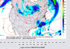
actually this fresh off the press SREF data is looking really juicy... Maybe we're about to get NAM'ed?
I bet the ARWs are carrying the wetactually this fresh off the press SREF data is looking really juicy... Maybe we're about to get NAM'ed?
Yeah I have no doubt the NAM will throw us an amped up solution at some point, I just don't like the trend with the SS wave. A weak flat wave just isn't going to budge NW, if we get NW trends it's gonna be b/c that wave is stronger and tilts more neutral to neg. Also amped doesn't guarantee frozen precip, we're not dealing with a true arctic airmass and have a HP that is moving out. I'm not cliff diving as other's imply just not too enthused about this just yet lolactually this fresh off the press SREF data is looking really juicy... Maybe we're about to get NAM'ed?
I will say even after the fail system here that went so far south a couple weeks back here, I'm not too sure this'll work out too. Not to be pessimistic but when a wave this small flattens out or shrinks, it usually doesn't come back. If it doesn't come back this suite and trend stronger the next 3 runs I'd just write this one off and expect nothing. Just watching it flatten out in a short range feels like a death sentence to this system honestly.Just need to turn the NAM off after that last rug pull. It's replacement (FV3) did much better with that system.
Yeah, I kind of agree with this, from a trend perspective. We need to hope that H5 is not too suppressive out east and that the wave is a little stronger/holds together a little longer. Not out of the realm for sure, but it's a 6 to 5 and pick 'em at this point.I will say even after the fail system here that went so far south a couple weeks back here, I'm not too sure this'll work out too. Not to be pessimistic but when a wave this small flattens out or shrinks, it usually doesn't come back. If it doesn't come back this suite and trend stronger the next 3 runs I'd just write this one off and expect nothing. Just watching it flatten out in a short range feels like a death sentence to this system honestly.
Not to mention the cold aloft associated with the northern stream is quickly exiting stage right and that weak wave isn't deep enough to generate much of it's own cold pool....Nam is good that it separated the wave from the initial trough. It's so slow though that the trailer might cause some issues

At least we'd have a little wiggle room wrt to wet bulbing but that's the only good i found lolNot to mention the cold aloft associated with the northern stream is quickly exiting stage right and that weak wave isn't deep enough to generate much of it's own cold pool....
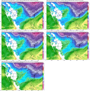
View attachment 112398
Bottom line is there are a lot of ways this one can fail, and only a very small margin for error with regards to timing/strength/track that would work for accumulating snow. Wintry slop with the in-situ cad has a wider window in the more favored climo cad areas for those so inclined.

It was still close to closing it off in the 70s hours. I wouldn't punt yet, maybe if the 0zs come in just as unimpressiveYeah total garbage
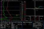
View attachment 112403
