• Hello, please take a minute to check out our awesome content, contributed by the wonderful members of our community. We hope you'll add your own thoughts and opinions by making a free account!

Wintry Feb 6-8 2022 Winter Potential

Due to the track and where it forms, I don’t think #temps will be a problem for Boone, Asheville, @BIG FROSTY but it will be about total precip starting to decline in the days ahead as it sorts favors just E of here maybe GSO areas. We can still thread the needle tho as seen on the gfs by slinging moisture back west but its something to monitor atm wouldn’t get too excited even tho temps are better back this way
Yeah this system will more than likely be weak not amped I think getting precip back our way will be our biggest issue. GSP not interested as of now don't know RNK thoughts. Blacksburg I mean for your area
 
I think the GFS has already trended in this direction just taking steps in doing so, as Shawn mentioned we probably end up with a blend. With models speeding up arrival of precip due to progressive pattern, weaker with less qpf seems right. Probably a minor event for someone Central to eastern Carolina's. Early guess
 
RNK earlier AM didn't seem to worried about precip this far north. Their thinking was it would be way to the south. But did note some models showed a differing idea. They didnt go into details of those ideas
 
I think the GFS has already trended in this direction just taking steps in doing so, as Shawn mentioned we probably end up with a blend. With models speeding up arrival of precip due to progressive pattern, weaker with less qpf seems right. Probably a minor event for someone Central to eastern Carolina's. Early guess

The southern stream has been such a black fly in our chardonnay in this pattern. Such weak sauce. Just don't like this event, the lakes low, the orientation of the high, the terrible dew points, the weak southern stream. Just alot of meh here. My early guess is the energy flames out like the euro shows. Man, it seems like we're soooo close but we can't get a real one to pop.
 
Very similar to some of our recent systems, I like the CMC to some extent. This is how those down east can score but not the mtns. With sharp gradients in precip Charlotte to Raleigh.
 
Very similar to some of our recent systems, I like the CMC to some extent. This is how those down east can score but not the mtns. With sharp gradients in precip Charlotte to Raleigh.
Not saying your wrong but the CMC has no support from its own ensemble, which I think ensembles are best to pay attention to in this sort of setup, given the interactions around the Baja, EPS = more suppression, CMCE = more juiced, GEFS = more juiced. Take a blend and you have ENC/central NC getting a minor event
 
Reading some posts on Twitter from the NE and it seems that the EC has caved to the GFS (RE this weekend). So there’s that, for whatever it may be worth.
 
GSP leans toward whiffers. Tosses GFS.

As of 250 PM EST Tuesday: Despite good model agreement and
increasing confidence in the short range, run to run and model
differences creating a low confidence forecast in the medium range.
The northern stream wave from the short term speeds by to our north
Saturday as the southern stream wave moves east. The GFS has a
stronger wave crossing the area Saturday night and early Sunday
while the ECMWF is weaker. Both models show cyclogenesis off the
southeastern coast, but the GFS is stronger and closer to the coast
initially and as it moves up the coast through Sunday. The ECMWF and
Canadian are weaker and farther off shore. The GFS has much more
precip with quite a wintry mix over the CWFA while the ECMWF and
Canadian shower little in the way of precip with only the smallest
potential for any wintry precip. The GFS is a cold and wet outlier,
the coldest and wettest of all the ensemble members for much of the
CWFA. The GEFS mean is much drier and warmer. Therefore, the
operational GFS much be taken with a huge grain of salt. Have gone
with the model blend forecast which has a chance of mostly rain for
most of the area. Temps near normal Saturday then below normal
Sunday. Of course, this bears watching as we get closer in time.

The guidance then shows a phasing split stream system developing
Monday and moving east of the area Tuesday. As with the first one,
the GFS is stronger with the upper waves and the resulting
cyclogenesis off the southeast coast but not as strong. The ECMWF
and Canadian show a weaker system with even less effect on our
weather. As with the first system, went with the guidance blend
which keeps a dry forecast for our area. Temps rise to near normal
Monday then drop a couple of degrees for Tuesday
 
I agree with KCAE:

There remains disagreement in the
guidance regarding the movement of the cold front and Saturday
may end up being unsettled if it stalls to our south.
Confidence is increasing for a period of precipitation on
Sunday. With temperatures in the Northern Midlands near freezing
Saturday night, have introduced a slight chance of snow at the
onset of the event. However, confidence remains low and further
adjustments in both timing and precipitation type are likely.

Lots to figure out still.
 
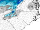
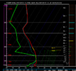
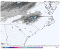
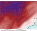
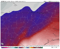
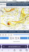
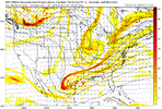
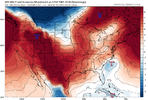
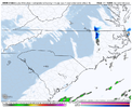
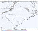
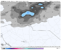
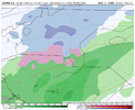
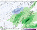
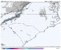
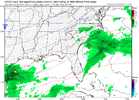
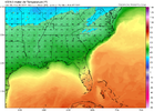
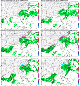
ICON still to weak with SS energy, crazy part is, the icon is far enough S with the SE can trough, that mid levels look good enough for snow for NC especially, but the wave is just so weak347A2AC2-1187-4781-B8AF-C13C90D7F9EE.pngF6231B74-85C0-43CB-B975-72C6C81428AE.gif
 
From RAH:

Confidence greatly decreases for the rest of the period, but it is
increasingly looking like an active pattern for central NC, with
potential winter weather. A southern stream shortwave that was over
the Desert Southwest early Friday will move east across the Southern
Plains and Deep South, becoming negatively-tilted as it does so. It
then looks to pass near or west of our region and spawn a coastal
low that will ride along the stalled Arctic front, which may result
in a period of precipitation across our region on Saturday night or
Sunday. The 12z ECMWF at least came around to the faster timing of
the GFS, but there are still significant differences between the two
models. The 12z GFS is much more amplified and very wet for central
NC, while the 12z ECMWF and the vast majority of its ensembles are
much weaker and more suppressed with the coastal low, hardly giving
us any precipitation at all. The GEFS are not as wet as the
operational run but have still trended wetter. The latest WPC QPF
trended wetter as well. Thus overall confidence is rising in at
least some precipitation across central NC, so increased POPs to low
chance in the south and east with slight elsewhere, and sped up
timing based on the 12z guidance. With the Arctic front to our south
and east and a strong high pressure system still over New England,
temperatures will be cold enough that precipitation type could be a
concern, but details this far out are still very uncertain. The GFS
has been showing the 850 mb low tracking far enough west for more of
an ice or rain threat as opposed to snow. However, its surface
temperatures for the event have been trending colder given its
faster timing. All that can be said at this point is that all types
of precipitation (snow, ice, and rain) are on the table, and
hopefully models will start to come into better agreement tomorrow
once some of the supporting dynamics reach onshore in western Canada.
 
Back
Top