euro and uk vs the american suite. basically the ryder cupFWIW, the 12z ukmet says no to a timely phase. Gonna be a tough hill to climb, but who knows.
View attachment 144558
-
Hello, please take a minute to check out our awesome content, contributed by the wonderful members of our community. We hope you'll add your own thoughts and opinions by making a free account!
You are using an out of date browser. It may not display this or other websites correctly.
You should upgrade or use an alternative browser.
You should upgrade or use an alternative browser.
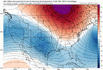
Pattern FEB 3-6 2024 System
- Thread starter SD
- Start date
- Status
- Not open for further replies.
Man what an incredible move by the GFS. The definition of phasing & yanking down cold air. 
I don't think so, but still have 7 days for this to change. Just saying we could see changes up until a couple of days out like what happened with the Christmas 2010 storm. Maybe not 12 hours out like what happened in 2000. But I just think we're going to see the precip come west and it'll be more about the cold supply than lack of precip.let me address this right now- jan 2000 resulted in millions (tens of millions? hundreds of millions?) being pumped into modeling research and development to make sure a catastrophic failure like that doesn't happen again. that storm was a mega surprise for all of i95. we're not going to see a surprise like that again.
ya. agreed. not singling out you, just know there's a ton of lurkers that equate jan 2000 to this forecasting nightmare and think it could still happenI don't think so, but still have 7 days for this to change. Just saying we could see changes up until a couple of days out like what happened with the Christmas 2010 storm. Maybe not 12 hours out like what happened in 2000. But I just think we're going to see the precip come west and it'll be more about the cold supply than lack of precip.
NoSnowATL
Member
Better for the NE, might be too late for the south besides NW NCMan what an incredible move by the GFS. The definition of phasing & yanking down cold air. View attachment 144560
Looks way late to me Mitch and just a cold front drug thru. For our parts anywayMan what an incredible move by the GFS. The definition of phasing & yanking down cold air. View attachment 144560
"Too late" for a system that isn't even in range of high-resolution modeling; meanwhile, we're still seeing substantial shifts in northern stream vorts a mere 72 hours out ?
GEFS looking better, lets see how much it translates in the snow means.

Getting exactly what we want from day 5-6 out...now dig you POSGEFS looking better, lets see how much it translates in the snow means.
View attachment 144562

packfan98
Moderator
We have a winner!

- Joined
- Jan 23, 2021
- Messages
- 4,604
- Reaction score
- 15,202
- Location
- Lebanon Township, Durham County NC
Significant bump in the means from 6z
Big fan of the gefs precip type map ? (probably skewed)

packfan98
Moderator
Starting to see some of the members with the low gaining some latitude up the coast. This one gives the eastern seaboard some love. Others are just off shore, but starting to round the bend and go poleward.

If the gfs showed this right now we would all be sweating bullets knowing it would trend nw lolWe have a winner!
View attachment 144565
- Joined
- Jan 23, 2021
- Messages
- 4,604
- Reaction score
- 15,202
- Location
- Lebanon Township, Durham County NC

GEFS definitely increased some. Quite a few members with snow.


D
Deleted member 609
Guest
GEFS - I have no idea what’s going to happen so here are 20 different outcomes.
NBAcentel
Member
This one just won’t die
packfan98
Moderator
UKMET and Canadian don't look good. Too far south with the low for snow from what I could see. Not sure how H5 looked.
NBAcentel
Member
UK = bad with both energiesUKMET and Canadian don't look good. Too far south with the low for snow from what I could see. Not sure how H5 looked.
CMC = further south with southern stream, but major improvement in northern stream, so not really a improvement or worsening trend yet, considering we need that up top
12 hits on gefs my area if i counted right.most by far whole time chasing this. Last nights canadian is what we need
NBAcentel
Member
Don’t wanna be that guy but with trends like this in the shorter range, this storm isn’t dead yet 
WolfpackHomer91
Member

WolfpackHomer91
Member
IK its lame and im not the sharpest in here but the 84hr NAM looks alot like the GFS to me with the NE confluence LP just down in TX instead of OKlahoma.....yes ik ik
NBAcentel
Member
not that the first trough matters anymore much just goes to show how much this setup can change 
not that the first trough matters anymore much just goes to show how much this setup can change View attachment 144592
Love seeing those Alaska and PAC Northwest disturbances easing a bit; less strain on the Central US ridge to retrograde eastward and gives our northern stream friend more westward wiggle room down the line if it holds


That NS energy needs to be a hair quicker and more robust
packfan98
Moderator
Looks like a no-go on the euro. A bit further SE and suppressed this run. (I'll take dry for MBY)

compared to gfs offshore bomb

Maybe that vort of energy over GL screws the pooch, want let flow back in an sharpen, get those lines going N/S, neutral
Webberweather53
Meteorologist

packfan98
Moderator
EPS follows the op and is shifting precip too far south for winter weather.

I thought both the euro and eps improved moderately. the improvement is like going from zach wilson to ryan tannehill but its something and i think we live to see another cycle
Euro wants to take this little vort over KS on a ride of a lifetime over the next week. It survives the trek over the mountainous omega block, while other global models fizzle most of it over Canada. Not sure how much (if any) this piece affects our overall evolution, but it's interesting to watch it unfold!


Hard not to believe a model that gives us 2 or 3 days of 40 degree rainJMA stalls the SLP just off the NC coast for a couple of days providing torrential rains. Makes sense.
View attachment 144599
View attachment 144598
That long range NAM tho?

rburrel2
Member
Just looking at soundings and there's still a path to victory for an isothermal nuking in a small area around the southeastern mountains/escarpment even down to foothill elevations.
This would be late Sunday night/Monday morning and isn't reliant on the phasing/CAA feed that potentially comes later.
I'm curious to see how the hi-res models handle it when they get in range, (assuming the heavy band of precip makes in to this region during that time frame.)
Here's a GFS sounding below from northern greenville county in SC with no elevation valid Monday at 1am. With heavy precip rates they'd be possibly looking at heavy snow.
.
- Status
- Not open for further replies.