-
Hello, please take a minute to check out our awesome content, contributed by the wonderful members of our community. We hope you'll add your own thoughts and opinions by making a free account!
You are using an out of date browser. It may not display this or other websites correctly.
You should upgrade or use an alternative browser.
You should upgrade or use an alternative browser.
Pattern FEB 3-6 2024 System
- Thread starter SD
- Start date
- Status
- Not open for further replies.
NBAcentel
Member
Gefs looks to go up with the SN mean again, prob signaling some members doing the thing again
Hmm, I'm actually not sure if I'm in the same camp on this one or not. I actually think that the ridge getting pinched is resulting in a better outcome as it is sharpening the east side of the ridge, forcing energy to dive into the trough at the last minute. That, along with a little slower trend of the southern ULL would open the door to phasing more and/or allowing more cold to make it into the system. We're starting to enter that timezone where legitimate trends are going to start appearing on the ops.i've been thinking about that @griteater observation from earlier in the day about the orientation/tilt of the big ridge and i think if we could pull off a better tilt to allow an anticyclonic wave breaking event to lower heights more in this area... it would be really really nice
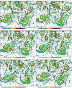
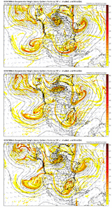
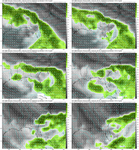
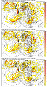
As @Myfrotho704_ and @griteater and others have discussed, there are so many small details feeding into this it is really tough to even suss out everything that is effecting the setup. Just in the map below there are 4 clear closed ULLs impacting the setup, with many more small vortices that could continue to result in adjustments.
LukeBarrette
im north of 90% of people on here so yeah
Meteorology Student
Member
2024 Supporter
2017-2023 Supporter
This GEFS run had the most variability I’ve seen so far. Heck one member turned it up the coast into a New England Blizzard. Another member had @Mitch West getting buried.
This has been so fascinating to watch the models slowly hone in on this setup. The northern stream bending back west on all modeling is very interesting, if that trend continues we will be seeing weenie runs shortly. Also noticing a trend of slowing down the southern wave on this 0z cycle which could increase chance of phasing!
Sent from my SM-A236U using Tapatalk
Sent from my SM-A236U using Tapatalk
NBAcentel
Member
CMCE slowed the southern wave down a lot, but doesn’t have the favorability with the northern stream interestingly, but the slowed ULL could be a big step to certain problems in future runs
NBAcentel
Member
Euro is a no, massive changes at H5 though, related and unrelated to the system
CNCsnwfan1210
Member
FYI, tropical tidbits is down (outage), no restoration time yet...Levi is working on it
Sent from my SM-A136U1 using Tapatalk
Sent from my SM-A136U1 using Tapatalk
Sucks for his site but that said I prefer pivotal!FYI, tropical tidbits is down (outage), no restoration time yet...Levi is working on it
Sent from my SM-A136U1 using Tapatalk
CNCsnwfan1210
Member
TT back up and running now
Sent from my SM-A136U1 using Tapatalk
Sent from my SM-A136U1 using Tapatalk
CNCsnwfan1210
Member
Looking at the CMCE (hr 168 Tuesday evening) quite a few members keep the low near the SE coast. Could certainly be an impressive coastal system especially if that southern wave slows and any phasing occurs with the NS

Sent from my SM-A136U1 using Tapatalk

Sent from my SM-A136U1 using Tapatalk
CNCsnwfan1210
Member
Man that was close (6z GFS)

Sent from my SM-A136U1 using Tapatalk

Sent from my SM-A136U1 using Tapatalk
CNCsnwfan1210
Member
This whole ordeal is just a couple ticks away from being a pants buster
Sent from my SM-A136U1 using Tapatalk
Sent from my SM-A136U1 using Tapatalk
Last line of RAHs overnight discussion:
............... "Given the continued track uncertainty, we kept precip
types all rain, but a more wrapped up system and further north track
could complicate ptypes if enough cold air were to advect into the
area."
So, wintery precip is not probable, but is still possible.
............... "Given the continued track uncertainty, we kept precip
types all rain, but a more wrapped up system and further north track
could complicate ptypes if enough cold air were to advect into the
area."
So, wintery precip is not probable, but is still possible.
CNCsnwfan1210
Member
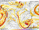
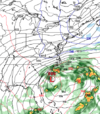
My guess is because there is a lot of energy associated with that wave, the low that does form is not consolidated enough to produce a large precip shield, but if and when the phasing process kicks in, that ballgame will change.View attachment 144494
This is for Monday morning. Can someone explain to how a 994 low just off Charleston gives this as a QPF response??
Sent from my SM-A136U1 using Tapatalk
It does continue to strengthen. Maybe as RAH stated it will "wrap up" more and push precip to the NW. I would think this is probable (with the below look).My guess is because there is a lot of energy associated with that wave, the low that does form is not consolidated enough to produce a large precip shield, but if and when the phasing process kicks in, that ballgame will change.
Sent from my SM-A136U1 using Tapatalk
At hour 144:
Lots of changes still coming (for good or bad).
View attachment 144494
This is for Monday morning. Can someone explain to how a 994 low just off Charleston gives this as a QPF response??
Blue_Ridge_Escarpment
Member
Very odd for the LP of that strength and position.
That's what was supposed to happen in January 2000. Just saying.View attachment 144494
This is for Monday morning. Can someone explain to how a 994 low just off Charleston gives this as a QPF response??
Bingo
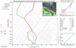
It's such a battle with the placement of the northern stream vort. On one hand, it'll provide the Carolinas with a colder air source and a potential phase that would lead to a much more dynamic and expansive precip field.
But then you have the negative affects of the northern stream shown here, i.e. if you get stuck with a late phase, you are battling with very dry and sinking air on the back side of the northern stream air that inhibits much precip growth on the northern flank of the southern ULL
Last edited by a moderator:
CNCsnwfan1210
Member
Doesn't look like we went backwards on the GEFS. Still has some varying solutions, I've seen worse.
Sent from my SM-A136U1 using Tapatalk
Definitely keeping hope alive. I counted more hits during the 6z than the 0z for Central NCDoesn't look like we went backwards on the GEFS. Still has some varying solutions, I've seen worse.
Sent from my SM-A136U1 using Tapatalk
- Joined
- Jan 23, 2021
- Messages
- 4,602
- Reaction score
- 15,197
- Location
- Lebanon Township, Durham County NC
it's hard to believe that precip doesnt make it but if the upper levels dry out, you're cooked.
Last edited:
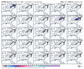
We've definitely pretty much lost the EPS. I would say the probs of this one working out are definitely fading. Worth keeping an eye on still, but unless we see some definitive positive moves today (including with the Euro suite), this is probably going to end up like the rest of our wintry hopes and dreams have the past two years in the Carolinas.
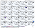


Good post. Way too many people on here see a "L" off the coast and think we should automatically be getting 1" QPF statewide every time, when it really doesn't work that way at all. Upper levels -- especially if you live inland -- are far more important than people realize. Think about how many sub 990 mb lows that are hurricanes scrape the Carolina coast with rain barely making it (or not at all) to RDU west.
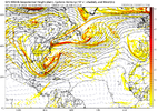
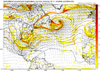
The Euro & Ensemble are warmer because no energy like shown on the Canadian & even the GFS pinwheels down & provides a cold air feed. That energy actually revamps another low which then throws back moisture into the cold air pushed down. Euro has some dislodgment but it never connects. Just my take.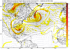


Last edited by a moderator:
Euro has been doing this for days minus 1 or 2 runs. The 0z cmc is really the playbook if you live in NC and want snow. This flat wave and deep ENE to NE flow in the MLs isn't going to work. It'll be hard to overlap cold and moisture without zapping the dgz in this setupGood post. Way too many people on here see a "L" off the coast and think we should automatically be getting 1" QPF statewide every time, when it really doesn't work that way at all. Upper levels -- especially if you live inland -- are far more important than people realize. Think about how many sub 990 mb lows that are hurricanes scrape the Carolina coast with rain barely making it (or not at all) to RDU west.
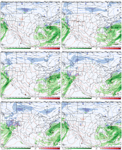
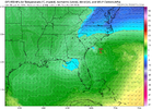
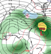
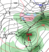
Definitely agree. And it’s definitely not impossible still at this lead time to see some significant adjustments still, but personally seeing the EPS with only a handful of members showing this happening (and dwindling each run) doesn’t inspire much confidence. Maybe the 12z runs will turn the momentum around.The Euro & Ensemble are warmer because no energy like shown on the Canadian & even the GFS pinwheels down & provides a cold air feed. That energy actually revamps another low which then throws back moisture into the cold air pushed down. Euro has some dislodgment but it never connects. Just my take.View attachment 144503View attachment 144504View attachment 144505
And the fact the CMC is the playbook is a huge red flag haha. But totally agree, the window is really narrowing but it isn’t closed yet.Euro has been doing this for days minus 1 or 2 runs. The 0z cmc is really the playbook if you live in NC and want snow. This flat wave and deep ENE to NE flow in the MLs isn't going to work. It'll be hard to overlap cold and moisture without zapping the dgz in this setup
Im more sanguine- I thought steps were made in the right direction last night and think there’s a good chance the momentum continues
No eps blows but is not a death knell
No eps blows but is not a death knell
CNCsnwfan1210
Member
Positive trend with the piece of energy over the NE

Sent from my SM-A136U1 using Tapatalk

Sent from my SM-A136U1 using Tapatalk
NoSnowATL
Member
GFS hates this system but hopefully its wrong for you weenies in NC.


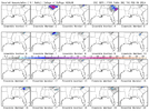
Please don't take this as argumentative or anything, this is just a "what am I missing" question but.... I'm just genuinely curious if you think the Euro took positive steps (that maybe I'm missing) or are you just referring to the non-Euro suite of guidance, because the below trend looks pretty bad (to me) on the Euro the past 3 runs in tandem with the diminishing signal from the EPS.Im more sanguine- I thought steps were made in the right direction last night and think there’s a good chance the momentum continues
No eps blows but is not a death knell
Last edited:
- Status
- Not open for further replies.

