All winter long it has been a fail. Tennessee isn’t going to score that much. Much of the Asheville area south-west isn’t going to either in CAD to that degree at least. Greensboro won’t hold the throne over places like Hickory. Those widespread heavy totals in WV will not verify. It has failed all winter with CAD with too much ice and wrong placement. CAD ground zero is the escarpment not Tennessee. I could go on and on.whats Wrong with the map chief ?
-
Hello, please take a minute to check out our awesome content, contributed by the wonderful members of our community. We hope you'll add your own thoughts and opinions by making a free account!
You are using an out of date browser. It may not display this or other websites correctly.
You should upgrade or use an alternative browser.
You should upgrade or use an alternative browser.
Wintry Feb 19-20 Possible Front-End Snow/Ice Thump
- Thread starter Webberweather53
- Start date
Nomanslandva
Member
Yea, knowing how warm noses over perform and wedges hold, it worries me it could be worse that that. Today's NAM runs with the ark of heavier qpf NW of here look better for less ice but tonight's runs are a different solution.Living on the edge or lights out ice for your neck of the woods? Lol
Western Surry into eastern Alleghany NC will outdo just about any of those heavier areas on that map. 90% of the time. I don’t think the NWS uses that particular model data at all.i have never seen a human forecast match up with it at least.
NBAcentel
Member
Western Surry into eastern Alleghany NC will outdo just about any of those heavier areas on that map. 90% of the time. I don’t think the NWS uses that particular model data at all.i have never seen a human forecast match up with it at least.
Lol matched up with the anafront fail weeks ago, it showed the bust potential and It happened, it also did ok in my opinion with the Dec storm, it showed insane amounts back with that January storm because it doesn’t account ronoff due to heavy precip rates, it counts all of it as ZR, it’s not a bad model
Rainforrest
Member
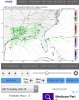
Looks like Transylvania and Henderson counties ground zero.
Yea it can be useful some. But it will continued to be ignored as it shows over half an inch of ice for northeast TN where there will not even be a winter weather advisory. It’s a hot mess and totally useless in many areas.
May be a little surprise there with a more favored earlier arrrival that far south-west. Any snow sleet accums would help rack that ZR total way up giving it something to stick to. I think this ground zero stretches from where you mentioned up to Boone.Looks like Transylvania and Henderson counties ground zero.
Cad Wedge NC
Member
The thing that confuses me is that GSP has winter storm warnings out and their forecast accumulation map show no warning criteria ice or snow for anyone including the mountains... strange. Someone explain that one to me.Lol matched up with the anafront fail weeks ago, it showed the bust potential and It happened, it also did ok in my opinion with the Dec storm, it showed insane amounts back with that January storm because it doesn’t account ronoff due to heavy precip rates, it counts all of it as ZR, it’s not a bad model
Blacksburg AFD explains it. Says criteria won’t be reached but will do a warning anyway due to high impact combination of some snow and ice. Assume GSP agreed. Raleigh did not.
Any ground truth to the snow returns on radar in north Georgia?
More returns on radar than what models have been showing ... will hopefully be a fun nowcaster
Seeing a lot of sleet reports coming in on the 11 Alive Stormtrackers Group on FB across North GA this morning.
Sent from my iPhone using Tapatalk
Sent from my iPhone using Tapatalk
HRRR and most models saying precip should start really developing starting over Louisiana around 8 am ... it’s currently 2 am and this is what our radar looks like ... intitial band is flourishing on radar too doesn’t really look like it’s drying out ... will be interesting to nowcast I will reiterate
Attachments
NBAcentel
Member
Even tho the hrrr is crappy, it’s interesting, still showing mostly rain after prolly due to its warm/mixing bias 
I’ve got a lot of sleet hitting my window right now at 39. Woke me up it was so loud.
D
Deleted member 1449
Guest
RAH has issued a WWA for the Piedmont Triad. Potential for up to .10 ice accrual.
D
Deleted member 1449
Guest
6Z NAM has backed way off with the freezing rain potential in the Piedmont regions. We'll have to see if this continues with the 12Z suite, but I'm inclined to believe in more of a cold rain than any significant ice accrual. We'll see.
packfan98
Moderator
Yes it did. Looks like everything is trending towards the GFS.6Z NAM has backed way off with the freezing rain potential in the Piedmont regions. We'll have to see if this continues with the 12Z suite, but I'm inclined to believe in more of a cold rain than any significant ice accrual. We'll see.
NBAcentel
Member
Did Atlanta just see thundersleet ?
NBAcentel
Member
SN/IP in Lancaster SC
HSVweather
Member
Even back in Huntsville at 522, sleet coming down good. 35 and 85%RH
Edit: 0611 all rain
Edit: 0611 all rain
Last edited:
B
Brick Tamland
Guest
6Z NAM has backed way off with the freezing rain potential in the Piedmont regions. We'll have to see if this continues with the 12Z suite, but I'm inclined to believe in more of a cold rain than any significant ice accrual. We'll see.
I don't know. The CAD is almost always stronger than what the models show. The temps could be off by a couple of degrees and that could make a big difference. They were off by almost 10 degrees with the forecast a few days ago.
Blue_Ridge_Escarpment
Member
6Z GFS upping the ante here. Went from 0.2 to 0.4 of freezing rain.
Surprise! NWS saying sleet possible this morning
I never thought it would do what it was showing. Yesterday sunshine heated up the roads and unless we get down to 29-30 degrees it will be a non event. We have already pre treated as that is what contracts want but shouldn't be much to it. We have had several close calls this year but this isn't horseshoes.6Z NAM has backed way off with the freezing rain potential in the Piedmont regions. We'll have to see if this continues with the 12Z suite, but I'm inclined to believe in more of a cold rain than any significant ice accrual. We'll see.
Temps were off the other day but will not be that far off this time. If a thump of snow happens it will cool down but rain will not cool us that much. This is a non event for mostI don't know. The CAD is almost always stronger than what the models show. The temps could be off by a couple of degrees and that could make a big difference. They were off by almost 10 degrees with the forecast a few days ago.
D
Deleted member 609
Guest
Pingers in south Charlotte. Win!
Not likely. I just arrived at work in Atlanta and it's barely rained here. Back home it was 35 and raining after a few hours of sleet/rain but I never heard thunder in the heavier band.Did Atlanta just see thundersleet ?
Storm5
Member
Pingers in northern miss and Alabama this am
Sent from my iPhone using Tapatalk
Sent from my iPhone using Tapatalk
You still have the RGEM6Z NAM has backed way off with the freezing rain potential in the Piedmont regions. We'll have to see if this continues with the 12Z suite, but I'm inclined to believe in more of a cold rain than any significant ice accrual. We'll see.


Sent from my SM-G950U using Tapatalk
What is still crazy to me is the models haven’t picked up on this band of precip that’s still moving in ... they don’t have widespread precip like that over spreading until later this afternoon... biggest wildcard imo
Pingers here in Spartanburg
Fountainguy97
Member
What is still crazy to me is the models haven’t picked up on this band of precip that’s still moving in ... they don’t have widespread precip like that over spreading until later this afternoon... biggest wildcard imo
Hrrr does pick it up. It just kills it over the next 4-5 hrs as the main storm takes over to the west.
HRRR doesn’t even show the thunderstorms already in southern Alabama... these short range models are crack rn .. this thing is a now caster for sure
Rosie
Member
A little sleet here.
Fountainguy97
Member
HRRR doesn’t even show the thunderstorms already in southern Alabama... these short range models are crack rn .. this thing is a now caster for sure
Use pivotal weather HRRR composite reflectivity.
https://www.pivotalweather.com/model.php?rh=2019021912&fh=2&dpdt=&mc=&r=conus&p=refcmp&m=hrrr
Webberweather53
Meteorologist
What is still crazy to me is the models haven’t picked up on this band of precip that’s still moving in ... they don’t have widespread precip like that over spreading until later this afternoon... biggest wildcard imo
Precipitation during large-scale overrunning events like this where warm moist air from the Gulf of Mexico is gliding up isentropic surfaces (areas of equal temperature) (i.e. isentropic upglide) is usually more widespread & intense than forecast especially on the northern fringes of where its forecast to occur and its not uncommon to see extra sleet or snow (if it's cold enough) on the front-end.
No the HRRR Initialized very light showers if anything over the areas seeing heavy sleet rn ... yeah no this would be an incorrect statementHrrr does pick it up. It just kills it over the next 4-5 hrs as the main storm takes over to the west.
Y'all need it! I'm stuck inside, can't tell if its still going heregetting sleet here in Columbia.