• Hello, please take a minute to check out our awesome content, contributed by the wonderful members of our community. We hope you'll add your own thoughts and opinions by making a free account!

Pattern Failbruary Thread

As we’re used to this year the pattern changes are usually delayed 1-2 weeks I could see this change occurring in the March 4-7 time range vs Feb 28-March 2 time frame
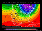
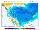
I’m still looking for a decent shot at near record or record highs here (just like has occurred in recent Febs) and nearby toward the middle of next week with a solid SER before any cooling precip reaches the area.

Regarding the potential of cold finally penetrating the SER pattern and getting into the SE near the end of Feb, models seem undecided on this, including the timing. We appear to have -EPO driven cold ready to hit much of the US. But sometimes the SER blocks the bulk of -EPO driven cold, especially during La Niña and moreso late in the winter. The SER seems to want to resist at least somewhat. Will the cold be mainly low level and be relegated to a Carolina/NE GA wedge? Or will the H5 trough axis actually fight off the SER and give the SE a more general cold period via a +PNA? Opinions?

At 12Z, the EPS is a good bit colder than the GEFS as of March 1st:

EPS:
8266749B-C313-49DF-81A1-8B715BE75A8A.pngE1AC984B-3AA9-4452-BFF3-E136BC6B1A0E.png


GEFS:
DA2EFA34-C0E2-45B2-A22E-A0307FF621BD.png
EDF5FB88-04ED-4409-B87C-D0D3CEA1EF4E.png
 
@GaWx Here ya go Larry ...

CPC is really hinting at it ... much like your 288 GFS and ECM ...


View attachment 113833

Indeed! Thanks, Phil.

Before we get to next week’s warmth, we have quite a warm day today in many areas. I just noticed that Hogtown was a whopping 84 at 3PM, not far from the record high of 86 set in 2019!

Before next week’s “heat”, we have a pleasantly low humidity weekend as a nice treat.
 
Winters last gasp?

gfs_mslp_pcpn_frzn_us_64.png
 
First week of march has a signal on ensembles, feel like this is the first true signal on ensembles since the early January event. Still long range but has rare support


Sent from my iPhone using Tapatalk
 
Lot of wild fires out there tonight. Pigeon Forge, TN. Winds will increase more for NC after midnight
 
If we’re going to see any chance at another winter weather event here in the SE it would probably be during this period of time in late February and early March .. still honestly wouldn’t bank on it as we would have to thread some needles and jump some hoops for something like that to line up.. certainly can bank on another period of colder than average temperatures regardless so it’ll still feel like winter at least1645152004540.png
 
I’m still looking for a decent shot at near record or record highs here (just like has occurred in recent Febs) and nearby toward the middle of next week with a solid SER before any cooling precip reaches the area.

Regarding the potential of cold finally penetrating the SER pattern and getting into the SE near the end of Feb, models seem undecided on this, including the timing. We appear to have -EPO driven cold ready to hit much of the US. But sometimes the SER blocks the bulk of -EPO driven cold, especially during La Niña and moreso late in the winter. The SER seems to want to resist at least somewhat. Will the cold be mainly low level and be relegated to a Carolina/NE GA wedge? Or will the H5 trough axis actually fight off the SER and give the SE a more general cold period via a +PNA? Opinions?

At 12Z, the EPS is a good bit colder than the GEFS as of March 1st:

EPS:
View attachment 113822View attachment 113823


GEFS:
View attachment 113824
View attachment 113825
Heh...would be fitting to end meteorological winter record warm in Deep South just like December was. Bookends basically.
 
Clemson, SC gusted to 64.4mph with the line last night. Looks like generally 35-45mph for NC piedmont areas. Current sfcobs with high 60s on the coast and 30s west of ATLbigsfc (1).gif
 
Back
Top