30 degrees and snowing up on Beech mtn currently
-
Hello, please take a minute to check out our awesome content, contributed by the wonderful members of our community. We hope you'll add your own thoughts and opinions by making a free account!
You are using an out of date browser. It may not display this or other websites correctly.
You should upgrade or use an alternative browser.
You should upgrade or use an alternative browser.
Pattern Fail or Fab February 2023 Pattern Thread
- Thread starter RBR71
- Start date
Que my man Shettley: Can't wait for his summer of 2023 outlook.India's setting records of 100+F in Winter. Going to be a insane summer IMO.
ATLwxfan
Member
The persistent and continuing trend of a legit -NAO to be present in the medium and long range looks increasingly likely. If this continues march could be the most interesting winter month of all of them around here. View attachment 133346
If 44° and rain is interesting then maybe so. Maybe some mountain ice if you’re into that sort of thing. You might sneak out something up your way.
The -NAO will still have to contend with a relentless -PNA. Some back and forth for sure.
Sent from my iPhone using Tapatalk
WEATHERBOYROY
Member
I know this goes to banter now, but Guntersville got snow the same time Madison and Huntsville did at least one of the times, but it doesnt't matter, no place in Alabama averages 3 inches a year unless maybe the highest peaks. If they got no snow aT ALL THAT MAP IS WRONG! SAME FOR MISSISSIPPI!If you look closely at the map,it shows Huntsville near normal. Which is correct.
GFS has Atlanta getting up to 83 on Thursday which would just be hilarious for February 23rd
29 now and it's coming down pretty good. When snow is hard to come by, at least we have places like this that we can go to rather quickly.30 degrees and snowing up on Beech mtn currently
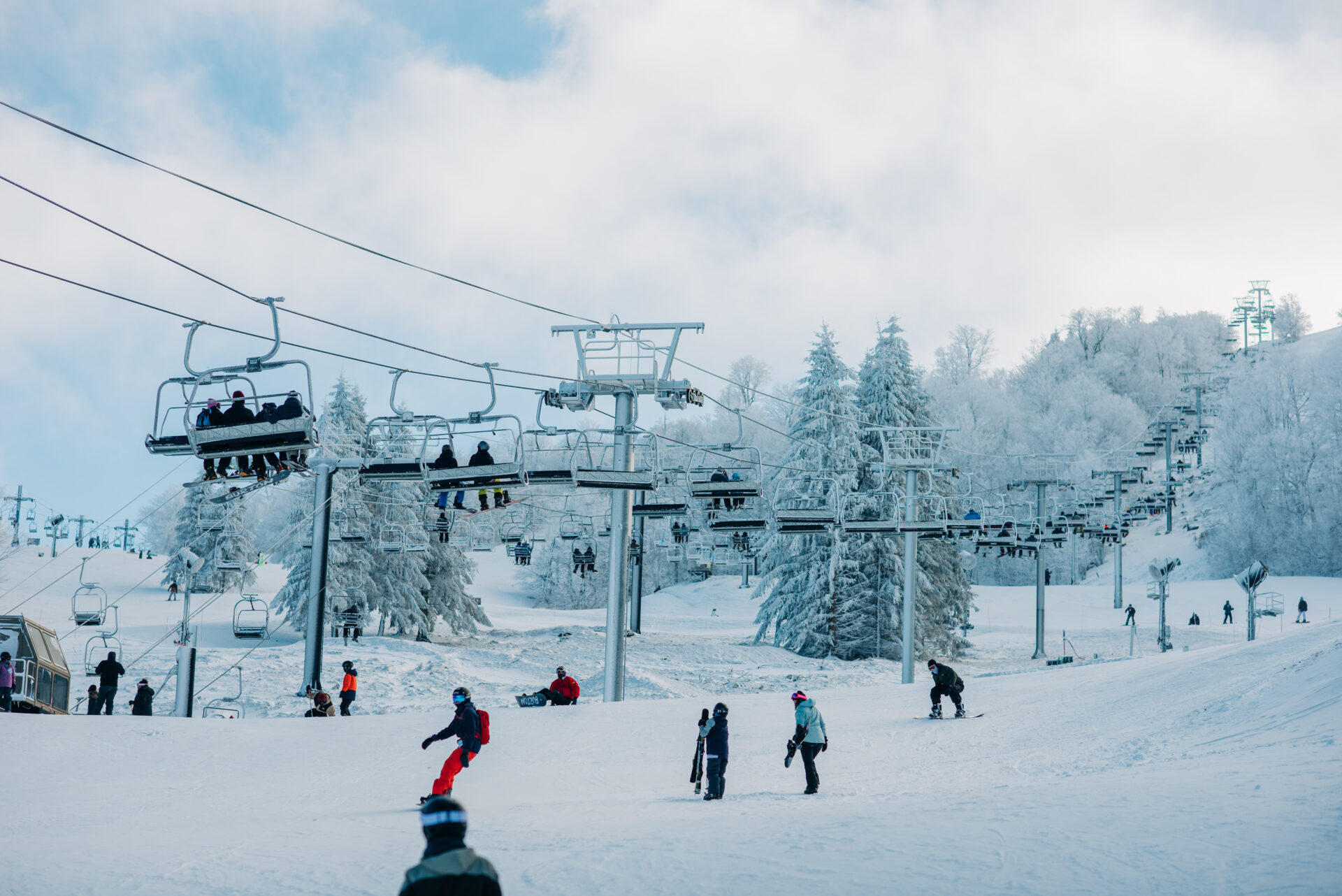
Web Cameras | Beech Mountain Resort
Check our web cameras at Beech Mountain Resort! Get live views of the slopes, weather conditions, and scenic landscapes to plan your visit.
 www.beechmountainresort.com
NBAcentel
Member
Euro has 20c 850s, in July this is impressive. Airmass next week it’s maxing out when it comes to how warm February can be 

- Joined
- Jan 23, 2021
- Messages
- 4,604
- Reaction score
- 15,203
- Location
- Lebanon Township, Durham County NC
If I didn’t know where we are in the calendar, given the warm temps and humidity plus the shower that just came through, I would’ve swore it was mid April.
I played golf once back in the 90s when it hit low 80s in February with a rapidly melting snowman in the shade of hole 1.GFS has Atlanta getting up to 83 on Thursday which would just be hilarious for February 23rd
Drizzle Snizzle
Member
The 6 to 12 below normal for Southern Mississippi really confuses me.I know this goes to banter now, but Guntersville got snow the same time Madison and Huntsville did at least one of the times, but it doesnt't matter, no place in Alabama averages 3 inches a year unless maybe the highest peaks. If they got no snow aT ALL THAT MAP IS WRONG! SAME FOR MISSISSIPPI!
tennessee storm
Member
Pna looks stay negative and get lower more as we head towards March
LovingGulfLows
Member
- Joined
- Jan 5, 2017
- Messages
- 1,499
- Reaction score
- 4,100
Pna looks stay negative and get lower more as we head towards March
I wonder why a relentless negative PNA is possible in winter but never a relentless positive PNA. We’re lucky if we get a positive PNA for a week and this is like every winter now. Im so ready to leave La Nina behind. Atlanta statistically does so much better with snow in El Ninos.
EPS mean for Thursday and then the probability of higher than 80 degrees on Thursday. Florida lol


JHS
Member
If we could get snow the cold would be ok. We are not getting winter precip so I prefer it to be warmer. 60-65 would be fine in Jan and Feb. I just do not see any use for the kind of cold we had before Christmas at any time though. That needs to stay well away from here.Better yet, stop hoping for these out of season heat waves that bring everything out early when we know there will be more freezes later. Just enjoy the chances for cool/cold weather when we have them, the heat will come later regardless.
I know, I know... what we hope for has no bearing but still...
The problem is that we’re setting up to see major agricultural damage later this spring that will produce millions of dollars in losses to farmers with after how warm it will be for a few days next week. Despite what some may think, we will get more cold snaps and hard freezes between now and at least early April. There is going to a lot of berry and peach blossoms that will be coming out next week very early and many of them won’t be surviving to yield fruit.If we could get snow the cold would be ok. We are not getting winter precip so I prefer it to be warmer. 60-65 would be fine in Jan and Feb. I just do not see any use for the kind of cold we had before Christmas at any time though. That needs to stay well away from here.
It's a yearly thing now. We are just stuck in a vicious cycle. I've had one good apple year in the last 5 or so years.The problem is that we’re setting up to see major agricultural damage later this spring that will produce millions of dollars in losses to farmers with after how warm it will be for a few days next week. Despite what some may think, we will get more cold snaps and hard freezes between now and at least early April. There is going to a lot of berry and peach blossoms that will be coming out next week very early and many of them won’t be surviving to yield fruit.
Shaggy
Member
heading to Disney in in mid March hope it stays that warmEPS mean for Thursday and then the probability of higher than 80 degrees on Thursday. Florida lol
View attachment 133352View attachment 133351
Yes and unfortunately it becomes a ripple effect. Farmer’s don’t bring in what they budget on berries, peaches, etc., so that drives prices up on other produce throughout the summer and fall.It's a yearly thing now. We are just stuck in a vicious cycle. I've had one good apple year in the last 5 or so years.
JHS
Member
That's true enough. Even in the warmest winters we do always seem to have a freeze sometime in April. Even in May at GSP in 1989.The problem is that we’re setting up to see major agricultural damage later this spring that will produce millions of dollars in losses to farmers with after how warm it will be for a few days next week. Despite what some may think, we will get more cold snaps and hard freezes between now and at least early April. There is going to a lot of berry and peach blossoms that will be coming out next week very early and many of them won’t be surviving to yield fruit.
ATLwxfan
Member
I wonder why a relentless negative PNA is possible in winter but never a relentless positive PNA. We’re lucky if we get a positive PNA for a week and this is like every winter now. Im so ready to leave La Nina behind. Atlanta statistically does so much better with snow in El Ninos.
It’s everything to do with the relentless Nina. If we transition to El Niño we are likely to see more positive PNA. It’s been a foregone conclusion that El Niño is coming but it’s by no means a sure thing.
Sent from my iPhone using Tapatalk
ATLwxfan
Member
That's true enough. Even in the warmest winters we do always seem to have a freeze sometime in April. Even in May at GSP in 1989.
Some good old radiational cooling. One of those 65°/27° days
Sent from my iPhone using Tapatalk
GFS has Atlanta getting up to 83 on Thursday which would just be hilarious for February 23rd
It's happened before (see 2018).
EDIT: Technically, the high on 2/23/18 was 79*F, but it was surrounded by a pair of 83*F on 2/22 and 2/24...
I remember the freeze he’s talking about because it occurred right after a major tornado outbreak in the western Carolinas on 5/5… it was a legit May cold snap with highs barely getting into the 50s outside the mountainsSome good old radiational cooling. One of those 65°/27° days
Sent from my iPhone using Tapatalk
Brent
Member
This should end well 
JHS
Member
The 18z GFS is taking away next weekend's cool snap from the NC/VA line and south. Looks like a really long warm and dry period coming up for many of us.
ATLwxfan
Member
The 18z GFS is taking away next weekend's cool snap from the NC/VA line and south. Looks like a really long warm and dry period coming up for many of us.
Yep, looks like the -PNA is winning out. Don’t bet against pattern persistence.
Meanwhile NYC finally gets a good snow!
Sent from my iPhone using Tapatalk
Back Yard "thermo" got up too 83F today..
though the "Official High" might have been around 76F or so.. (NWS) @ KILM.
Current Obs.. (Backyard).
65F.. / 57F
Pressure 29.89 in
Visibility Limited & overcast/Mist
Clouds Overcast
Dew Point 63 F
Humidity 97 %
Rainfall 0.31 in
Wind WSW @17MPH..
though the "Official High" might have been around 76F or so.. (NWS) @ KILM.
Current Obs.. (Backyard).
65F.. / 57F
Pressure 29.89 in
Visibility Limited & overcast/Mist
Clouds Overcast
Dew Point 63 F
Humidity 97 %
Rainfall 0.31 in
Wind WSW @17MPH..
iGRXY
Member
EPS still showing a nice transition into a
-NAO and continually holding the 50/50 low. Pacific remains the same but being able to count on CAD to keep things at a minimum average to slightly below average around here will be nice.
-NAO and continually holding the 50/50 low. Pacific remains the same but being able to count on CAD to keep things at a minimum average to slightly below average around here will be nice.
NBAcentel
Member
more like slightly above normal, it’s clear the -PNA is gonna keep things on the warmer side with a few cad days, next weekend is a good example as we have went from the wedge to warmEPS still showing a nice transition into a
-NAO and continually holding the 50/50 low. Pacific remains the same but being able to count on CAD to keep things at a minimum average to slightly below average around here will be nice.
ATLwxfan
Member
more like slightly above normal, it’s clear the -PNA is gonna keep things on the warmer side with a few cad days, next weekend is a good example as we have went from the wedge to warm
Yes, pretty clear as we get under 5 days we keep seeing the wedge lose ground. Until we see that change there’s no good reason to assume a reliable pattern change takes hold.
Sent from my iPhone using Tapatalk
J1C1111
Member
The cold at Christmas barely lasted 3 days. What was so bad about it. Really just Friday and Saturday we're cold but not historic and then we were back above freezing and near 40 degrees on Christmas. I personally would like about 2 weeks of that weather around here just to show people it can still get cold around here and stay a week or two like it used to. If I can't have snow I'll take the cold any day any time. Might not happen again anytime soon but it will happen again and I just hope im around to see it. Getting ready for close to 80 next week and then the bottom to fall out sometime in March and again in April and again in May guaranteed until the miserable heat and humidity overtakes me and I begin to melt until around Halloween or the first week of November as usual. Bring on the wedges. My only hope in the short term to deal with May weather in February.If we could get snow the cold would be ok. We are not getting winter precip so I prefer it to be warmer. 60-65 would be fine in Jan and Feb. I just do not see any use for the kind of cold we had before Christmas at any time though. That needs to stay well away from here.
Snowman63
Member
GFS has Atlanta getting up to 83 on Thursday which would just be hilarious for February 23rd
2M temps in the 80's in Feb/March are certainly not normal but it does happen... the 1st week of March/2022 last year - Memphis recorded several days in the upper 70's and a couple days in the low 80's. Then we turned cold in week 2. On 3/11 we picked up 4"-6" of snow with temps in the 20's. The moral of the story is March can be very unpredictable and some of the biggest snows in the Mid-South/ South-East have occurred during this time.

I got down to 27 last night. Still below freezing right now. You have to wonder when the next time we get below freezing again. LR models don't look good for freezing temps.
NBAcentel
Member


JHS
Member
The gfs is slowly trending back to having a cooler shot next weekend at least north of I-20. Still above normal, but not as warm as before. The Carolinas need to watch Wednesday for a cooler day too. The boundary has dropped from Penn down to the NC/VA border now. Also trending a little cooler out in the extended too.
Blocking finally responding to the SSWE and better mjo phase probably in 8 by early mid March. If we’re going to have a chance at snow march will be when we do it. Sucks that we have to wait to the bitter end when sun angle time of day and all that bs matters but I’ll take it. You can bet at the very least cold rains will shower down upon us ??
ATLwxfan
Member
Fro…what are you doing?
Sent from my iPhone using Tapatalk
26.1 this morning, much needed
TonightI got down to 27 last night. Still below freezing right now. You have to wonder when the next time we get below freezing again. LR models don't look good for freezing temps.