• Hello, please take a minute to check out our awesome content, contributed by the wonderful members of our community. We hope you'll add your own thoughts and opinions by making a free account!

Pattern Fail or Fab February 2023 Pattern Thread

Fog has been something else on an off this past month, espeacilly these past few days. Tonight is no different. Looks like front has made it into and through va/nc border counties. Hopefully it will scour these w/o conditions out of here.

Wednesdays high temp should be at 12:01 tonight.
 
Fog has been something else on an off this past month, espeacilly these past few days. Tonight is no different. Looks like front has made it into and through va/nc border counties. Hopefully it will scour these w/o conditions out of here.

Wednesdays high temp should be at 12:01 tonight.
I ran tonight and with how sweaty I was I was literally steaming afterwards, haha.
 
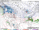
Well that's a look on the 12k. If it's there at 48hrs might be on to something. 69hrs is not such an unbelievable range
It was on the prior run, too, IIRC. Who knows, maybe rates truly can overcome. Could set up a band of T-3” type totals if it comes to fruition.
 
sn10_acc-imp.us_ma.png
Improvement, I guess? Honestly, if we're able to squeeze out more than a T from this before NYC I'll take that as a W.
 
From Rah AFD

A few models were hinting at the possibility of sleet for an hour or two near the VA border Thursday morning, however confidence was too low to include that in the forecast.

Lol they haven't seen the NAM this morning ??
 
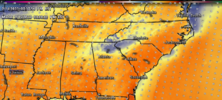
3k further south, starting to look like the SE may see some legit snow fall on the backside. Obviously not buying those totals, just showing potential for snow to be falling

View attachment 131954
At this point anything white falling from the sky would be a win during this dumpster fire of a winter
 
Last edited:
Of course my area has a small chance of some snow this weekend. Probably because I'll be out of town :mad:. If you see any flakes you're welcome. Local WFO isn't onboard with a turnover to all snow YET but maybe a rain/snow mix. From their disco.....

"Thursday and Friday...Robust southern stream trough pushes
across the Gulf states and Southeast, pushing a strong front
through the area Fri. Rain likely Thu into Friday morning, with
periods of moderate to locally heavy rain possible late Thu
into early Fri morning. Temps will fall behind the front Fri
as strong CAA develops. Still doesn`t look like any ptype
concerns with cold air chasing the moisture Friday. However, the
GFS and NAM both show potential for brief RA/SN mix as precip
ends along the southern forecast area Friday afternoon. Will
continue to monitor that, though given sfc temps well above
freezing, etc. no impacts expected at this time. Below normal
temps will continue with highs in the 40s."
 
Last edited:
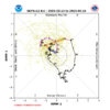
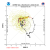
Roughly 15/20 GFS ensemble members have a brief changeover or at the very least rain mixing with snow over parts of NC Friday morning (hr 54).
69922fd1b52c25c394ff57089c8f3061.jpg


Sent from my SM-A136U1 using Tapatalk
 
Roughly 15/20 GFS ensemble members have a brief changeover or at the very least rain mixing with snow over parts of NC Friday morning (hr 54).
69922fd1b52c25c394ff57089c8f3061.jpg


Sent from my SM-A136U1 using Tapatalk
I need precip a little more North and a slower exit, don't think I'm asking too much.
 
Back
Top