• Hello, please take a minute to check out our awesome content, contributed by the wonderful members of our community. We hope you'll add your own thoughts and opinions by making a free account!

Pattern Fail or Fab February 2023 Pattern Thread

Meanwhile Dallaska strikes again. So sick of hearing about winter in Texas. At least we have the snowless I-95 corridor to warm the cockles of our hearts.


Sent from my iPhone using Tapatalk
Yeah, but their events are always pretty small. Every time i see Dallas and wintry weather its like this tiny little ice coating...LOL
 
Sent from my iPhone using Tapatalk
[/QUOTE]
Just to reinforce some of what's been posted here today about the 85 Gradient.
There's a reason why !
Also that pic that IGRXY posted was very telling.
You see the sharp cutoff in GVL & Spg counties.
On this board you always hear about the Wake gradient but,
That's not nearly as noticable to my eyes on that pic as in SC.
You can distinctly see the difference in what looks to be measurable snowfall just a few miles to nothing.
I agree. It's a huge cut off down there for you guys as well. I've experienced it several times over and it's real. Feast or famine. Since we're talking about gradients im going to throw in the Rutherford county nc gradient. It's one that never gets much mention but it should with the elevation change as there's a huge gradient here in the county and if you have lived here long enough you know. You go from the upstate to the mountains from the southern end of the county to the north western end of the county. From the state line NC/SC state line just out of Chesnee in to RC to Chimney Rock there is a crazy difference in elevation and snow totals north to south. I'm a mile south of the 74 bypass sitting at 1000ft elevation and there's a big gradient there as well 74 south to 74 north with the snow totals. Just one example off the top of my head Dec 18 2009. Chesnee maybe around 2 inches. My location Danieltown right off of 221 5 miles south of Rutherfordton 6 inches. Rutherfordton 10 inches and Chimney Rock 14 inches in that storm. Elevation is king.
 
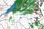
I think it’s not out of the realm of possibility to see some freezing drizzle or rain from Raleigh and places NW late Wednesday night into Thursday morning. Some short range models have us flirting with freezing with some precip in the area. Key would be getting the precip in early enough and also making it down to freezing. Best chance would be around @metwannabe 599B1A71-6092-40AE-8A45-D83BBA442EFE.jpeg
 
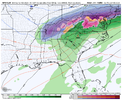
Can’t imagine the GEFS pulling something out here but the majority want to mix in some sort of snow flakes on the northern edge of precip. About as razor thin of a margin as we can get. (Don’t look at member 8) CA1E79C5-0EEE-4B28-BC40-34405218C967.jpeg
 
Can’t imagine the GEFS pulling something out here but the majority want to mix in some sort of snow flakes on the northern edge of precip. About as razor thin of a margin as we can get. (Don’t look at member 8) View attachment 131933
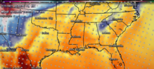
When cold chasing moisture does work at all, it's setups like this. If can get a slp to form to hekp slow precip exit some and orientation of caa (more northerly component and not w/nw) then maybe just maybe a few lucky souls see those splattering raindrops on the windshields lol
 
What kind of weather station ?
6-Weather-Vane-Picture-3.jpg
 
Yeah, but their events are always pretty small. Every time i see Dallas and wintry weather its like this tiny little ice coating...LOL

Umm…they get events. In town Atlanta hasn’t in half a decade, token flakes notwithstanding.


Sent from my iPhone using Tapatalk
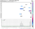
 
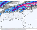
It probably doesn't mean a hill of beans, but GFS showing a trend of a slower exit of precip on Friday
7c1497e3b445d7f3b733f74396d3b3ff.gif


Sent from my SM-A136U1 using Tapatalk
It could mean a hill of slushy raindrops though
 
Last edited:
Back
Top