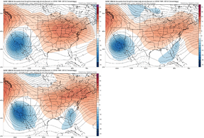
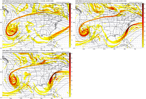
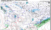
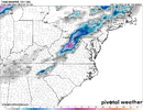
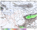
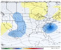
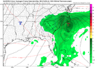
We need a couple more ticks south for wiggle room as it corrects NW, right!my suspicion is that it ends back up in northern Virginia.
-
Hello, please take a minute to check out our awesome content, contributed by the wonderful members of our community. We hope you'll add your own thoughts and opinions by making a free account!
You are using an out of date browser. It may not display this or other websites correctly.
You should upgrade or use an alternative browser.
You should upgrade or use an alternative browser.
Pattern Fail or Fab February 2023 Pattern Thread
- Thread starter RBR71
- Start date
rburrel2
Member
ForsythSnow
Moderator
The soundings for N GA are pretty close to snow, only being 38 at the surface but below at 925 even. Given its a deform band setting up that could enhance rates enough to make it through and it's not even set in yet so we will see as we get closer. 2 more ticks and it'd be a good storm for N GA, upstate SC, and most of NCFor NEGA and western Upstate folks, you want this thing to continue to dig and close off little further west. Granted even now with what the GFS shows and the rates, I would not be surprised if some of what it is showing as rain isn't snow.
iGRXY
Member
Cutoff ULL is one way to get a monster. Ridging all around it so it can't go anywhere, but you have to get the ULL track and where it closes off right
lexxnchloe
Member
I said the ICON wouldnt be right and there would be a foot+ in Raleigh.We done trending or no?View attachment 132278
rburrel2
Member
Ukmet closing it off too far west... still lots of uncertainty on the track here. I wouldn't rule anybody out of the game.For NEGA and western Upstate folks, you want this thing to continue to dig and close off little further west. Granted even now with what the GFS shows and the rates, I would not be surprised if some of what it is showing as rain isn't snow.
rburrel2
Member
The good thing is it's looking like a bowling ball cutoff scenario is likely at this point. Bad news is there were be extreme winners and lots of losers in this set up, and the winners won't encompass a very large area. No way to know who yet... but at least it's looking increasingly likely that someone in the Southeast will get a paste bomb.
iGRXY
Member

Mhmmmmmmmm
N Ga or just NE Ga?The soundings for N GA are pretty close to snow, only being 38 at the surface but below at 925 even. Given its a deform band setting up that could enhance rates enough to make it through and it's not even set in yet so we will see as we get closer. 2 more ticks and it'd be a good storm for N GA, upstate SC, and most of NC
I've seen way too many of these GFS paste bombs with marginal 850s that only center NC. Just look back at the archive threads from the past few years. I would expect the wave to trend warmer due to the cut-off of solid cold air sourcing from Canada. If we do see something, I would bet we would see a simmer down of the amplification.
NBAcentel
Member
Yep, that’s my biggest concern, In these modeled setups we typically lose the amplification and lose the cold air aloftI've seen way too many of these GFS paste bombs with marginal 850s that only center NC. Just look back at the archive threads from the past few years. I would expect the wave to trend warmer due to the cut-off of solid cold air sourcing from Canada. If we do see something, I would bet we would see a simmer down of the amplification.
It’s typically our most marginal set ups that can end up producing the goods but it’s nice to see at least these marginal hits 100 hours out.. almost certainly means a NAMing is comingYep, that’s my biggest concern, In these modeled setups we typically lose the amplification and lose the cold air aloft
Canadian says enjoy your cold cool rain.
LukeBarrette
im north of 90% of people on here so yeah
Meteorology Student
Member
2024 Supporter
2017-2023 Supporter
Hate to say it but CMC looks much more plausible remembering how warm sfc temps will be for the next 4 days
NBAcentel
Member
CMC sucks because it’s not amplified enough, which leads to BL issues
Blue_Ridge_Escarpment
Member
severestorm
Member
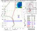
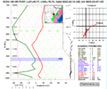
It looks like the Piedmont will see snow, but it will be rate driven. The icon has RDU below freezing during the heavy returns but temps spike when rates relent. But this is looking like it's going to be the best shot of snow for RDU for the season.Yep, that’s my biggest concern, In these modeled setups we typically lose the amplification and lose the cold air aloft
RDU during heavy returns:
RDU after when rates relent
Blue_Ridge_Escarpment
Member
It’s definitely playing catch-up. Maybe by 12Z tomorrow it will be there!Look at this 3 run trend but we are calling it reliable lolView attachment 132286
- Joined
- Jan 23, 2021
- Messages
- 4,602
- Reaction score
- 15,197
- Location
- Lebanon Township, Durham County NC
packfan98
Moderator
Looks like Virginia is the favored spot right now.
rburrel2
Member
@BIG FROSTY licking his chops while everyone else will be licking wounds 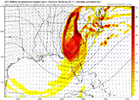

NBAcentel
Member
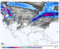
Another high country special. Shocker!That’s very discouraging View attachment 132293
Blue_Ridge_Escarpment
Member
A blend of CMC/UK would probably get you a NC paste bomb.That’s very discouraging View attachment 132293
packfan - it sounds like you may be infected with the fearcasting disease. It’s an affliction that causes forecasts to be made out of fear instead of sound judgement. It is commonly found on weather boards among members with a long history of being let down by late model adjustments, particularly during winter. Although a serious disease, it’s not quite as severe as its cousin, the bittercasting diseasemy suspicion is that it ends back up in northern Virginia.
I guess that UKMet run from yesterday wasn’t quite so crazy after all huh
Last edited:
iGRXY
Member
GFS is a blend of CMC/UK. On to the euro
packfan98
Moderator
No fear here. Just sharing my thoughts. Others might have these weather afflictions, but my immunity has built up after following every model run for 20 years.packfan - it sounds like you may be infected with the fearcasting disease. It’s an affliction that causes forecasts to be made out of fear instead of sound judgement. It is commonly found on weather boards among members with a long history of being let down by late model adjustments, particularly during winter. Although a serious disease, it’s not quite as severe as it’s cousin, the bittercasting disease
I guess that UKMet run from yesterday wasn’t quite so crazy after all huh
- Joined
- Jan 23, 2021
- Messages
- 4,602
- Reaction score
- 15,197
- Location
- Lebanon Township, Durham County NC
I'll be right with you all for this "tracking", but how many times has the GFS pulled us in this year...
- Joined
- Jan 23, 2021
- Messages
- 4,602
- Reaction score
- 15,197
- Location
- Lebanon Township, Durham County NC
I was told it was not going to snow and that we were going to torch the rest of the winter. So, I haven't been paying much attention.
D
Deleted member 609
Guest
You had to go and jinks it for me didn't ya!!! ? Not licking any chops around here, way to far out for that! lol The models will change half a dozen times between now and Saturday. But at least we got something encouraging to look at for a few hours anyway!@BIG FROSTY licking his chops while everyone else will be licking wounds
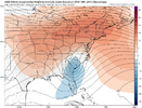
Not sure about upper air and surface temps, but it looks close. I would say, being five days out, that just having a low off our coast is a good sign. Just need some basic agreement right now.I don't know if this is good or not. Someone smarter than me can explain.View attachment 132297
Looks good to me. ?
CltNative90
Member
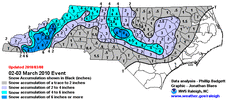
These types of setups, as modeled, are always very fickle and rate driven. Usually a very narrow strip of accumulation with a few lucky lollipops strewn in. Areas outside that strip will see flakes fall, but if the rates aren’t there, little or nothing will accumulate. I remember a similar setup (maybe March 2010 shown below?) when I was home for spring break and local mets were calling for 2-5 inches. I watched it snow for about 3 hours and it never stuck at my house. This setup as modeled would be even more marginal. This would probably be a radar watching/ nowcasting type of event, if it were to play out.
