accu35
Member
Euro showing some good love for the mountains"major crush job for the mountains WITH THAT LOOK though."
Euro showing some good love for the mountains"major crush job for the mountains WITH THAT LOOK though."
Looks like more of the same. Rain rain and more rain.That 18z GFS was ugly for Georgia
Sent from my iPhone using Tapatalk
Not out of the realm this could drive a neg AOThis is unlikely to impact our weather for the better with our raging +AO and the total disconnect between the stratosphere and the troposphere.
Sent from my iPhone using Tapatalk
A few ensembles skewing this a bit .. but in terms of trends if we want to get some snow out of this I could certainly see these trends being favorable. If we can get a good bowling ball upper low set up over us we can get cold enough air up too along with higher rates to be able to overcome these boundary layer temps .. long way to go here but it’s interesting to be able to get a trend like this as we close in on 100 hoursGefs is interesting
Sent from my iPhone using Tapatalk
There’s a few good members this runA few ensembles skewing this a bit .. but in terms of trends if we want to get some snow out of this I could certainly see these trends being favorable. If we can get a good bowling ball upper low set up over us we can get cold enough air up too along with higher rates to be able to overcome these boundary layer temps .. long way to go here but it’s interesting to be able to get a trend like this as we close in on 100 hours
Yeah, realistically that’s likely 32-33 with heavy snow.Ukmet would be a March 2009 type hammer job for the same locations if it wasn't a touch too warm at the surface. If we got a 5h low like it depicts I'd imagine there would be more snow accumulation under the heaviest bands. It's showing -4 850s and -2 925 temps in a lot of locations and depicting them around 36-37 at the surface with rain.
I hope your right. I haven't been paying much attention to this one but it looks promising if Lucy doesn't yank the ?. Seems to be the theme this year.Honestly couple more ticks and we might just thread this needle and time something just right


Correct me if I’m wrong, but isn’t the UK historically pretty good at sniffing out the big ULL events?The GEFS and GFS are mostly by themselves here w/ big snow totals into the coastal plain + piedmont. Not a ton of support for snow outside the mountains & foothills.
Correct me if I’m wrong, but isn’t the UK historically pretty good at sniffing out the big ULL events?
And a very good shot at thundersnow with a strong ULL as depicted.BL issues obviously and still need some help, lots of help but it's better than nothing for now. Still a shot someone sees snow fall at least if we can get this ull to come to fruition. ULL always wildcards
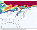
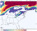
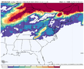
The GEFS and GFS are mostly by themselves here w/ big snow totals into the coastal plain + piedmont. The snowfall means are gonna be heavily skewed by one or two big members. There's really not a ton of support for snow outside the mountains & foothills, likely because it's too warm.
Really need the upper low to completely close off about a day sooner than currently modeled and tilt neutral-negative & slide across the I-20 corridor to give folks in NC a good hit. We're a long ways off from that atm.
View attachment 132257
View attachment 132256
View attachment 132255
