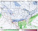
• Hello, please take a minute to check out our awesome content, contributed by the wonderful members of our community. We hope you'll add your own thoughts and opinions by making a free account!

Pattern Fail or Fab February 2023 Pattern Thread

Who has the good maps @Myfrotho704_ @BullCityWx @KyloG thanks

500h_anom-mean.conus.png
 
100 miles further south with the 850 low would work wonders for the I-40 crew. Any guesses to why the models have trended southwest over the past 24hrs and if there's room for the improvement to continue?
 
I think from what I'm seeing on the free maps, the EPS was much improved and showing support of a ULL system.... let's go!
That's the big takeaway right now. That the euro trended towards the cutoff like the gfs had. Get some agreement on that then we start to worry about the details
 
100 miles further south with the 850 low would work wonders for the I-40 crew. Any guesses to why the models have trended southwest over the past 24hrs and if there's room for the improvement to continue?
Weaker northern stream wave slower southern. Ridge in the west that's building in behind it thumbs over top then fully builds in and the wave gets trapped and closes. I think the 12z ICON is probably the farthest SW you could get this. The miss connection across the plains is really what we are looking at. More interaction=north less we could limp it a few more miles south vs say the euro
 
ROA looks legit...I'm moving here

View attachment 132334
No need. I just started a thread for this threat. I'm sure that will kill it off quickly. Post away everyone!
 
ROA looks legit...I'm moving here

View attachment 132334
Gotta say I’m definitely feeling good about this. Although I’m worried about the system tracking too far south for me. Even though I much rather have the NC guys score.
 
And yet someone in the south or mid Atlantic could see a winter storm in this time period. That’s why we track the “little barely anything” cold shots that come through
This type of pattern can be nearly as good as really cold patterns where you track "barely anything" storm chances in between long cold/dry spells with no chance of a storm.

At least with this pattern when we get a cold front push through it may lay a decent boundary just to our south instead of blasting through Southern Florida and sending the high pressure towards the gulf.
 
Man imagine if we can shift that SE Canada cortex farther SE, it’s still to far for any notable CAD, but continue to slow it and this system will become more interesting on the front end. but at the same time
It’s slowing down the flow which can hurt
1AFB58DB-42F0-4EF2-A378-B96DD67DFD2C.gif
 
Another long range torch period that trends to another weekend significant cold shot. Like I said a few days ago the roller coaster continues in this pattern. This has a good chance at holding our next period to watch for some sort of winter weather chance. It will certainly have much more cold air to deal with than we have right now 1675899405190.gif
 
Back
Top