• Hello, please take a minute to check out our awesome content, contributed by the wonderful members of our community. We hope you'll add your own thoughts and opinions by making a free account!

Pattern Fabulous February

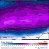
Don't know about yall, but I've been keeping and eye on this small event last few runs.
gfs_asnow_seus_21.png
 
The always to cold Canadian still hanging on to Sun/Mon ice event

1549367641585.png
 
The Kamchatka trough I've been talking about the last several days dug considerably more on this 0z EPS run and what a huge surprise (/s), look what happens to the downstream pattern over the NE Pacific and North America.
View attachment 14951

Lol my high has worn off, anyways Big improvement, continue this trend, PNA starting to slowly improve aswell
 
This -EPO/-PNA couplet is relentless.

We desperately need a +PNA or at least a neutral PNA. When this goes neutral is when our next chance will be. Maybe we can salvage the last 10 says or week of Feb.

a81af20a043357fd1ffd4c2d3803eacc.jpg

668dfafaabdd6a59b3fce64ec6aa8b91.jpg

1ee21745a147737692b9caa09f1dad87.jpg


Sent from my iPhone using Tapatalk
 
Folks, check out the 6Z GEFS hours 360-384. That’s a legit strong +PNA with cold moving into the SE! Yes, those funny looking blue colors actually move in. This is by a good margin the best looking GEFS of any run for around that period. If this happens, could we get one of those blockbuster late Feb/early March weak El Niño finishes to winter? Even way on down in the Deep South we have gotten major events as late as the first week in March, including SAV’s 2nd heaviest snow of alltime and another storm that gave major ZR to much of inland SE GA and S SC. In addition, SAV in 1986 got over 1” of snow at the start of March and some ZR in the near boardwide event of 3/2/1980 (weak Niño). And don’t forget the 2/25/1914 weak El Niño near boardwide major winter storm from a very far south Miller A GOM track. As Yogi Berra supposedly once said, winter’s not over til winter is over.
 
Folks, check out the 6Z GEFS hours 360-384. That’s a legit strong +PNA with cold moving into the SE! Yes, those funny looking blue colors actually move in. This is by a good margin the best looking GEFS of any run for around that period. If this happens, could we get one of those blockbuster late Feb/early March weak El Niño finishes to winter? Even way on down in the Deep South we have gotten major events as late as the first week in March, including SAV’s 2nd heaviest snow of alltime and another storm that gave major ZR to much of inland SE GA and S SC. In addition, SAV in 1986 got over 1” of snow at the start of March and some ZR in the near boardwide event of 3/2/1980 (weak Niño). And don’t forget the 2/25/1914 weak El Niño near boardwide major winter storm from a very far south Miller A GOM track. As Yogi Berra supposedly once said, winter’s not over til winter is over.
I am having a hard time remembering that one storm in 1914 for some reason.....
 
Back
Top