Nice trend.... even though I had to look at it like 10 times to figure out which way it was going LolThe Kamchatka trough I've been talking about the last several days dug considerably more on this 0z EPS run and what a huge surprise (/s), look what happens to the downstream pattern over the NE Pacific and North America.
View attachment 14951
-
Hello, please take a minute to check out our awesome content, contributed by the wonderful members of our community. We hope you'll add your own thoughts and opinions by making a free account!
You are using an out of date browser. It may not display this or other websites correctly.
You should upgrade or use an alternative browser.
You should upgrade or use an alternative browser.
Pattern Fabulous February
- Thread starter PEA_RIDGE
- Start date
Webberweather53
Meteorologist
Nice trend.... even though I had to look at it like 10 times to figure out which way it was going Lol
We need that trough over eastern Russia to dig like there's no tomorrow into the mid-latitude North Pacific to amplify the downstream ridge to give us a look we want w/ a SE Canada vortex coupled to a AK ridge. We'll have to string a trend like this together for several days in a row to turn our fortunes around around mid month.
Went to bed.. lol.Where is @Storm5 @DarkKnight on this potential Valentine's day storm I need their thoughts on this only 9 days awayView attachment 14943
It’s hard to believe anything with the models at this moment. We all got burned a week ago with the snow it had. I do think we will get a 2-3 week period after February 15th when the pattern does flip back and we don’t have to worry about a SER.
snowlover91
Member
Went to bed.. lol.
It’s hard to believe anything with the models at this moment. We all got burned a week ago with the snow it had. I do think we will get a 2-3 week period after February 15th when the pattern does flip back and we don’t have to worry about a SER.
My rule of thumb is we need a model consensus on a winter threat and inside 5 days to call it a legit threat. So far the only one that fit the bill was the early December system and that one panned out for quite a few folks in NC.
B
Brick Tamland
Guest
My rule of thumb is we need a model consensus on a winter threat and inside 5 days to call it a legit threat. So far the only one that fit the bill was the early December system and that one panned out for quite a few folks in NC.
Yeah, the FV3 latched onto that storm early, but the others didn't come around until we were at least inside 7 days.
Flurry
Member
My rule of thumb is we need a model consensus on a winter threat and inside 5 days to call it a legit threat. So far the only one that fit the bill was the early December system and that one panned out for quite a few folks in NC.
I would even reduce that number to 3 days...LOL
accu35
Member
Just like I posted gfs/FV3 This morning, now icon has something small Saturday
Kylo
Member
Just like I posted gfs/FV3 This morning, now icon has something small Saturday
After all was said and done, seems the Icon wasn't so bad with the last event out that way. The 12z has a 1044 HP overhead allowing enough cold air to get involved for a small window of some snow flakes through MS, AL with surface temperatures above freezing.
Nothing accumulating, one would guess, but flakes flying in the heavier bands.
Kylo
Member
accu35
Member
Now hold on a second. We're not supposed to get involved in this
don’t let that map fool you. Cad holds on for maybe some onset ice but seeing how the rest of our onset events have gone this winter I wouldn’t worry too much about itNow hold on a second. We're not supposed to get involved in this
don’t let that map fool you. Cad holds on for maybe some onset ice but seeing how the rest of our onset events have gone this winter I wouldn’t worry too much about it
The actual accumulation map is definitely off, but it would possibly be flakes for a good many IF the moisture is heavier (ICON hints at this) than other modeling. The lower levels are above freezing, 35-36F and flakes mixing in would seem most probable if the ICON were taken verbatim. The 32F line, though, is not far off on other modeling (like the Euro) which could lead to some freezing drizzle at the onset.
Just getting around to looking at recent modeling.. and the Euro definitely has my interest to go with a little what I was saying about I-20 not having that "threat" this season, yet as we head into the prime-time climo for it.
You can see on the 00z Euro's end, that the Gulf is starting to brew something up with cold air filtering in. Not quite sure where it would go on further frames, but it would be the peak time to have a chance in the deep South. Other modeling has shown hints (much further out, like the 384 hr GFS of something like this being possible.
I was figuring if we do get the threat down this way, it will be a little bit earlier than the 00z GFS being past Feb. 20th. I'm not making a forecast but the 13-18th doesn't look horrible if we can get the SE ridge to back off a bit.

snowlover91
Member
snowlover91
Member
I would like to note, after reading the WPC discussion from this morning and looking over the new 12z GFS so far, the 00z Euro and current 12z GFS/Canadian are world apart once again.
WPC had said this morning, they did not prefer the 00z Euro because its so much different bringing in colder air/more progressive. I'm torn between which to believe. So in the medium-long term we have a slight model war with overall sensible weather with the GFS/CMC vs Euro. (at least on the operational runs)
The Euro would change our pattern to something that could be more conductive for Winter weather chances while the others say keep the shorts out.
snowlover91
Member
I would like to note, after reading the WPC discussion from this morning and looking over the new 12z GFS so far, the 00z Euro and current 12z GFS/Canadian are world apart once again.
WPC had said this morning, they did not prefer the 00z Euro because its so much different bringing in colder air/more progressive. I'm torn between which to believe. So in the medium-long term we have a slight model war with overall sensible weather with the GFS/CMC vs Euro. (at least on the operational runs)
The Euro would change our pattern to something that could be more conductive for Winter weather chances while the others say keep the shorts out.
I would add to this that the FV3 seems to be more in the Euro camp with a colder look and more potential threats like the CAD event on the 11-12th it's been showing and a few others. If the Euro/FV3 idea ends up being correct there would be a brief 2-3 week window of some possible snow chances if we can get the right timing of the precip and cold.
snowlover91
Member
With the way things are trending I really like the Valentine's day time-frame as maybe our best shot in a while....As a good example, after the 11-12th storm the FV3 has this a few days later.
View attachment 14990
Frozen QPF
View attachment 14991
snowlover91
Member
With the way things are trending I really like the Valentine's day time-frame as maybe our best shot in a while....
Yeah there is some potential there if we can get the Euro or FV3 overall pattern. The CMC isn't good at 5H and I believe the old GFS has inferior 5H verification scores compared to the Euro/FV3 so with both of them showing a colder look I like the chances. Let's see what the Euro and EPS show today. If we can get a better pattern by February 10-15th we would still have 2-3 weeks for a snow threat which is plenty of time.
As a note...correlation for SOI in Jan/Feb higher than March. So...to little to late, maybe.
View attachment 14975View attachment 14976
Kylo,
Where do you get these correlation maps to SOI from? I've never seen them.
Kylo
Member
Kylo,
Where do you get these correlation maps to SOI from? I've never seen them.
Here you go
https://www.esrl.noaa.gov/psd/data/correlation/
The main worry I have about the GFS/CMC vs Euro deal is that the GFS is usually more progressive vs. the slower Euro. That's what has me confused feeling on which is the more likely outcome because the roles are switched currently.
The Euro tends to overdo the SE ridge, and it's not showing that currently.. and much faster than the (usually too fast) GFS in the medium-long term.
The Euro tends to overdo the SE ridge, and it's not showing that currently.. and much faster than the (usually too fast) GFS in the medium-long term.
tennessee storm
Member
that model has been so terrible... its unreal... by far worst....imoAs a good example, after the 11-12th storm the FV3 has this a few days later.
View attachment 14990
Frozen QPF
View attachment 14991
tonysc
Member
I am having a hard time remembering that one storm in 1914 for some reason.....
Well you probably won't remember these either but in more recent times late March 1983 I believe, and I know for sure March 25th 1971, about 10 inches across the Upstate of SC.I am having a hard time remembering that one storm in 1914 for some reason.....
B
Brick Tamland
Guest
At least there is potential on the Euro and FV3. Of course, they and the GFS and CMC are night and day from each other right now. The only thing that gives me pause about the FV3 showing something around the 14th is we're in the same time frame now that it was showing a storm here for this weekend, and look how that turned out. I keep hoping the FV3 gets another storm right like it did the December one, but lately it's been showing storms around 10 days out only to take them away a couple of days later.
tennessee storm
Member
the 1971... I don't recall... I was so young... but read about it a lot... now march 83... I was at parris island marine boot camp,,,, but remember that one well....Well you probably won't remember these either but in more recent times late March 1983 I believe, and I know for sure March 25th 1971, about 10 inches across the Upstate of SC.
The MJO signal continues to improve across most model arrays. For some reason, the Euro Op hasn't loaded for today, so I'll use the Monthlies as a proxy. The GEFS, CFS, and EMON continue to move it along into Phase 8, and eventually beyond. I expect we will see the models' H5 depictions to respond. I also expect to see an increased frequency of winter storm threats, with potentially a couple of big dogs showing up. This probably starts just after mid-Feb and lasts into a portion of March.
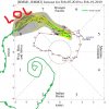
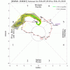
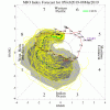
And the Euro at and near the end of its run continues to look better:


And the Euro at and near the end of its run continues to look better:

NBAcentel
Member
The MJO signal continues to improve across most model arrays. For some reason, the Euro Op hasn't loaded for today, so I'll use the Monthlies as a proxy. The GEFS, CFS, and EMON continue to move it along into Phase 8, and eventually beyond. I expect we will see the models' H5 depictions to respond. I also expect to see an increased frequency of winter storm threats, with potentially a couple of big dogs showing up. This probably starts just after mid-Feb and lasts into a portion of March.
View attachment 14996
View attachment 14997
View attachment 14998
And the Euro at and near the end of its run continues to look better:
View attachment 14999
WAR would help us out in that situation, if you get a storm it would let it go poleward off the coast and get it to bomb, but what I’m saying is extremely unlikely
NBAcentel
Member
Six Mile Wx
Member
B
Brick Tamland
Guest
Well, that's a start. Nice mean this far out. Now let's see if we can get e10 to happen.
Six Mile Wx
Member
I think you have to look at the facts... EURO has always been an amazing model and I tend to think it knows what it’s doing inside 240 hours and the fact that the Fv3 which is the new gfs model and will be replacing it is showing the same thing. The old GFS which is CRAP and the CMC which has always been a ridiculous model to have in anyone camp .. it’s worthless.. time to start looking at the leadersAt least there is potential on the Euro and FV3. Of course, they and the GFS and CMC are night and day from each other right now. The only thing that gives me pause about the FV3 showing something around the 14th is we're in the same time frame now that it was showing a storm here for this weekend, and look how that turned out. I keep hoping the FV3 gets another storm right like it did the December one, but lately it's been showing storms around 10 days out only to take them away a couple of days later.


