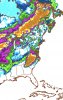
That NAO is doing just what JB said it would do. Now, whether it really does it or not is another story.One positive on the GEFS is the pac ridge weakens and allows trough to pull back far enough west and heights lower in SE. And of course NAO but we know that won’t happen
View attachment 14779
-
Hello, please take a minute to check out our awesome content, contributed by the wonderful members of our community. We hope you'll add your own thoughts and opinions by making a free account!
You are using an out of date browser. It may not display this or other websites correctly.
You should upgrade or use an alternative browser.
You should upgrade or use an alternative browser.
Pattern Fabulous February
- Thread starter PEA_RIDGE
- Start date
NBAcentel
Member
One positive on the GEFS is the pac ridge weakens and allows trough to pull back far enough west and heights lower in SE. And of course NAO but we know that won’t happen
View attachment 14779
Can also maybe begin to see a sign of a +PNA at the end, but that’s so far out, maybe the last 10 days of feb won’t disappoint ?
Kylo
Member
That NAO is doing just what JB said it would do. Now, whether it really does it or not is another story.
My guess is to little to late. We haven’t had a 4” snowstorm in March in 36 years. So yeah, we can see flakes into March but a nice winter storm just doesn’t happen in March anymore for us.
One positive on the GEFS is the pac ridge weakens and allows trough to pull back far enough west and heights lower in SE. And of course NAO but we know that won’t happen
View attachment 14779
Interesting. So, on this GEFS run, the -EPO weakens while the +PNA starts to come back. This is just another example that illustrates that the correlation to SE cold is higher for a +PNA than it is for a -EPO. Of course, the best would be to have both.
NBAcentel
Member
My guess is to little to late. We haven’t had a 4” snowstorm in March in 36 years. So yeah, we can see flakes into March but a nice winter storm just doesn’t happen in March anymore for us.
Yep, as it gets further and further into March, ULL’s are more needed for snow since they carry there own cold pocket aloft, just like last year where I got a solid 1.5” of snow from a ULL
Given that its MJO forecasts are trash, and it’s pushing the pulse into phase 6, the H5 depiction is not surprising. Hopefully, it’s wrong.Well, the 12Z GEPS looks even worse than its prior version in the 11-15 for the SE. Just plain UGLY!
NBAcentel
Member
Given that its MJO forecasts are trash, and it’s pushing the pulse into phase 6, the H5 depiction is not surprising. Hopefully, it’s wrong.
Really hope it’s wrong, SE ridge never goes away, just like what the gefs did the trough/ridge moved even further west allowing for a stronger SER, lol it has the -NAO aswell, but other than that ??

pcbjr
Member
RC,Given that its MJO forecasts are trash, and it’s pushing the pulse into phase 6, the H5 depiction is not surprising. Hopefully, it’s wrong.
Please don't limit yourself to just one model or forecast ...
Phil
It’s crazy that many people in here praise the euro (as I do .. and as you should) and the euro ends up being the only model ever on top and for once the model is being consistent and showing everyone the phase shift in MJO and the cold returning and south east ridge not dominating but y’all see some long range model forecasts on the GEPS(???) and Gfs And gefs EVEN THOUGH we know for a fact that those models can show u something then for 180 two days later ... let’s stop being a bunch of pansies and start celebrating those darn north east weenies who got nothing and let’s be happy the king model is the one we’re banking on and not the stupid GEFS GEPS and Gfs ugly twins (although Fv3 is better)
NBAcentel
Member
It’s crazy that many people in here praise the euro (as I do .. and as you should) and the euro ends up being the only model ever on top and for once the model is being consistent and showing everyone the phase shift in MJO and the cold returning and south east ridge not dominating but y’all see some long range model forecasts on the GEPS(???) and Gfs And gefs EVEN THOUGH we know for a fact that those models can show u something then for 180 two days later ... let’s stop being a bunch of pansies and start celebrating those darn north east weenies who got nothing and let’s be happy the king model is the one we’re banking on and not the stupid GEFS GEPS and Gfs ugly twins (although Fv3 is better)
Lol this is what the euro showed, I posted on banter yesterday, sure, it’s a really good weather model, but I should have 3 inches of snow on the ground rn.... it’s not perfect either and the fact the eps took a step towards the gefs last night is even worse, maybe it will improve today but we’ll see

The Euro at hour 240 fwiw has the polar opposite of what the SE likes to see for cold chances: an Aleutian high rather than a low. This is not fun at all. Edit: on a second look, that's not so much an Aleutian high but it looks ugly to me: -EPO with -PNA. Won't work for SE cold.
pcbjr
Member
Larry,The Euro at hour 240 fwiw has the polar opposite of what the SE likes to see for cold chances: an Aleutian high rather than a low. This is not fun at all. Edit: on a second look, that's not so much an Aleutian high but it looks ugly to me.
For both of us (and perhaps many others) ... time for a walk ...

Larry,
For both of us (and perhaps many others) ... time for a walk ...
I would have done multiple likes for that if I could. Maybe so (I had an enjoyable one yesterday evening), but I don't just like to report on only good news in the spirit of objectivity. Admittedly, though, I tend to get quiet and sometimes disappear from posting for a period when it is looking mild in the SE US. But I'm not at the moment during this crucial period from a forecasting point of view.
One positive on the GEFS is the pac ridge weakens and allows trough to pull back far enough west and heights lower in SE. And of course NAO but we know that won’t happen
View attachment 14779
Doesn't this scream ice for the deep south? you can see the long range op gfs trying, to show some mixed/zr/sleet.
pcbjr
Member
You are only 2 hours north of me; if you quit posting or go into a vanishing mode, I've got a GMC that'll quickly take me up I-95 to hunt you down and reinvigorate you ...I would have done multiple likes for that if I could. Maybe so (I had an enjoyable one yesterday evening), but I don't just like to report on only good news in the spirit of objectivity. Admittedly, though, I tend to get quiet and sometimes disappear from posting for a period when it is looking mild in the SE US. But I'm not at the moment during this crucial period from a forecasting point of view.
Yes, and I'd toss you 5000 likes if the software would allow ...
packfan98
Moderator
Can you fellas take this discussion to the banter thread or pm please? Many thanks.You are only 2 hours north of me; if you quit posting or go into a vanishing mode, I've got a GMC that'll quickly take me up I-95 to hunt you down and reinvigorate you ...
Yes, and I'd toss you 5000 likes if the software would allow ...
pcbjr
Member
Done and understood ...Can you fellas take this discussion to the banter thread or pm please? Many thanks.
I’m talking MJO forecasts not fantasy storms in the long range ... we’ve been told time and time again you don’t look at any specifics that far out. If u believe specifics that far out you will get burned every time. Mjo forecasts have been steadily going into the COLD phases for us for later ... you can’t look at every model runs specifics for 360 hours out and say yep that’s 100 percent going to happen ... because it’s not other models have finally started putting MJO forecasts in 8 just as euro has ... eventually that will make its way to the surface maps and we will eventually have a storm to track.Lol this is what the euro showed, I posted on banter yesterday, sure, it’s a really good weather model, but I should have 3 inches of snow on the ground rn.... it’s not perfect either and the fact the eps took a step towards the gefs last night is even worse, maybe it will improve today but we’ll see View attachment 14782
NBAcentel
Member
I’m talking MJO forecasts not fantasy storms in the long range ... we’ve been told time and time again you don’t look at any specifics that far out. If u believe specifics that far out you will get burned every time. Mjo forecasts have been steadily going into the COLD phases for us for later ... you can’t look at every model runs specifics for 360 hours out and say yep that’s 100 percent going to happen ... because it’s not other models have finally started putting MJO forecasts in 8 just as euro has ... eventually that will make its way to the surface maps and we will eventually have a storm to track.
We shall see, but MJO is initially going vs a strong SER/-PNA combo, gefs did show some hope at the end probably due to better phases
Well, the 12Z EPS is not at all giving in in the 11-15 day period. So, the stark contrast to the GEPS/GEFS persists with it having near normal SE temps then vs the much warmer than normal on both the 12Z GEPS and GEFS. This EPS run maintains strong blocks in the Greenland, -AO, and especially the -EPO position. However, it also maintains a -PNA and a SE Ridge block in the Atlantic. So, that SER/-PNA still prevents the SE from getting cold.
NBAcentel
Member
Well, the 12Z EPS is not at all giving in in the 11-15 day period. So, the stark contrast to the GEPS/GEFS persists with it having near normal SE temps then vs the much warmer than normal on both the 12Z GEPS and GEFS. This EPS run maintains strong blocks in the Greenland, -AO, and especially the -EPO position. However, it also maintains a -PNA and a SE Ridge block in the Atlantic. So, that SER/-PNA still prevents the SE from getting cold.
Tbh I’m siding with the eps, just think geps/gefs is overdoing things
Jessy89
Member
I think we have to hang our hats on a little bit of ice on the 10th. Because that’s probably the last threat of winter for most people
Sent from my iPhone using Tapatalk
Sent from my iPhone using Tapatalk
NBAcentel
Member
Ridge on eps is slightly more east in AK, looks more like a classic -EPO pattern for the US, looks pretty different from the gefs 

NBAcentel
Member
sucks I can’t see past 240
Webberweather53
Meteorologist
The EPS may look better than the GEPS/GEFS right now, but it'll eventually show much warmer solutions if we keep trending towards a lifting trough over the east coast of Russia like it has been over successive runs lately. We need a stout North Atlantic block to save us and squelch the WAR/SER. Given our history w/ getting a -NAO of late, good luck with that...
We're all punting until at least the 3rd week of February w/ this kind of pattern, 2-3 weeks of legitimate snowfall climo at most would be left for most of the board.
.gif")
We're all punting until at least the 3rd week of February w/ this kind of pattern, 2-3 weeks of legitimate snowfall climo at most would be left for most of the board.
NBAcentel
Member
The EPS may look better than the GEPS/GEFS right now, but it'll eventually show much warmer solutions if we keep trending towards a lifting trough over the east coast of Russia like it has been over successive runs lately. We need a stout North Atlantic block to save us and squelch the WAR/SER. Given our history w/ getting a -NAO of late, good luck with that...
We're all punting until at least the 3rd week of February w/ this kind of pattern, 2-3 weeks of legitimate snowfall climo at most would be left for most of the board.
View attachment 14785
Looks like I’ll have to take my bets on a super rare every 100 year ULL for snow this March ???

Webberweather53
Meteorologist
Even at hr 216 whose 420 hr didn't look terribly atrocious yesterday is headed the wrong way w/ the trough lifting towards NE Siberia much quicker, dampening the Alaskan ridge and allowing the trough over the central US to pull back closer to the Rockies, which obviously gives the SE US ridge more breathing room to expand right back over us... Sigh.
We really, really need this trough over the Kamchatka Peninsula to dig s.t. it increases the sinuosity and meridional extent & amplitude of the downstream waves to give us any glimmer of hope in the longer term because I'm personally not counting on the Atlantic to save us until it's too warm to snow even in a perfect pattern.
.gif")
We really, really need this trough over the Kamchatka Peninsula to dig s.t. it increases the sinuosity and meridional extent & amplitude of the downstream waves to give us any glimmer of hope in the longer term because I'm personally not counting on the Atlantic to save us until it's too warm to snow even in a perfect pattern.
NBAcentel
Member
Even at hr 216 whose 420 hr didn't look terribly atrocious yesterday is headed the wrong way w/ the trough lifting towards NE Siberia much quicker, dampening the Alaskan ridge and allowing the trough over the central US to pull back closer to the Rockies, which obviously gives the SE US ridge more breathing room to expand right back over us... Sigh.
We really, really need this trough over the Kamchatka Peninsula to dig s.t. it increases the sinuosity and meridional extent & amplitude of the downstream waves to give us any glimmer of hope in the longer term because I'm personally not counting on the Atlantic to save us until it's too warm to snow even in a perfect pattern.
View attachment 14786
Even the euro is heading the wrong direction, big oof

Well. The long range Winter forecasts are toast.
It's raining here today. There was a 30% chance of rain (officialy forecast) and I think that was given because the Euro had small amounts of moisture through here.
The Icon and RGEM were the best as of 00z forcasting more moisture here. Even the HRRR, the 3KM NAM, the GFS, as of 12z + confined moisture to the Eastern sections.
My point is, American models suck. They are currently wrong, and not even initializing correctly with real time observations. Pretty damn sad if you ask me.
Even at hr 216 whose 420 hr didn't look terribly atrocious yesterday is headed the wrong way w/ the trough lifting towards NE Siberia much quicker, dampening the Alaskan ridge and allowing the trough over the central US to pull back closer to the Rockies, which obviously gives the SE US ridge more breathing room to expand right back over us... Sigh.
We really, really need this trough over the Kamchatka Peninsula to dig s.t. it increases the sinuosity and meridional extent & amplitude of the downstream waves to give us any glimmer of hope in the longer term because I'm personally not counting on the Atlantic to save us until it's too warm to snow even in a perfect pattern.
View attachment 14786
For the laymen like myself, can you explain in relatively simple terms what actually drives what in the northern hemisphere? That’s always something I wonder about. Is there even a simple answer? Is every case different? With Eurasia the largest continent and the Pacific the largest ocean, do they tend to drive things more often than not? Or is that irrelevant? I think JB has hinted at that idea in the past though he usually mainly emphasizes SST anomalies. Or are there typically different areas in the northern hemisphere competing against each other? In this case, where is the strength and persistence of the SE ridge/WAR originating? Could it actually be due to the very warm SW Atlantic/+AMO as per the image below? If so, could the SER/WAR be the main driver of other parts of the world over the next 2 weeks?

NBAcentel
Member
For the laymen like myself, can you explain in relatively simple terms what actually drives what in the northern hemisphere? That’s always something I wonder about. Is there even a simple answer? Is every case different? With Eurasia the largest continent and the Pacific the largest ocean, do they tend to drive things more often than not? Or is that irrelevant? I think JB has hinted at that idea in the past though he usually mainly emphasizes SST anomalies. Or are there typically different areas in the northern hemisphere competing against each other? In this case, where is the strength and persistence of the SE ridge/WAR originating? Could it actually be due to the very warm SW Atlantic/+AMO as per the image below? If so, could the SER/WAR be the main driver of other parts of the world over the next 2 weeks?
View attachment 14788
That can apply that to me aswell, what drives these things, want to learn why and how
Webberweather53
Meteorologist
For the laymen like myself, can you explain in relatively simple terms what actually drives what in the northern hemisphere? That’s always something I wonder about. Is there even a simple answer? Is every case different? With Eurasia the largest continent and the Pacific the largest ocean, do they tend to drive things more often than not? Or is that irrelevant? I think JB has hinted at that idea in the past though he usually mainly emphasizes SST anomalies. Or are there typically different areas in the northern hemisphere competing against each other? In this case, where is the strength and persistence of the SE ridge/WAR originating? Could it actually be due to the very warm SW Atlantic/+AMO as per the image below? If so, could the SER/WAR be the main driver of other parts of the world over the next 2 weeks?
View attachment 14788
In the mid-latitudes at the scales we're concerned with, the atmosphere largely drives the ocean thru wind stress induced turbulent mixing and overturning of the upper ocean, the depth of this upper ocean overturning circulation is also known as the Ekman layer. The secondary feedback related to thermal damping many inherently and almost always incorrectly assume is the actual "driving force" behind said pattern at least in our part of the world plays second or third fiddle to planetary-scale waves forcing the ocean, the tropics are a much different story. The sea surface temperature anomalies you see in the mid and even high latitudes are more representative of integrated planetary-scale wave variability forcing mixing of the ocean rather than the sea surface temperature anomalies forcing said variability of the waves themselves. However this does occur but only to a small extent on the scales we're worried about (season-season/year-year)
pcbjr
Member
Take a dead still pond. Throw a stone in it. Ripples. Throw another stone. More ripples. They intersect. Throw a 3rd stone. Now 3 sets of ripples intersect. Now toss a rock. Bigger ripples intersecting with the little ones. Now toss another stone. Small ripples. Now a slight breeze blows by. The ripple circles are not concentric. See that leaf floating on the pond? It moves in a seemingly random way with the ripples, but actually it's moving with the force of strongest motion.
Which rock or stone or series of rocks and a stone along with the breeze made that leaf move in the direction it does?
Weather ...
(In this little tale, the rocks and stones are models and their input; the breeze is what the models don't grasp)
Which rock or stone or series of rocks and a stone along with the breeze made that leaf move in the direction it does?
Weather ...
(In this little tale, the rocks and stones are models and their input; the breeze is what the models don't grasp)
Last edited:
In the mid-latitudes at the scales we're concerned with, the atmosphere largely drives the ocean thru wind stress induced turbulent mixing and overturning of the upper ocean, the depth of this upper ocean overturning circulation is also known as the Ekman layer. The secondary feedback related to thermal damping many inherently and almost always incorrectly assume is the actual "driving force" behind said pattern at least in our part of the world plays second or third fiddle to planetary-scale waves forcing the ocean, the tropics are a much different story. The sea surface temperature anomalies you see in the mid and even high latitudes are more representative of integrated planetary-scale wave variability forcing mixing of the ocean rather than the sea surface temperature anomalies forcing said variability of the waves themselves. However this does occur but only to a small extent on the scales we're worried about (season-season/year-year)
Thanks. So, it sounds like you’re saying the very warm SW Atlantic SSTs are only at best a secondary influence vs planetary scale waves (PSWs). So, I’ll ask you about the PSWs. I’m assuming you’re largely talking about upper level winds. If not, please correct me. But if so, what is driving what in the upper atmosphere right now to allow for the predicted strong SER, —PNA, and -EPO ridge? Where in the N Hem is the upper atmosphere causing this combo to be predicted? Is there a crucial part of the N Hem? I noticed you referring to a trough over E Asia. Are the upper winds over that region about to be a major driver now? If so, why would it be the major driver and the SE ridge or some other region not be the major driver, for example? And I do know that tropical forcings like MJO and ENSO are often critical. Are they still the main driver? Regardless, I’d still like to know why you just emphasized the E Asia trough.
Interesting development with the new gfs .. on the surface it may look eh ... but a very strong -NAO signal is replacing the very positive signal in previous runs ... that’s what I believe will end up taking over ... you can even see how the SER tries to flare up but keeps getting shunted further south as the -NAO and overall blocking takes over
tennessee storm
Member
I wouldn't take it seriously... anything past 5 days out... take it with a grain of salt....Interesting development with the new gfs .. on the surface it may look eh ... but a very strong -NAO signal is replacing the very positive signal in previous runs ... that’s what I believe will end up taking over ... you can even see how the SER tries to flare up but keeps getting shunted further south as the -NAO and overall blocking takes over
If u say it about the cold than u must say it about the warm tooI wouldn't take it seriously... anything past 5 days out... take it with a grain of salt....
Jessy89
Member
GUYS WEENIE MAP ALERT FV3 GOES ABSOLUTLY INSANE
Is it ice snow or what?
Sent from my iPhone using Tapatalk