• Hello, please take a minute to check out our awesome content, contributed by the wonderful members of our community. We hope you'll add your own thoughts and opinions by making a free account!

Pattern Fabulous February

Meanwhile, the typically clueless CFS 0Z was quite cold with suggestions of Miller A’s and major snow threats in mid Feb! It was cold practically throughout its run. However, the 6Z CFS changed to warmth.

That’s what is so aggravating, why even look at them? Total flip flop from run to run!! But you know what the warm runs always seem to verify.............. So dang frustrating!!


Sent from my iPhone using Tapatalk
 
I’ve seen this image pop up several times in the LR. I do not believe for a minute that there will be a big trough like that east of HI and then a -PNA/SE ridge combo. We will see, but that looks ridiculous to me.

View attachment 13828
No, but zonal flow wouldn’t be much of a surprise
 
No way the pattern will verify as modeled, the snow gods don't hate us this bad. Pretty tough to have a -EPO and a -PNA but somehow in this hell forsaken winter we are going to do it.

14-km EPS Global Northern Hemisphere 5-day Avg 500Z Anom 360 (4).png
 
Since I have lived in NW and Northern GA, we have seemed to fair better during ENSO neutral or La Nina patterns, especially without the -NAO which seems to have disappeared during winter months to only establish itself in April. Sure, a La Nina is drier but at least the cold air seems to establish itself and you just need some freak moisture to overrun.
 
How ironic we've all been touting jan25th as a big turning point for couple weeks. Had weeklies on board and everything for a fab feb into march. But it wasnt even 48 hrs into this holy grail pattern and we are already looking for the next one. Gonna take a lucky fluke for alot of us to net a synoptic winter storm. Hopefully the post Feb 15th produces. Really do hate to see a lot of folks end up shutout. Atleast this front will help a few out. Summer is to long and painful down here without getting atleast one snowfix beforehand.
 
How ironic we've all been touting jan25th as a big turning point for couple weeks. Had weeklies on board and everything for a fab feb into march. But it wasnt even 48 hrs into this holy grail pattern and we are already looking for the next one. Gonna take a lucky fluke for alot of us to net a synoptic winter storm. Hopefully the post Feb 15th produces. Really do hate to see a lot of folks end up shutout. Atleast this front will help a few out. Summer is to long and painful down here without getting atleast one snowfix beforehand.

I think you'd agree that we still have a LOOOOONG away to go before even thinking about calling it quits despite this VERY disappointing turn of events in the models. Heck, just 18 hours ago the very best CFS run I've ever seen was released! The 2 week models can see out only 10 days on a semi-reliable basis. That only takes us to 2/7. And that's just semi-reliable. The best snow climo for much of the SE per history has been 2/8+. Yes, it would have been nice to have a cold first week in Feb. But alas that's not to be barring some miracle. But fortunately, we will have 3 more valuable weeks in Fab Feb to get more wins. Plus the first 2 weeks in March, especially the first week even way down here (2nd biggest snow of all-time), can be wild, especially in El Nino. So, from my perspective, we still will have 4-5 more weeks of opportunities for memories even after punting the first week in Feb.. And lest I forget, a good number of folks are about to score a nice one followed by cold for all including Phil getting his radiator tested. So, you know things could be a lot worse in the wx opportunity dept.

So, with that, let's see if Doc, GooFuS, and company can set us on a return to a great pattern soon.
 
So, as I look at the overnight medium to long range guidance I can't help but be somewhat optimistic for mid-February. It appears as if we only get a brief warm-up before another round of blocking commences--and this time we may in fact get a return of the previously active southern stream to join in with the fun. Time will tell of course, but no reason to throw in the towel just yet, in my opinion.
 
I believe a day 15 map of cold and warmth the same...with skepticism until we get in range can can get consistency. The Feb 12+ range is still 15+ days out and entirely too far out to write off.

There’s no doubt this winter has been frustrating and if we do have a warm first 1/3rd of Feb which looks almost certain, it’s not a back loaded winter it’s a mild winter.

But I’ll keep my eyes on Feb 12+ on the pattern changing back to something we can work with. I don’t think this pattern coming up “locks in” or takes a long time to kick out, there’s no feature that I think will cement itself. Models can still change quickly in the day 10-15 period they have been god awful (they don’t automatically become 100% when predicting heat)

Another L for the weeklies, which I think were predicting an epic pattern for the entire month multiple runs in a row...


Sent from my iPhone using Tapatalk
 
So, as I look at the overnight medium to long range guidance I can't help but be somewhat optimistic for mid-February. It appears as if we only get a brief warm-up before another round of blocking commences--and this time we may in fact get a return of the previously active southern stream to join in with the fun. Time will tell of course, but no reason to throw in the towel just yet, in my opinion.
Another round of blocking. Another ? We are still waiting for the first round ... lol
 
Week 3 of the weeklies which takes us thru Feb 20 is trending a lot warmer apparently. Hopefully this doesn't come to fruition


#TemperatureScalesMatter

If he used the same one in the left image it wouldn’t be as drastic

The yellows would be orange
Brown (normal) would be yellow
And the light blue would be brown

A little warm but only 1-2F+ for the SE

Sent from my iPhone using Tapatalk
 
#TemperatureScalesMatter

If he used the same one in the left image it wouldn’t be as drastic

The yellows would be orange
Brown (normal) would be yellow
And the light blue would be brown

A little warm but only 1-2F+ for the SE

Sent from my iPhone using Tapatalk
Yeah but the deep red makes it more dramatic. Good catch @Jon
 
I definitely see some strong warm shots showing up in the long range, but I'm not really concerned about a warm pattern locking in for the SE. I don't think the backloaded consistent cold pattern has much of a chance either. It's probably going to be variable, averaging out within a degree or two of normal from here on out. We'll still have a shot at another winter storm or two before all is said and done.
 
I think this is the model that GaWx was speaking on, when he said it spit out the best winter pattern he has ever seen, then 6 hours later, not so much

Yeah, thats a blend of last several days showing cold. The 18z run from last night was a torch fest.

cfs_t2m_anom_northamerica_201902_1.png
 
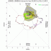
MJO: Both the GEFS and EPS are projecting a pretty lengthy period in phase 7, but the amplitudes are way different. GEFS is very strong and exceeds 3 while EPS is weak and near 1 (right on circle):
 

Attachments

  • 6C98893A-7071-42C4-A587-411ECF8C9B79.gif
    6C98893A-7071-42C4-A587-411ECF8C9B79.gif
    29.1 KB · Views: 46
  • 71480E90-C09D-4131-8D2A-213A42DF8F9E.gif
    71480E90-C09D-4131-8D2A-213A42DF8F9E.gif
    24.7 KB · Views: 47
Back
Top