I thought the GFS had backed off… at least that was the view from the Jonesville Desert
-
Hello, please take a minute to check out our awesome content, contributed by the wonderful members of our community. We hope you'll add your own thoughts and opinions by making a free account!
You are using an out of date browser. It may not display this or other websites correctly.
You should upgrade or use an alternative browser.
You should upgrade or use an alternative browser.
Pattern Dry July 2024
- Thread starter SD
- Start date
JHS
Member
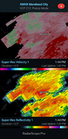
That is most likely happening. There will be plenty of storms from northeast NC southwest across the SC midlands into central GA that will only slowly move east with 2-4 inches of rain for many. Meanwhile it'll be mostly dry back to the west today. Hopefully we can get something back this way on Thursday, because after that we start to dry out and heat back up.MHX put a flood watch on us...calling for a slow moving training line of storms right over the central coastal plains...
JHS
Member
The GFS and Euro have not really backed off but are mostly wrong. Only the HRRR can be trusted right now.I thought the GFS had backed off… at least that was the view from the Jonesville Desert
iGRXY
Member
Downeastnc
Member
I heard once that however the Dog Days start the pattern usually holds for a month.
January to March is a lot longer than a month, buddy.I heard once that however the Dog Days start the pattern usually holds for a month.
JHS
Member
There goes any chance of rain for tomorrow too since GSP expects low clouds over the area again. If we do not get something Thursday, we will have to wait a long time for rain here. The NAM, GFS, and Euro are simply wrong. Right now, only the HRRR matters.
I guess it just matters where you’re at because the 3kNAM has done very well in my area the last few days. I had another 1.2” overnight… the 4th straight with over an inch and I’m actually closing in on 9 for the monthThe GFS and Euro have not really backed off but are mostly wrong. Only the HRRR can be trusted right now.
JHS
Member
We have not had more than .05 in any 1 event since July 7 here. Just trace amount mostly. BTW the heat is coming back this weekend along with drier weather. CAE is already talking about heat advisories and warnings in their area with near 100 degree highs there.I guess it just matters where you’re at because the 3kNAM has done very well in my area the last few days. I had another 1.2” overnight… the 4th straight with over an inch and I’m actually closing in on 9 for the month
Drizzle Snizzle
Member
Fortunately we only have about 20 more days until the Dog Days end ( on August 11).I heard once that however the Dog Days start the pattern usually holds for a month.
RDUHeatIsland
Member
Durham just can’t stop winning
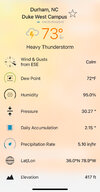
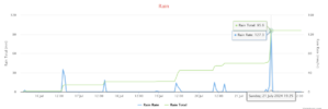
It’s a repeat of Saturday evening here (which gave me just over 2”) including nearby CTG lightning:
FLOOD ADVISORY
NATIONAL WEATHER SERVICE CHARLESTON SC
445 PM EDT MON JUL 22 2024
GAC051-222245-
/O.NEW.KCHS.FA.Y.0048.240722T2045Z-240722T2245Z/
/00000.N.ER.000000T0000Z.000000T0000Z.000000T0000Z.OO/
CHATHAM GA-
445 PM EDT MON JUL 22 2024
..FLOOD ADVISORY IN EFFECT UNTIL 645 PM EDT THIS EVENING
* WHAT...FLOODING CAUSED BY EXCESSIVE RAINFALL IS EXPECTED.
* WHERE...A PORTION OF SOUTHEAST GEORGIA, INCLUDING THE FOLLOWING
COUNTY, CHATHAM.
* WHEN...UNTIL 645 PM EDT.
* IMPACTS...MINOR FLOODING IN LOW-LYING AND POOR DRAINAGE AREAS.
* ADDITIONAL DETAILS...
- AT 444 PM EDT, DOPPLER RADAR INDICATED HEAVY RAIN DUE TO
THUNDERSTORMS. MINOR FLOODING IS ONGOING OR EXPECTED TO BEGIN
SHORTLY IN THE ADVISORY AREA. BETWEEN 1 AND 2 INCHES OF RAIN
HAVE FALLEN BETWEEN DOWNTOWN SAVANNAH AND CHATHAM CITY.
- ADDITIONAL RAINFALL AMOUNTS OF 1 TO 2 INCHES ARE EXPECTED
OVER THE AREA. THIS ADDITIONAL RAIN WILL RESULT IN MINOR
FLOODING.
JHS
Member
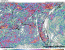
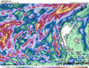
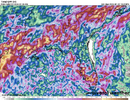
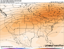
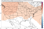
This might put us in the ring of fire if it is correct. Severe storms from the Dakota down into the Carolinas.Might have to fire up the August thread soon. Looks like we get right back to a similar patternView attachment 148714
View attachment 148715
Just like on Saturday evening:
PRELIMINARY LOCAL STORM REPORT
NATIONAL WEATHER SERVICE CHARLESTON SC
517 PM EDT MON JUL 22 2024
.TIME... ...EVENT... ...CITY LOCATION... ...LAT.LON
.DATE... ....MAG.... ..COUNTY LOCATION..ST.. ...SOURCE.
..REMARKS..
0510 PM FLOOD SAVANNAH 32.05N 81.08W
07/22/2024 CHATHAM GA 911 CALL CENTER
EMERGENCY RESPONDERS AND TRAFFIC MAPS ARE REPORTING
SEVERAL FLOODED ROADWAYS ACROSS THE SAVANNAH METRO AREA
DUE TO HEAVY RAINFALL. SEVERAL VEHICLES ARE FLOODED.

