Shaggy
Member
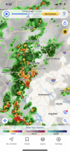
Low stratus is cracking down here and we are seeing some sun. Oddly enough almost all my heavier storms have hit either overnight or 1st thing in the mornings over the last week. It's gonna be another day of winners and losers.It sucks to really attempt to pin down a forecast today. The front is likely to fire off some convection starting around noon through the afternoon but it's going to start to get wavy as the S flow begins pushing against it and it loses all help to get south. A decent shortwave will move NE out of SC and GA after dark so instability is decreasing but forcing is going up. Areas south of the front should be free to fire convection but how long does this stratus hang around and limit overall instability there.
I personally find the shortwave/mcv coming north interesting this evening and overnight. Models aren't super active with it but as it interacts with the old front and starts lifting over it I do wonder if the models are under playing coverage and intensity tonight
On a different note this has been a solid big win of a week. I'm closing in on 6 inches of rainnsonce last Thursday. There was the surprise rain Wednesday morning our forecast highs of 96-98 have not come close to panning out due to residual cloud debris.
Only negative has been an explosion of mosquitos


