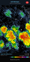
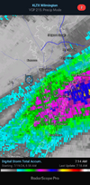
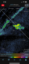
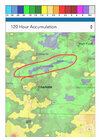
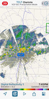
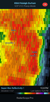
The newest HRRR is holding that together and expanding it over the next few hoursThat is a long way from here and it probably will not make it to Union County.
-
Hello, please take a minute to check out our awesome content, contributed by the wonderful members of our community. We hope you'll add your own thoughts and opinions by making a free account!
You are using an out of date browser. It may not display this or other websites correctly.
You should upgrade or use an alternative browser.
You should upgrade or use an alternative browser.
Pattern Dry July 2024
- Thread starter SD
- Start date
JHS
Member
That HRRR run drops .04 here and nothing around Charlotte. Our rainy Friday night is GONE.The newest HRRR is holding that together and expanding it over the next few hours
.33 .77 .55 the last 3 days.
That area is interesting to me even here. That's a pretty rapid decay on the models this evening but it looks like there's some hints of a mcv near Augusta. It'll be interesting to see if that starts forcing warm muggy air over the ofb that went south today and there's enough elevated instability for that to beat the models in longevity and coverage.The newest HRRR is holding that together and expanding it over the next few hours
I’ve been receiving mainly moderate rain from several thunderstorms over the last ~90 minutes. The CTG lightning is currently rather frequent with it causing a power blink a few minutes ago. No wind to speak of. Typical summer storms.
BHS1975
Member
That area is interesting to me even here. That's a pretty rapid decay on the models this evening but it looks like there's some hints of a mcv near Augusta. It'll be interesting to see if that starts forcing warm muggy air over the ofb that went south today and there's enough elevated instability for that to beat the models in longevity and coverage.
The latest HRRR is holding it together for us.
Sent from my iPhone using Tapatalk
JHS
Member
Rain is falling apart as it gets closer to this area, meanwhile places with 3-5 inches on the week are getting hit again. May as well bring the 100+ temps back, I guess.
Ended up with 1.01 today, .92 yesterday, and .38 the day before. Pretty good start to the Big Wet.
received 1” on the nose in just under 30 minutes today putting us at 5.67” for the month. After basically nothing from the 2nd week of May until last week it’s welcome. The grass never got going before the drought hit so it’s finally filling in.
Brent
Member
There were 50s on the map this morning here...
Shaggy
Member
Well thought I was gonna get blanked today but as usual the pattern of night time development seems to be playing out again with a line popping very close and just south of me
GoDuke
Member
I feel your pain buddy. Been watching the bs on radar all week.Rain is falling apart as it gets closer to this area, meanwhile places with 3-5 inches on the week are getting hit again. May as well bring the 100+ temps back, I guess.
I hope no one from the NWS is watching the radar over Wilkes Co tonight cause I have the storms moving from “East to West” and slamming into the blue ridge with a back build currently. No other storms doing this nearby.
NAMs and the FV3 does. But the latest HrrrrrRs aren't enthusiastic.The latest HRRR is holding it together for us.
Sent from my iPhone using Tapatalk
Shaggy
Member
Got an inch so far in Athens, GA. Not ideal but we'll take it.
Shaggy
Member
Gonna be a good night for me. Already have .65 and plenty more coming. Some places have gotten 2.5 In just an hour
Shaggy
Member
I get it and it's the same for me. No complaints about my rain total but I would like to catch the core of one of these imby, if for nothing else than to satisfy my weather nerd. It's been a while since I've been dead centerAlways the bridesmaid never the bride. I hate to even complain because I ended up with exactly 1 inch over night. Then again I was on the cutoff between much lower totals and some places that had 5 inches.View attachment 148658
WFFaithful
Member
0.2 since Thursday. This wet period is off to a great start!
Man the weather nerd part I get. I don't want/need any rain now but if a storm is coming I want to be dead center too. For that reason alone, otherwise if I could I'd deflect every raindrop your wayI get it and it's the same for me. No complaints about my rain total but I would like to catch the core of one of these imby, if for nothing else than to satisfy my weather nerd. It's been a while since I've been dead center
Shaggy
Member
It's like waking up and seeing 3 inches of snow on the ground. You are happy you got it and it's much appreciated then you realize just a couple miles down the road got 8 inches and the pain and letdown sets in.I get it and it's the same for me. No complaints about my rain total but I would like to catch the core of one of these imby, if for nothing else than to satisfy my weather nerd. It's been a while since I've been dead center
JHS
Member
Tomorrow will mark 2 weeks since we have had a good rainfall here and the HRRR says we basically see none for the next 48 hours. The great wet is a no show here. The big heat is coming back and maybe we can somehow get a storm with that in about 10 days.
Last edited:
Welcome to SE Wake Co, just replace the 3 inches with a flake and two sleet pellets.It's like waking up and seeing 3 inches of snow on the ground. You are happy you got it and it's much appreciated then you realize just a couple miles down the road got 8 inches and the pain and letdown sets in.
Im on the other side of the apps today near Johnson city. Pops couldnt handle the curves coming down from Boone, so went up to VA and cane dow I 81. Its been dry as well through sw VA back into TN. Fescue Brown. But they got rain all around this morning. Usually plush green in southern Apps during humid summer. Bout as brown as Ive ever seen it in summer
Drizzle Snizzle
Member
I'm beginning to wonder if Atlanta will hit 90 again this summer.
It most certainly will
The airport certainly will many times. Now that our humidity and soil moisture are normal we shouldn’t see many, if any mid or high 90s. At least the stations that aren’t over 5 runways.I'm beginning to wonder if Atlanta will hit 90 again this summer.
Probably several times in OctoberIt most certainly will
Summer storms man. Our yards are long and narrow it was just pouring on the fence at the back of my yard and not raining on the road in front of the house
GoDuke
Member
JHS
Member
Still nothing here and no good chance for rain anytime soon.
Brent
Member
High today of 87. Any high below 90 this time of year is a win and we've got a few more days to go
Still not seeing any extreme heat showing up
Still not seeing any extreme heat showing up
Further to the above post (also the lightning including nearby CTG strikes just now has become frequent):
FLOOD ADVISORY
NATIONAL WEATHER SERVICE CHARLESTON SC
818 PM EDT SAT JUL 20 2024
GAC051-210215-
/O.NEW.KCHS.FA.Y.0047.240721T0018Z-240721T0215Z/
/00000.N.ER.000000T0000Z.000000T0000Z.000000T0000Z.OO/
CHATHAM GA-
818 PM EDT SAT JUL 20 2024
..FLOOD ADVISORY IN EFFECT UNTIL 1015 PM EDT THIS EVENING
* WHAT...FLOODING CAUSED BY EXCESSIVE RAINFALL IS EXPECTED.
* WHERE...A PORTION OF SOUTHEAST GEORGIA, INCLUDING THE FOLLOWING
COUNTY, CHATHAM.
* WHEN...UNTIL 1015 PM EDT.
* IMPACTS...MINOR FLOODING IN LOW-LYING AND POOR DRAINAGE AREAS.
* ADDITIONAL DETAILS...
- AT 816 PM EDT, DOPPLER RADAR INDICATED HEAVY RAIN DUE TO
THUNDERSTORMS. MINOR FLOODING IS ONGOING OR EXPECTED TO BEGIN
SHORTLY IN THE ADVISORY AREA. UP TO 1.5 INCHES OF RAIN HAVE
FALLEN.
- ADDITIONAL RAINFALL AMOUNTS OF 1 TO 2 INCHES ARE EXPECTED
OVER THE AREA. THIS ADDITIONAL RAIN WILL RESULT IN MINOR
FLOODING, ESPECIALLY WITHIN DOWNTOWN SAVANNAH.
The rainfall here has really been adding up quickly. And still lots of lightning!
Related to this:
PRELIMINARY LOCAL STORM REPORT
NATIONAL WEATHER SERVICE CHARLESTON SC
838 PM EDT SAT JUL 20 2024
.TIME... ...EVENT... ...CITY LOCATION... ...LAT.LON
.DATE... ....MAG.... ..COUNTY LOCATION..ST.. ...SOURCE.
..REMARKS..
0835 PM FLOOD 1 W SAVANNAH 32.05N 81.10W
07/20/2024 CHATHAM GA PUBLIC
TRAFFIC MAPS REPORTED SEVERAL FLOODED ROADWAYS ACROSS
THE SAVANNAH METRO AREA DUE TO HEAVY RAINFALL.
———————
PRELIMINARY LOCAL STORM REPORT
NATIONAL WEATHER SERVICE CHARLESTON SC
913 PM EDT SAT JUL 20 2024
.TIME... ...EVENT... ...CITY LOCATION... ...LAT.LON
.DATE... ....MAG.... ..COUNTY LOCATION..ST.. ...SOURCE.
..REMARKS..
0912 PM FLOOD SAVANNAH 32.05N 81.08W
07/20/2024 CHATHAM GA 911 CALL CENTER
MULTIPLE VEHICLES STUCK IN FLOOD WATERS ON EAST VICTORY
DRIVE.
———————————
PRELIMINARY LOCAL STORM REPORT
NATIONAL WEATHER SERVICE CHARLESTON SC
941 PM EDT SAT JUL 20 2024
.TIME... ...EVENT... ...CITY LOCATION... ...LAT.LON
.DATE... ....MAG.... ..COUNTY LOCATION..ST.. ...SOURCE.
..REMARKS..
0905 PM FLOOD SAVANNAH 32.05N 81.08W
07/20/2024 CHATHAM GA EMERGENCY MNGR
REPORTS OF VEHICLES STALLED IN FLOOD WATERS NEAR THE
600 BLOCK OF EAST HENRY STREET. ADDITIONAL FLOODING NEAR
THE INTERSECTION OF ATLANTIC AND E. 41 STREET, E. 56
STREET AND HABERSHAM STREET.
————————————-
*Edit: It finally slackened to mainly light rain, which is still continuing, at ~9PM and nearby lightning appears to be done. Looks like I got 2”+.
Last edited:
Downeastnc
Member
JHS
Member
Models are trending drier for everyone. The so called big wet is done.

