-
Hello, please take a minute to check out our awesome content, contributed by the wonderful members of our community. We hope you'll add your own thoughts and opinions by making a free account!
You are using an out of date browser. It may not display this or other websites correctly.
You should upgrade or use an alternative browser.
You should upgrade or use an alternative browser.
Pattern Dry July 2024
- Thread starter SD
- Start date
I got .81 inches of rain here near Lake Wheeler. The drive home from work was slow but that is to be expected when heavy rain causes ponding on the roadways.
9.22 for the month, I'll gladly share
LickWx
Member
Go for 15! Get greedy9.22 for the month, I'll gladly share
Hope this continues for a week… CLT suburbs

Sent from my iPhone using Tapatalk

Sent from my iPhone using Tapatalk
Not what I was hoping today would be imby but .61 with some light rain still falling. We take
Rained hard east and west and south and north of us. We got maybe 20 minutes of light rain then poof gone. Drought loves drought.
JHS
Member
Sunday will be 2 weeks since we have had good rain and I'm not expecting any before then.
GoDuke
Member
.14 from that line today. Storms split me so closely the hdr could barely pick up the gap. Incredibly frustrating. That’s the way it’s been the last week. Tuesday it’s literally thundered all around me for hours from noon till about 7.Rained hard east and west and south and north of us. We got maybe 20 minutes of light rain then poof gone. Drought loves drought.
JHS
Member
The HRRR is about right for tomorrow. Time to drop pops down to about 20-30% instead of 60-80% tomorrow.
Both the HRRR and the 3kNAM handled today really well and both are wanting to produce an area of training heavy rainfall late tomorrow evening into the overnight from the upstate to CLT metroThe HRRR is about right for tomorrow. Time to drop pops down to about 20-30% instead of 60-80% tomorrow.
Nerman
Member
I spot treated the weeds in my yard today to ensure the rain Gods would bless us.
This dry period is finished here.
Shaggy
Member
Shaggy
Member
The storms held together and gave me another .75 for a 2 day total of 1.5 to.add to last Saturdays 4 inch total
Shaggy
Member
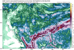
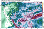
Only about a 2 to 3 inch difference between the 3knam and the hrrr for today
Bannerdude
Member
Wow, 53F on Mt Mitchell this morning
Only about a 2 to 3 inch difference between the 3knam and the hrrr for today
It sucks to really attempt to pin down a forecast today. The front is likely to fire off some convection starting around noon through the afternoon but it's going to start to get wavy as the S flow begins pushing against it and it loses all help to get south. A decent shortwave will move NE out of SC and GA after dark so instability is decreasing but forcing is going up. Areas south of the front should be free to fire convection but how long does this stratus hang around and limit overall instability there.
I personally find the shortwave/mcv coming north interesting this evening and overnight. Models aren't super active with it but as it interacts with the old front and starts lifting over it I do wonder if the models are under playing coverage and intensity tonight
Last edited:
Shaggy
Member
Low stratus is cracking down here and we are seeing some sun. Oddly enough almost all my heavier storms have hit either overnight or 1st thing in the mornings over the last week. It's gonna be another day of winners and losers.It sucks to really attempt to pin down a forecast today. The front is likely to fire off some convection starting around noon through the afternoon but it's going to start to get wavy as the S flow begins pushing against it and it loses all help to get south. A decent shortwave will move NE out of SC and GA after dark so instability is decreasing but forcing is going up. Areas south of the front should be free to fire convection but how long does this stratus hang around and limit overall instability there.
I personally find the shortwave/mcv coming north interesting this evening and overnight. Models aren't super active with it but as it interacts with the old front and starts lifting over it I do wonder if the models are under playing coverage and intensity tonight
On a different note this has been a solid big win of a week. I'm closing in on 6 inches of rainnsonce last Thursday. There was the surprise rain Wednesday morning our forecast highs of 96-98 have not come close to panning out due to residual cloud debris.
Only negative has been an explosion of mosquitos
Was 53 here this morning! Nice little cool snap!Wow, 53F on Mt Mitchell this morning
For mby and I’m sure many others the rain has been lackluster from the forecasts the past few days/weeks. I’m not sure I can recall a time where storms have been so sporadic. When a rain shower does pop up locally it is short lived and accumulations aren’t what was forecasted ( I know ,such is life). I would love a good 12 hour slow soaking rain but don’t see that happening in the immediate future.
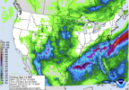
Doesn’t look to wet in Iowa!
BHS1975
Member
Yes sir

Sent from my iPhone using Tapatalk

Sent from my iPhone using Tapatalk
It amazing how close we live to each other and just what a difference that few miles makes… I’ve had 2.3” of rain this week bringing my total for the month to 8.32”.For mby and I’m sure many others the rain has been lackluster from the forecasts the past few days/weeks. I’m not sure I can recall a time where storms have been so sporadic. When a rain shower does pop up locally it is short lived and accumulations aren’t what was forecasted ( I know ,such is life). I would love a good 12 hour slow soaking rain but don’t see that happening in the immediate future.
Yeah it’s not even close. I don’t think I’ve reached 1 inch in Marshville . Sorry I guess it was 1.38” on the 8th. I work in Midland and it either rains well there or here. No where near those totals.It amazing how close we live to each other and just what a difference that few miles makes… I’ve had 2.3” of rain this week bringing my total for the month to 8.32”.
Last edited:
I was looking out for y’all!Doesn’t look to wet in Iowa!
Appreciated bro!I was looking out for y’all!
You are right about this current tropical weather pattern we are in with warm humid weather giving good chances for rain each day for the next several days bringing out the mosquitoes. I just got back from taking the dog I have in my avatar to the veterinarian and got bit for the first time this year. Before that I only recall seeing a couple of mosquitoes this yearLow stratus is cracking down here and we are seeing some sun. Oddly enough almost all my heavier storms have hit either overnight or 1st thing in the mornings over the last week. It's gonna be another day of winners and losers.
On a different note this has been a solid big win of a week. I'm closing in on 6 inches of rainnsonce last Thursday. There was the surprise rain Wednesday morning our forecast highs of 96-98 have not come close to panning out due to residual cloud debris.
Only negative has been an explosion of mosquitos
Didn't take much to get the front popping today
Guess we could get a repeat today of yesterday afternoon. Getting dark here.
JHS
Member
Same places again. Not a drop and not looking for anything. The HRRR says tonight's heavy rain is gone and it does not look good for tomorrow either. Maybe sometime next week things will change but I'm not expecting it unless it goes back to drier and hotter.
Dang
To go with the .81 inches I received yesterday, I've already gotten .72 inches today. That's over 1.5 inches in the past two days. If the current weather pattern holds up for the next week or so as forecasted, the recent drought may go to the other extreme.
Yeah, it’s never gonna rain until November!Same places again. Not a drop and not looking for anything. The HRRR says tonight's heavy rain is gone and it does not look good for tomorrow either. Maybe sometime next week things will change but I'm not expecting it unless it goes back to drier and hotter.
JHS
Member
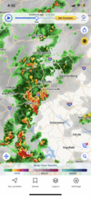
That is a long way from here and it probably will not make it to Union County.

