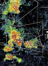
That don’t equate to precip on the ground! Hopefully we can get a change going forward!
-
Hello, please take a minute to check out our awesome content, contributed by the wonderful members of our community. We hope you'll add your own thoughts and opinions by making a free account!
You are using an out of date browser. It may not display this or other websites correctly.
You should upgrade or use an alternative browser.
You should upgrade or use an alternative browser.
Pattern Dry July 2024
- Thread starter SD
- Start date
Hopefully we keep up this spirit in the winter when 3840 hour JMA maps get postedThat don’t equate to precip on the ground! Hopefully we can get a change going forward!
Nice rains here last night. Probably picked up .5-1”
Grass needs cut again
Grass needs cut again
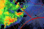
I think the Eastern Piedmont is in for a rainy period for at least the next week or so with a cold front pushing to the coast on Thursday and then gradually lifting north during the period. That will be the focus for showers and thundershowers and the NWS doesn't have a rain chance of less than 50 percent for the next seven days. My garden which has received some rain recently sure would benefit from this.
Shaggy
Member
Models did a horrible job picking up this mornings rain event. We were suppose to be 97 with storms after 3pm. It's been a wet morning ing and we are still under cloud canopy
I wouldn't be surprised to see a slight introduced in parts of NC tomorrow. The setup isn't eye popping but it's one that could concentrate some areas of wind damage if we get a consolidated line or segments
https://www.cnn.com/2024/07/17/weather/summer-heat-temperatures-us-climate/index.html
Notice the only red spot on this map in North Carolina and where it is located (RDU). There is no denying that it has been a very hot summer so far for much of the United States.
Notice the only red spot on this map in North Carolina and where it is located (RDU). There is no denying that it has been a very hot summer so far for much of the United States.
JHS
Member
Got missed today. Just a trace of rain.
rusrius
Member
Since June 10th, that's June and not July, I've had 2 rains totaling half an inch. I pray I get something over the next few days.
GeorgiaGirl
Member
That was some storm this evening. You had a wind gust recorded of nearly 70 MPH at the airport.
Storming like crazy on the NC/VA border.
Yeah, I just drove through it coming back from Kings Dominion. Some really intense storms.Storming like crazy on the NC/VA border.
Shaggy
Member
Picked up another .35 over bringing my total up to .70 yesterday
1.82 last night, 8.65 for the month, goodness.
iGRXY
Member
A couple of solid storms yesterday. Hopefully we continue this the rest of the week.
Shaggy
Member
That's pretty solid and we still have a wet few days ahead1.82 last night, 8.65 for the month, goodness.
Under a level 2 risk for severe storms today. Let's see if I can actually get a storm comparable to last week when I got a good one when we weren't under any risk for severe storms.
Uh oh, looks like the sun is trying to come out.
Shaggy
Member
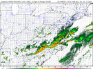
Nam 3k is excited for a state tall line to form so I think everyone has a decent chance at a good showUh oh, looks like the sun is trying to come out.
Downeastnc
Member
If that pans out, I would expect Fro to post some awesome lightning pictures. The air definitely feels like something is brewing for later… currently it’s 91/78 hereBeen awhile since something like this has panned out or at least it feels that way...
View attachment 148625
It's beginning.
Severe Thunderstorm Warning for parts of Granville, Durham, Orange and Person County until 2:15 PM. It's moving east at 25 mph and has the potential to produce winds of 60 mph.
Severe Thunderstorm Warning for parts of Granville, Durham, Orange and Person County until 2:15 PM. It's moving east at 25 mph and has the potential to produce winds of 60 mph.
The front has dropped in behind that mcv across south va and is from hky to gso to near roxboro. It'll be interesting to see how this evolves this afternoon into the evening as the ofb/front drops south but the mcv moves away. Good setup to temporarily train cells where convection really fires in the next few hours until it gets outflow dominant and everything moves to the SE
Been storming good here the last 30 minutes.
- Joined
- Jan 23, 2021
- Messages
- 4,587
- Reaction score
- 15,141
- Location
- Lebanon Township, Durham County NC
Pretty sure the front is almost over me with the storms lining up. Pushing 2” for the day.
Pouring outside. We have gone from famine to feast.
This ofb slipping south through wake and the next upper level energy being west of CLT makes me think there going to be suck hole right over my house
100%. I was lucky to get a little cell pop up and drop .15 but no way we're going to get anything to speak of with all that mess heading to the east up north and the western stuff being too far south.This ofb slipping south through wake and the next upper level energy being west of CLT makes me think there going to be suck hole right over my house
LickWx
Member
This ofb slipping south through wake and the next upper level energy being west of CLT makes me think there going to be suck hole right over my house
In a perfect dream world that ofb would run out of gas right between us and we would cook later but those things don't happen around here100%. I was lucky to get a little cell pop up and drop .15 but no way we're going to get anything to speak of with all that mess heading to the east up north and the western stuff being too far south.
LickWx
Member
It’s storming here! What an amazing drought free summer  I’ve been fortunate
Home for the weekend and it’s dumping the storms love me
The storms have passed. Is that it for today?
your maA what over your house
JHS
Member
Storms are done over most of upstate SC for today and we did not get 1 drop and not expecting much over the next 2 days either. That front goes farther south and takes all storms south of I-20 until Sunday or Monday.


