- Joined
- Jan 5, 2017
- Messages
- 3,779
- Reaction score
- 5,990
.25" and down to 66 degrees in 20 minutes.
Sad but true. Just my forecast hope I’m wrong. Trying to get better at narrowing down “when” vs a seasonal broad forecast. I think winter forecasts should be narrower and sectionedGood lord. If you push it back too much beyond Jan 25 we will be pushing March.
Is this good or bad?
We’re on track to follow the phase 7 composites, which is a very cold & snowy phase.Is this good or bad?
Seems like it's pretty awesome for Yukon CorneliusIs this good or bad?
So let me see if I understand this ...... Alaska cold, we torch. Alaska warm, we torch. Got it..... I really don't get that whole "Alaska has to thaw before we get cold" thing. Ridge in Alaska obviously doesn't mean what it used to mean for us.Yep.
Is this good or bad?
So let me see if I understand this ...... Alaska cold, we torch. Alaska warm, we torch. Got it..... I really don't get that whole "Alaska has to thaw before we get cold" thing. Ridge in Alaska obviously doesn't mean what it used to mean for us.
That looks like a jacked up Aluetian ridge/EPO ridge that's too far west forcing a -PNA. Definitely not pretty and probably not going anywhere anytime soon. We're going to have to rely on a -NAO and hope it materializes. With the cold shots the EPO does provide the NAO may block this up just enough to give us better odds to time something up.So let me see if I understand this ...... Alaska cold, we torch. Alaska warm, we torch. Got it..... I really don't get that whole "Alaska has to thaw before we get cold" thing. Ridge in Alaska obviously doesn't mean what it used to mean for us.
Red blob in bad spot. Jimmy want to shift red blob east. Then Jimmy hug.
We saw this pattern infinitely many times in the 2010s (esp during 2012-13, 2013-14, & 2014-15), so none of this has changed.
-EPOs usually translate to SE ridge in the means & are mild over all, but w/ occasional bouts of brutally cold arctic air that can help deliver wintry weather in the deep south

That looks like a jacked up Aluetian ridge/EPO ridge that's too far west forcing a -PNA. Definitely not pretty and probably not going anywhere anytime soon. We're going to have to rely on a -NAO and hope it materializes. With the cold shots the EPO does provide the NAO may block this up just enough to give us better odds to time something up.
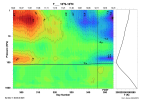
This is definitely one of the more insightful papers I've come across on the MJO-QBO relationship
https://journals.ametsoc.org/view/journals/clim/32/18/jcli-d-19-0010.1.xml?tab_body=pdf
our area actually does better winter storm wise with -PNAs. Typically because our best shots at snow here are really cold CADs and overrunning events. That typically coincides with - NAO/-PNA/-EPO. +PNAs drop the hammer with the cold but typically suppress any winter storms and areas around the 95 corridor east end up getting their snows this way.That looks like a jacked up Aluetian ridge/EPO ridge that's too far west forcing a -PNA. Definitely not pretty and probably not going anywhere anytime soon. We're going to have to rely on a -NAO and hope it materializes. With the cold shots the EPO does provide the NAO may block this up just enough to give us better odds to time something up.
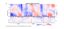
When you also consider that MJO propagation into the W Hem-Indian Ocean is enhanced during -NAO and when the MJO is initially strong (like it is now)...
https://journals.ametsoc.org/view/journals/clim/34/23/JCLI-D-21-0153.1.xml
I bring these papers up to say that we're stacking the deck towards MJO propagation in the long-run & from a subseasonal point of view, it seems more likely than not the MJO will run through phases 8-1 and perhaps even 2-3, which is generally a good thing for snow lovers in the eastern US.


Lights out Texas View attachment 97573
Man. Webber and anyone in Texas is going to cash in on this pattern View attachment 97576
Please do! That would be awesomeIf I see legit snow out here, I'll definitely make an effort to go chase it in the mountains and send some pics/vid.
No such thing as a solid ice event man. Cold rain is better. No one wants iceFeel like that trough and it’s associated low in Canada/NW of the GLs needs to get out of here and get replaced with higher heights, and that introduces chances of classical CAD/ string banana high and not some weak in-situ CAD event, the look at H5 honestly isn’t far off from some solid ice event View attachment 97577View attachment 97578
I disagree. The results of this site contradict that.No such thing as a solid ice event man. Cold rain is better. No one wants ice
I use to be in that I don’t want ZR camp, but I’ve switched. Seeing any type of winter precip is a rarity nowadays here, gotta cherish anything that’s frozen nowadaysI disagree. The results of this site contradict that.
How much do you like Freezing Rain?
There's a lot of controversy over this, so I'm interested to find out the results.southernwx.com
Ice storms are fun.I disagree. The results of this site contradict that.
How much do you like Freezing Rain?
There's a lot of controversy over this, so I'm interested to find out the results.southernwx.com
Lights out Texas View attachment 97573
It's always been okay. As a site, we've never discriminated against people outside of the SE. Some people are just rude.So wait, discussion about weather in Texas is ok now?
When I discussed our hot temperatures this past Summer/Fall, I was lambasted by more than one member for posting because Texas isn't in the Southeast. ?
So wait, discussion about weather in Texas is ok now?
When I discussed our hot temperatures this past Summer/Fall, I was lambasted by more than one member for posting because Texas isn't North Carolina. ?
Honestly for our area, our ice storms over the last 15 years have turned into sleet storms anyway which I don’t mind one bitI use to be in that I don’t want ZR camp, but I’ve switched. Seeing any type of winter precip is a rarity nowadays here, gotta cherish anything that’s frozen nowadays
IMO if there’s people in here from other states outside of the southeast it’s okay to talk about themSo wait, discussion about weather in Texas is ok now?
When I discussed our hot temperatures this past Summer/Fall, I was lambasted by more than one member for posting because Texas isn't in the Southeast. ?
Q
our area actually does better winter storm wise with -PNAs. Typically because our best shots at snow here are really cold CADs and overrunning events. That typically coincides with - NAO/-PNA/-EPO. +PNAs drop the hammer with the cold but typically suppress any winter storms and areas around the 95 corridor east end up getting their snows this way.
So wait, discussion about weather in Texas is ok now?
When I discussed our hot temperatures this past Summer/Fall, I was lambasted by more than one member for posting because Texas isn't in the Southeast. ?
What Ollie said. I've personally found having folks from outside of the region posting nice and if we grow more within the region or outside it'll be even more fun.It's always been okay. As a site, we've never discriminated against people outside of the SE. Some people are just rude.
