NBAcentel
Member
Right you are… some of the videos I’ve seen this morning looks absolutely unreal.Unfortunately, this December is going to be remembered for one of the worst tornado outbreaks in recent history.
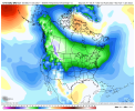
12z gfs bringing us back to reality View attachment 97522
Yup it’s really crazy. I’ve heard that our winters will be like Texas winters in 50 years. I can’t wait lolI think this is the new normal. Colder winters for Texas. Balmy winters for the deep and mid south.
Sent from my iPhone using Tapatalk
12z gfs bringing us back to reality View attachment 97522
Yeah I understand that. I just meant that this gfs solution makes more sense over the last couple runs that showed arctic outbreaksThis is a 264 hour op GFS map for 12/22, which isn’t even warm in NC and which is during high amp MJO 7, a not cold phase on average (near normal) in the SE in late Dec. The best shot at cold domination, especially up north, has been and continues to be after 12/26 when MJO gets to the often cold phases of 8-1-2 into mid Jan along with cross polar/-EPO 12/27-1/11.
This is a 264 hour op GFS map for 12/22, which isn’t even warm in NC and which is during high amp MJO 7, a not cold phase on average (near normal) in the SE in late Dec. The best shot at cold domination, especially up north, has been and continues to be after 12/26 when MJO gets to the often cold phases of 8-1-2 into mid Jan along with cross polar/-EPO 12/27-1/11.
Larry, I tried to tell people that MJO phase 7 is pretty normal weather for the SE outside of NC/Va which are a little cooler than average. What we want in the SE is phases 8,1 and 2 to get exciting times here in the SEThis is a 264 hour op GFS map for 12/22, which isn’t even warm in NC and which is during high amp MJO 7, a not cold phase on average (near normal) in the SE in late Dec. The best shot at cold domination, especially up north, has been and continues to be after 12/26 when MJO gets to the often cold phases of 8-1-2 into mid Jan along with cross polar/-EPO 12/27-1/11.
nice and warm out right now, with a hint of swamp ass
I know. On the look out for cumulobimbus this December 11th. Urghnice and warm out right now, with a hint of swamp ass
I don't know if it will meander in phase 7 but it very well could collapse into the circle and not have much effect. Any pattern change is still 2 weeks away and you know how that goes. It may or may not happen.Does this propagation have to happen though? Couldn’t it just meander in phase 7 for a good long while?
Sent from my iPhone using Tapatalk
Does this propagation have to happen though? Couldn’t it just meander in phase 7 for a good long while?
Sent from my iPhone using Tapatalk
Yessir merry torchmas everyone ! View attachment 97525
I don't know if it will meander in phase 7 but it very well could collapse into the circle and not have much effect. Any pattern change is still 2 weeks away and you know how that goes. It may or may not happen.
If it goes nearer to or even inside the COD but stays on left side (8-1-2), that has actually been shown to have better prospects for SE cold in January than high amp 8-1-2. A complete collapse into the middle or right side of COD is highly unlikely per a combo of 1975-2021 diagrams and model forecasts.
Last night was scary. I did not go to bed till almost 4AM once the the tornado threat was gone. Had lots of tornado warned storms moving north east directly towards my town. Luckily the storms started to weaken as they came over me. It was a hell of a light show though for December, and as the thread title says it will be a month to remember but for all the wrong reasons.Unfortunately, this December is going to be remembered for one of the worst tornado outbreaks in recent history.
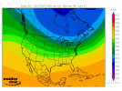
CFSv2 finally starting to catch onto the -NAO that develops and retrogrades into Greenland by the end of Dec, persisting into early-mid January when I (still) think our best shot to catch a winter storm will be.
View attachment 97535
CFSv2 finally starting to catch onto the -NAO that develops and retrogrades into Greenland by the end of Dec, persisting into early-mid January when I (still) think our best shot to catch a winter storm will be.
View attachment 97535
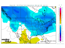
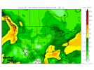
These 6Z CFS maps have major Carolina/N GA icestorm written all over them:
View attachment 97538View attachment 97539
The 6Z CFS maintained the intense cold from Chicago to NYC to dominate most of the 3 weeks from late Dec til mid Jan. She remains at the bottom with cold alternating with mild. Coldest SE Jan 3-10.
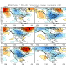
It is forecasted to meander in high amp 7 by the consensus for most of the next 2 weeks. But that same consensus then has it move to 8 by late Dec. Looking at history, it meandered a long time in 7 in Febs of 1981, 1987, 1989, and 2021 but made it to 8 (outside or within the COD) by March. So, based on history and models, chances of this never getting to 8 are very low although it could end up low amp 8-1-2, including inside COD. That low amp in itself would be even better for cold chances in the SE per history in late Dec-January.
Good lord. If you push it back too much beyond Jan 25 we will be pushing March.^ I agree with that for now @Webberweather53 still January 15th or later IMO. By this Sunday night tho, I’m re-examining my outlook to see if will be pushed back to January 25th and later. I’m certainly not moving ahead only back based on what I see.
Good work sir! Good to see that if it enters the COD that it'll still have the same effect if not better. I'm glad to see it coming right at the perfect time. Based on the chart above I hope it does meander awhile in 7 and head to 8 slowly in Jan because 1 and 2 are not good. I wouldn't have thought that. What's more surprising is the warm phases of 4-6 doesn't mean much come Feb.If it goes nearer to or even inside the COD but stays on left side (8-1-2), that has actually been shown to have better prospects for SE cold in January than high amp 8-1-2. A complete collapse into the middle or right side of COD is highly unlikely per a combo of 1975-2021 diagrams and model forecasts.
