When you look at snow events on a % or return period basis you really start to see how infrequent big events are. I've seen a foot plus in 39 years so my yearly chance is what a little over 5% even 6+ the %chance only gets to around 10-15. Not that greatYea I feel like we avg 1 good storm every 5-10 years. I can remember like 5-6 good one in my short 36 years.
-
Hello, please take a minute to check out our awesome content, contributed by the wonderful members of our community. We hope you'll add your own thoughts and opinions by making a free account!
You are using an out of date browser. It may not display this or other websites correctly.
You should upgrade or use an alternative browser.
You should upgrade or use an alternative browser.
Pattern December to Remember
- Thread starter SD
- Start date
cd2play
Member
GFS literally goes Indian Summer around mid month.
NoSnowATL
Member
Kirk Mellish had his winter outlook this morning on the radio. Called for a warm December with below rainfall, Avg Jan with below rainfall, Really warm Feb with below rainfall and a cold march with below rainfall. Snow chances will be below avg but cant rule out a freak storm with good timing but is worry about the drought. He thinks it will be bad going into spring.
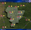
Zooming in on that map, I would assume it’s downsloping that increases the frequency in those locations. It even falls off for eastern CLT metro… often times when rain breaks up over the mountains, it will start building back up quickly just east of I-77.While our droughts aren’t typically severe , we are one of the most drought prone areas in the nation, specially north ga/ upstate sc / clt area . Not sure why , wonder if down-sloping and a rain shadow affect of sorts is to blame .View attachment 96618
iGRXY
Member
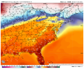
If the SE ridge really holds on through mid December as depicted right now, I got a feeling we're going to be seeing a lot of days of this right here. Those east of the Apps better get ready for a lot of cloudy 40 degree days mixed in with the 60's and 70's. West of the Apps looks like they're going to be baking for at least 2 weeks right now.Solid wedge on the iconView attachment 96620
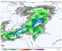
12Z GFS bringing the goods for drought reliefI just noticed the euro actually has 3 rain events with the 3rd firing up at D10. Wouldn't erase the dry anomalies but would certainly help recharge the water table and stream flows. This would likely be the highest 10 day rain totals for a good part of the state since probably early augustView attachment 96608
NBAcentel
Member
NBAcentel
Member
NBAcentel
Member
NBAcentel
Member
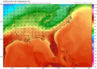
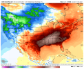
GFS basically says we take a trip to early June/late May with consistent upper 70s/low 80s for highs and lows in the upper 60s/low 70s pretty outrageous run
tennessee storm
Member
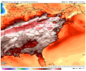
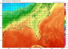
Absolutely insane be honest.GFS has 850s around 17-18C that could technically support temps in the mid 80s View attachment 96628View attachment 96630View attachment 96629
tennessee storm
Member
You got have winter first to have .Indian summerGFS literally goes Indian Summer around mid month.
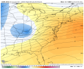
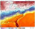
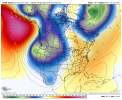
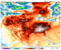
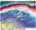
It’s been showing this for a while now there shouldn’t be much shock .. once we actually get to those days it’ll be interesting to feel but this isn’t shocking as it’s had the SER going flame on for like a week nownice setup For elevated thunderstorms on top of the wedge on the icon, but man it looks like the GFS now with a full on raging dumpster fire pattern View attachment 96621View attachment 96625View attachment 96622View attachment 96623View attachment 96624
GFS has 850s around 17-18C that could technically support temps in the mid 80s View attachment 96628View attachment 96630View attachment 96629
Will likely be looking at an stout inversion though, and plenty of low clouds.
NBAcentel
Member
Upper 70s/low 80s would still be likely because that’s just a helluva lot of SW flow from such a strong H5 ridgeWill likely be looking at an stout inversion though, and plenty of low clouds.
NBAcentel
Member
You thought the last GEFS run was warm ? Oh man this one about to turn the torch on
December's starting off with an insame temperature here (well into the double digits) and the next several days will be well above average
Will need one heck of an extended cold blast to bring the average back below normal for the month.
Will need one heck of an extended cold blast to bring the average back below normal for the month.
L
Logan Is An Idiot 02
Guest
Anyone starting to believe this could very well be top 3 Warmest December for the SE?
NBAcentel
Member
If tropical forcing remains in ph6 for a while then yes, I could easily see top 7, possibly top 5Anyone starting to believe this could very well be top 3 Warmest December for the SE?
L
Logan Is An Idiot 02
Guest
The good news is for a cold and snow lovers is that there’s a whole two months of winter for this pattern to flip. The bad news is in typical la Niña‘s the second half of winter isn’t favorable for winter weather.
Hoping for a repeat of 1984-5, when ENSO was very similar:
Nov of 1984 was mild in most of the central US and Maine but quite cold in the SE/lower MA states, very similar to Nov of 2021: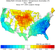
Dec of 1984 was way AN in the E US due largely to MC dominant MJO and we’re very likely headed to a similarly very mild Dec of 2021:
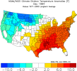
Here’s the historic Jan of 1985, which turned sharply colder as the MJO rotated to the cold/left side:
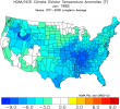
Here’s to hoping for a January of 1985 this January (again the ENSO is similar and the MJO will hopefully be similar)!
Nov of 1984 was mild in most of the central US and Maine but quite cold in the SE/lower MA states, very similar to Nov of 2021:

Dec of 1984 was way AN in the E US due largely to MC dominant MJO and we’re very likely headed to a similarly very mild Dec of 2021:

Here’s the historic Jan of 1985, which turned sharply colder as the MJO rotated to the cold/left side:

Here’s to hoping for a January of 1985 this January (again the ENSO is similar and the MJO will hopefully be similar)!
Brent
Member
NBAcentel
Member
L
Logan Is An Idiot 02
Guest
Yeah that’s absolutely absurd. Dripping sweat around Christmas time Is the worstThis ain’t just a SER… it’s a swamp ass SER with dewpoints in the 60s and high PWATs View attachment 96636View attachment 96635View attachment 96637
cd2play
Member
I would not count out a +10 departure for the month.Anyone starting to believe this could very well be top 3 Warmest December for the SE?
- Joined
- Jan 2, 2017
- Messages
- 1,566
- Reaction score
- 4,279
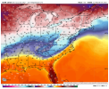
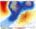
That is butt ugly!All 3 major ensembles 5-day mean temperature anomalies through mid-Dec
?????


L
Logan Is An Idiot 02
Guest
I personally think it’s going to be Warmer than 2015.I would not count out a +10 departure for the month.
NBAcentel
Member
Looking like once more we’re gonna have a cold November leading up to a very warm December
I should add that quite likely Dec of 2021 will be significantly warmer than November of 2021 in absolute temperatures. The same was the case in Nov/Dec of 1984. Then came January of 1985 and its super cold.
Webberweather53
Meteorologist
GFS has 850s around 17-18C that could technically support temps in the mid 80s View attachment 96628View attachment 96630View attachment 96629
Time to head to the beach for Christmas
Looking like once more we’re gonna have a cold November leading up to a very warm December
Or for some of us, a warm November leading up to an extremely warm December.
Webberweather53
Meteorologist
Big difference between this year and 1984-85 is that there are no signs of a big stratospheric warming event on the horizon. The one in Dec 1984 was one of the strongest ever observed and sent the polar vortex tumbling into eastern N America. Seems like a rather extreme scenario to hope forI should add that quite likely Dec of 2021 will be significantly warmer than November of 2021 in absolute temperatures. The same was the case in Nov/Dec of 1984. Then came January of 1985 and its super cold.
NBAcentel
Member
It’s honestly amazing what a -NAO can do, if it wasn’t there last year we probably would have had a dominant SER, looks like it was a one year wonder
Big difference between this year and 1984-85 is that there are no signs of a big stratospheric warming event on the horizon. The one in Dec 1984 was one of the strongest ever observed and sent the polar vortex tumbling into eastern N America. Seems like a rather extreme scenario to hope for
It is a very extreme scenario to hope for no doubt. But at least ENSO is similar and the MJO may be in cold phases later this month. Also, didn’t Bastardi recently claim a new SSW is on the way this month? He’s an overhyping weenie of course and always looks ahead when it is mild in winter. But might he be right about a new SSW?
tennessee storm
Member
That winter 84. 85 is about a once lifetime event to be honest … remember that winter really well. Went from 70s December here to minus 10 middle January with bout total 35 inches snow all total here west TennesseeBig difference between this year and 1984-85 is that there are no signs of a big stratospheric warming event on the horizon. The one in Dec 1984 was one of the strongest ever observed and sent the polar vortex tumbling into eastern N America. Seems like a rather extreme scenario to hope for
L
Logan Is An Idiot 02
Guest
Junecember?
Jessy89
Member

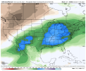
These rain totals on all that rain next week. 4-5 maybe 6 inches in spots

Sent from my iPhone using Tapatalk
Niña drought cancel
These rain totals on all that rain next week. 4-5 maybe 6 inches in spots
Sent from my iPhone using Tapatalk

