NoSnowATL
Member
Sitting at 50 and cloudy. BN today. Oops
Haven't you learned? We don't talk about the now, how dare you, we only talk about D8 and beyond. Come to think of it though, this will be nice when we finally are roasting our chestnuts off, we will actually be talking about the upcoming cold so it won't seem so bad ?Sitting at 50 and cloudy. BN today. Oops
This is very true… it also would not suprise me to see a significant severe weather outbreak as the pattern starts to change. I can remember a couple times in the 90s when a mild pattern broke down and brought some big thunderstorms ahead of the cold.We’re not going to get into the cold without first getting into the warmth in this kind of pattern.
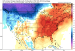
Speaking of warmth, the 12Z Euro is also a warmer run. Great news for getting outside and having fun.
holy ?

Y’all worried about the future too much. I’m freezing my codsack off today.
Theoretically there could be an mPing tomorrow as well. somewhere in Granville county probably . Torches don’t mPing!Haven't you learned? We don't talk about the now, how dare you, we only talk about D8 and beyond. Come to think of it though, this will be nice when we finally are roasting our chestnuts off, we will actually be talking about the upcoming cold so it won't seem so bad ?
Dang, even with the next few days at/slightly BN, the weekend makes it AN !! I’ll take +5 to +7 accounting for the last few days View attachment 97132

The pattern on today's CFSv2 was very weenie looking after Christmas.
30-day mean pattern from the Winter Solstice to about MLK Day

In all seriousness, do you envision anything remotely close if mjo gets moving ,albeit slowly and some Scandinavian stuff?
Yeah, I've been thinking something like this might show up in/around early Jan for a while now.
For the sake of sanity, do not share that with JB ...The pattern on today's CFSv2 was very weenie looking after Christmas.
30-day mean pattern from the Winter Solstice to about MLK Day is just about as good looking as it gets.

Jb is that you? LolFor the sake of sanity, do not share that with JB ...
Well, it's JB, of course, but since I fully expect to see nothing worthwhile south of Tifton anytime until ... I'm tempeted to hang my hat on this and that and exacerbate my disappointment ... LOL ... :
"Amazing how severe outbreaks late Dec 67- jan 1968, Jan 1985, Jan 1996 were preceded by similar set ups, Its as if the pattern that begets US warmth is the very signal, that once pattern evolves, that is followed by extreme cold. Players are there to take the field"
...
"while the nation is warm the next 10-15 there are things lining up that we are telling anyone that will listen that major, perhaps extreme cold, is going to invade the nation Dec 20-jan 20. MJO, Pacific oscillations analogs to past year, strat vortex split. too much to ignore"
*puts on Amazon wishlist*The pattern on today's CFSv2 was very weenie looking after Christmas.
30-day mean pattern from the Winter Solstice to about MLK Day is just about as good looking as it gets.

Not me, assuredly ... I live in the land of sanity and verisimilitude ... ?Jb is that you? Lol
Amazon went on strike last week*puts on Amazon wishlist*
quit braggin'Sheesh down right COLD tomorrow! Wonder if some even make it out of the 30s I think low 40s is reasonable unless we get more rain coverage than expectedView attachment 97137
The pattern on today's CFSv2 was very weenie looking after Christmas.
30-day mean pattern from the Winter Solstice to about MLK Day is just about as good looking as it gets.

There's a big difference between 95° and 80 with low humidityWarmth in winter is a lot more tolerable than in summer.
Springs arrived . Saw this on Reddit , it’s a cherry tree that blooms during warm spells. Happened in December 2015 happening now .
hope hope the NMME is a garbage model
hope hope the NMME is a garbage model
View attachment 97142
Such a sharp gradient
View attachment 97143
I need to work on this color table but just realized I had snow totals
View attachment 97144
It's the WSV3 program but I'm really just starting to dig into what I can do with it and how I can manipulate it, sometimes I just want to smash my laptop on the ground because it can get frustrating to me. The original goal was to push images/loops to our socials and a southernwx web page but there is a little red tape involved that im trying to get confirmation on that we are good to go before really looking into it. I believe Brad P uses it for a lot of his social media videos he's far better with the program than me.Wow those are absolutely beautiful, I especially like the choice of colors and smoothed/coherent look of the HRRR plot. I hope these become readily accessible at some point because they're extremely eye-catching.
I see your 18z GFS and raise you an 18z GEFSView attachment 97141
End of the GFS FWIW

