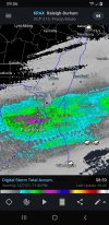
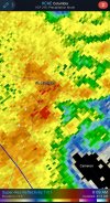
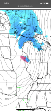
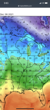
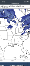
No… the week of Valentines had 2 separate storms… CLT actually recorded snowfall 5 consecutive days that week including 3 straight days with at least an inch of snow… there was a lot sleet as well. MBY ended up with 11.4 inches total for the two storms which is exactly 0.1” more than I’ve had in the nearly 8 years since.Was that a blowtorch ? I dint remember
-
Hello, please take a minute to check out our awesome content, contributed by the wonderful members of our community. We hope you'll add your own thoughts and opinions by making a free account!
You are using an out of date browser. It may not display this or other websites correctly.
You should upgrade or use an alternative browser.
You should upgrade or use an alternative browser.
Pattern December to Remember
- Thread starter SD
- Start date
D
Deleted member 1449
Guest
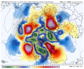
My good buddy MFD doing some work...offering some hope.
Looks to be around 0.56 here today so far; nice!
lj0109
Member
I got flooded with .12". Kidding aside that is twice what the NWS grid had for me.
Shaggy
Member
Definitely an over performer. Rained like crazy the last 2 hours
My good buddy MFD doing some work...offering some hope.
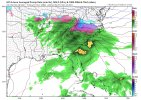
If all of these teleconnections materialize like they are and we’re roaming in the phase 7 towards phase 8 MJO … man oh man I can smell the Miller B we could get outta this pattern. I’m impatient but it almost looks fool proof I’m glad we’re at-least seeing fantasy storms a little more frequently
I got a solid .5 .. right on target .. the ground is gasping for more
LickWx
Member
Did you just say an hour 384 storm looks almost fool proof ? Just when I thought I’ve seen it all .If all of these teleconnections materialize like they are and we’re roaming in the phase 7 towards phase 8 MJO … man oh man I can smell the Miller B we could get outta this pattern. I’m impatient but it almost looks fool proof I’m glad we’re at-least seeing fantasy storms a little more frequently View attachment 97188
No. That pic was just for the fantasy storm comment. I said a period of time where all the teleconnections are in the right place along with a higher amp phase 7-8 is almost fools proof way to get something. But there’s plenty of fools in the SE me included so it’s not saying muchDid you just say an hour 384 storm looks almost fool proof ? Just when I thought I’ve seen it all .
Itll be interesting to see how close these runs of the gfs are come verification time. It seems like it's latched on to a system in that time period over the last few runs but with wildly varying results. I'd be impressed if it just had the timing of the system right 16 days out much less snow/ice/rainIf all of these teleconnections materialize like they are and we’re roaming in the phase 7 towards phase 8 MJO … man oh man I can smell the Miller B we could get outta this pattern. I’m impatient but it almost looks fool proof I’m glad we’re at-least seeing fantasy storms a little more frequently View attachment 97188
I just hope we can manage any semblance of a pattern change before Christmas, that's asking a lot I know, but a slight cool down around that time would be nice. However, along with taxes and death, one other thing that is a certainty is models are too quick with pattern changes. Probably January before we have a real shot of wintry, unfortunately, but man I'd love to be wrongItll be interesting to see how close these runs of the gfs are come verification time. It seems like it's latched on to a system in that time period over the last few runs but with wildly varying results. I'd be impressed if it just had the timing of the system right 16 days out much less snow/ice/rain
Agreed. Even if we could just beat the SER back enough to get some mid-upper 50s and lows around freezing for the week leading into Christmas that would work for me.I just hope we can manage any semblance of a pattern change before Christmas, that's asking a lot I know, but a slight cool down around that time would be nice. However, along with taxes and death, one other thing that is a certainty is models are too quick with pattern changes. Probably January before we have a real shot of wintry, unfortunately, but man I'd love to be wrong
smast16
Member
My wife said she wasn't going running this AM because it was going to rain on her. I had to inform her that wasn't the case.Me, too. A big old 0.00” when I woke up. I’m on 25 straight days without any measurable rain.
Cary_Snow95
Member
This is basically verbatim what the CFS shows. We moderate near normal the week of Christmas. Then we torch a bit after Christmas. Then around 1/5 the hammer dropsAgreed. Even if we could just beat the SER back enough to get some mid-upper 50s and lows around freezing for the week leading into Christmas that would work for me.
The areas that missed the rain are the typical bread winners of cad and winter weather in general. Almost like they are saving the dry air for the big Miller b. Wilkes-Surry-Mtns-Yadkin-Winston. Food for thought
Webberweather53
Meteorologist
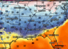
I thought upper 30s CAD wasn’t going to verify … it’s down right COLD out there .. have more time to warm up and we will probably go lower 40s but still! I was stoned for thinking this cold wedge was possibleCurrent TempsView attachment 97192
LickWx
Member
You said yesterday it was gon be 30s lol. 45 today is my prediction .I thought upper 30s CAD wasn’t going to verify … it’s down right COLD out there .. have more time to warm up and we will probably go lower 40s but still! I was stoned for thinking this cold wedge was possible
Yeah not sure how much low cloudiness is going to be trapped but clearing is getting into the foothills now. May have just enough sun late to get up to 45-50 but we will see. Either way today is 100% a winter look/feel outsideI thought upper 30s CAD wasn’t going to verify … it’s down right COLD out there .. have more time to warm up and we will probably go lower 40s but still! I was stoned for thinking this cold wedge was possible
NBAcentel
Member
My good buddy MFD doing some work...offering some hope.
Hope NE weenies realize that a -EPO/-NAO means suppression to the SE
Yeah, low clouds/fog/drizzle seems to be setting in atm, very wedgy out. Going to be close I thinkYeah not sure how much low cloudiness is going to be trapped but clearing is getting into the foothills now. May have just enough sun late to get up to 45-50 but we will see. Either way today is 100% a winter look/feel outside
iGRXY
Member
If we can moderate the week of Christmas or potentially get a CAD look to appear that would be great for the holiday. Christmas just doesn't feel like Christmas if we are in the 60's and 70's.
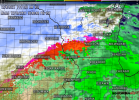
I know! Nothing but backend flurries for me on Friday night! ? I’ve been watching all week, GFS has been pretty consistent with this track, I need a SE trend in the worst way! I think NAMs are coming in a little South of GFS, I thought I was never gonna have to worry about rain /mix line again! 2 counties to my N, are already under winter storm watch!When you escape the SE but can't escape the rain snow line @Tarheel1 View attachment 97195
iGRXY
Member
Will say that the 6Z GFS and GEFS had us in the upper 40's low 50's for the week of Christmas so hopefully that becomes sustainable on the models.If we can moderate the week of Christmas or potentially get a CAD look to appear that would be great for the holiday. Christmas just doesn't feel like Christmas if we are in the 60's and 70's.
NBAcentel
Member
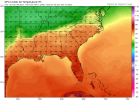
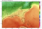
Boxed SERs are the warmest SERsClassic boxed in SER View attachment 97196
Yeah wedge sneaks in on the gfs right after that image but in that look that's expected. Still like you said when you bound the entire region by fronts we warm, raise dews, and stay warm at nightBoxed SERs are the warmest SERs
SouthSideYankee
Member
Chilly 45° here today. Feels like winter.
Eventually taken over by the CAD creatorClassic boxed in SER View attachment 97196
NBAcentel
Member
iGRXY
Member
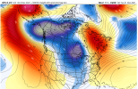
GFS really getting a -NAO look Christmas week. Can see the hammer of cold air pushing SE but it's already in the lower 50's for highs.
iGRXY
Member
One thing about this pattern is although we have a SER, as we start progressing into a pattern change which looks like the week of Christmas is when you're seeing the pieces come together, it starts to progress into a -NAO. Luckily for us east of the mountains when this starts happening you see a lot of CAD which is what keeps us in the upper 40's and lower 50's. You stay above average because the lows and highs are roughly within a few degrees of each other but you don't torch either.

NBAcentel
Member
Sky is clearing out
smast16
Member
There is nothing about that image that excites me. Especially if you go look at 250 Mb winds. Yikes

