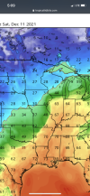
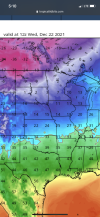
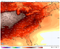
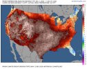
43 here and I’ve been saying low 40s are what is expectedFirst, it was supposedly going to be 30s, then low 40s at best, now its 45 and not done climbing. @NickyBGuarantee bro you are on a roll!
-
Hello, please take a minute to check out our awesome content, contributed by the wonderful members of our community. We hope you'll add your own thoughts and opinions by making a free account!
You are using an out of date browser. It may not display this or other websites correctly.
You should upgrade or use an alternative browser.
You should upgrade or use an alternative browser.
Pattern December to Remember
- Thread starter SD
- Start date
Cary_Snow95
Member
The sun is about to pop over there. It’s legit blue skies in morrisville. Warming quick43 here and I’ve been saying low 40s are what is expected
Cary_Snow95
Member
Still chilly here. I’ll believe all this heat when I feel it on the back of my neck.
LickWx
Member
Saw a bit of sky here in Zebulon. Even see the sun through a hole in the clouds.
Looking at the sun through these clouds is so cool don’t even feel it in the eyeballsSaw a bit of sky here in Zebulon. Even see the sun through a hole in the clouds.
Cary_Snow95
Member
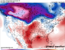
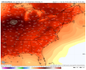
Think my normal low is 11 or so, that would be impressive anomalies! ??View attachment 97222
Very realistic time table. Multiple SER events then the big outbreak early January
LickWx
Member
Bruh y’all are anxious ! We got hour 636 maps out here lol.View attachment 97222
Very realistic time table. Multiple SER events then the big outbreak early January
pcbjr
Member
smast16
Member
Euro is worse.Welp, there goes this weekends rains.... 0.00" for today and i'm not holding my breath for Sat night anymore either.
View attachment 97209
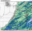
#fail.
These troughs are coming in too positive and we're getting rain shadowed to death from the mtns.
D
Deleted member 609
Guest
Hey, in 500 hours it will only be 612 hours away.Bruh y’all are anxious ! We got hour 636 maps out here lol.
- Joined
- Jan 5, 2017
- Messages
- 3,779
- Reaction score
- 5,990
Stuff that. My normal low is around 35 so that would be close to 0 for me. I don't want that.Bruh y’all are anxious ! We got hour 636 maps out here lol.
Got some decent rain this morning. Not sure how much but it’s still puddled up in the yard and in my driveway.
L
Logan Is An Idiot 02
Guest
Meh. Short livedHere she comes.....View attachment 97230
Here she comes.....View attachment 97230
It’s a start. Set back and enjoy the ride.Meh. Short lived
LukeBarrette
im north of 90% of people on here so yeah
Meteorology Student
Member
2024 Supporter
2017-2023 Supporter
18z GFS says the dumping out west never ends
Cary_Snow95
Member
With this type of evolution you’re gonna see a short lived cold shot followed by a ser before we get into a settled cold patternMeh. Short lived
ATLwxfan
Member
You have to wonder about pattern persistence here. Setting up to be a tough cycle to break.
Sent from my iPhone using Tapatalk
Sent from my iPhone using Tapatalk
LickWx
Member
High of 48. So not only was Nicky wrong , but so was I! I said mid 40s not upper !
Cary_Snow95
Member
18z GEFS favors a western dump that fires up the ser around Christmas
36/36 mega frost watch
Cary_Snow95
Member
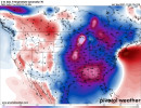
GFS finally showing this bad boy again .. only a matter of time before it takes over our pattern.. is it before Christmas? The day of? January 1-10? All would be fine with me!View attachment 97233
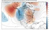
It’ll be early to mid January imo
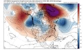
This is December 22 and you can see the pieces trying to come together overtop … I would say December 27-January 3rd is our flip periodView attachment 97235
It’ll be early to mid January imo
Cary_Snow95
Member
If you go verbatim off of modeling. In the past modeling almost always rushes pattern changes, I don’t see this being any different. We will have multiple ser flare ups late month as the western trough keeps getting dumped. Honestly though if this sets up by mid to late January I’m more than giddy. Basically prime climoThis is December 22 and you can see the pieces trying to come together overtop … I would say December 27-January 3rd is our flip period
NBAcentel
Member
Webberweather53
Meteorologist
StormWatch
Member
Are you talking about the Greenland block, the mega -NAO? Greenland block won't necessarily mess up the pattern across the Eastern US. A -NAO is typically a good thing for production of cold/winter storms. I know it's the long range GFS, but I can actually agree with that - because I mentioned that blocking can go towards Greenland and poleward as troughs forces the blocking from the upcoming cutting storms. The colder pattern between the 17th - 22nd is still a go!GFS finally showing this bad boy again .. only a matter of time before it takes over our pattern.. is it before Christmas? The day of? January 1-10? All would be fine with me!View attachment 97233
I see nothing to lead me to believe there will be any pattern change between the 17th and 22nd. Doesn't matter how hard you look it's not there. If the MJO progression is actually correct then maybe by the 1st week in January.Are you talking about the Greenland block, the mega -NAO? Greenland block won't necessarily mess up the pattern across the Eastern US. A -NAO is typically a good thing for production of cold/winter storms. I know it's the long range GFS, but I can actually agree with that - because I mentioned that blocking can go towards Greenland and poleward as troughs forces the blocking from the upcoming cutting storms. The colder pattern between the 17th - 22nd is still a go!
NBAcentel
Member
17-22th is way to earlyAre you talking about the Greenland block, the mega -NAO? Greenland block won't necessarily mess up the pattern across the Eastern US. A -NAO is typically a good thing for production of cold/winter storms. I know it's the long range GFS, but I can actually agree with that - because I mentioned that blocking can go towards Greenland and poleward as troughs forces the blocking from the upcoming cutting storms. The colder pattern between the 17th - 22nd is still a go!
Cary_Snow95
Member
He must’ve meant of January ?17-22th is way to early
Agreed. While I do think it’s important that models are starting to pick up on changes, I don’t think we’ll see cold pattern dominate in the east until sometime in the first week of January. That’s not to so that we won’t see some quick hitting cool shots between now and then, but we should definitely see some warm days too the last week of the monthI see nothing to lead me to believe there will be any pattern change between the 17th and 22nd. Doesn't matter how hard you look it's not there. If the MJO progression is actually correct then maybe by the 1st week in January.
BelmontWX79
Member
By "colder" you mean from mega torch to just kinda torchy.Are you talking about the Greenland block, the mega -NAO? Greenland block won't necessarily mess up the pattern across the Eastern US. A -NAO is typically a good thing for production of cold/winter storms. I know it's the long range GFS, but I can actually agree with that - because I mentioned that blocking can go towards Greenland and poleward as troughs forces the blocking from the upcoming cutting storms. The colder pattern between the 17th - 22nd is still a go!
GeorgiaGirl
Member
18z GEFS favors a western dump that fires up the ser around Christmas
Welp, I tried to reverse jinx it, but my attempt seems as if it's going to not work.
Feels as if we made a deal with the devil with 12/25-26/2010, as it seems like most, if not all of the Decembers since then have torched.
If so, I have no regrets.
ATLwxfan
Member
I could see us going into that painful period of cold plunging to the western gulf and stalling west of the Mississippi while the ridge flares to the East. The all too familiar set up.
Sent from my iPhone using Tapatalk
Sent from my iPhone using Tapatalk

