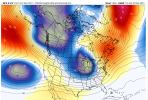
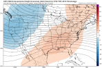
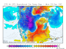
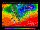
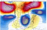
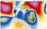
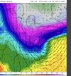
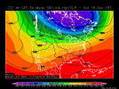
Although this may not look appetizing it’s certainly what you want to see to head towards that pattern change that blocking poleward is sending that cold air south and eventually that air has to go somewhere and I’m assuming we get some CAD to show up nicely for the Christmas week time period .. still too early for any details though but you have to live this large scale evolution over top of usEverything way out can certainly change, but even though stuff may be changing up top, to me it looks the same for the SE as far as the eye can see. The Pacific ridge is still too far west and needs to scoot further east and poleward hopefully. Get the PNA at least neutral and stop the dump out west.
Good to see more red showing up on the top of the world, but hoping it gets in a better configuration for the SE the following week. Maybe this is the start. ??

-
Hello, please take a minute to check out our awesome content, contributed by the wonderful members of our community. We hope you'll add your own thoughts and opinions by making a free account!
You are using an out of date browser. It may not display this or other websites correctly.
You should upgrade or use an alternative browser.
You should upgrade or use an alternative browser.
Pattern December to Remember
- Thread starter SD
- Start date
NBAcentel
Member
Tomorrow afternoon smells like elevated thunderstorms on top the wedge with 850mb WAA and 7Cmidlevel lapse rates
Webberweather53
Meteorologist
Definitely an equivalent barotropic look to the troposphere-stratosphere around this time over Canada, i.e. those stratosphere anomalies will tend to be more directly coupled to the troposphere.
Cary_Snow95
Member
Cary_Snow95
Member
This guy is right - NEVER! I’m glad he’s saying this! He is the Randy Mulkey of meteorologists!
Yeah. Judah predictions don’t scare me. But if he’s right it’s gonna hurt..This guy is right - NEVER! I’m glad he’s saying this! He is the Randy Mulkey of meteorologists!
It’s early but I just want to note that every winter lately it just seems we just can’t sustain a favorable PNA. Annual snow in Seattle is getting old
I know it's the ICON but it looked fairly wedgy with no real torch (especially the CAD regions) for next 7 days.
Stephenb888
Member
Which model was correct at predicting the overall pattern/temps of November? And by that I mean before November even started which one was the best at getting it right?
Cary_Snow95
Member
Edit: Just went back and looked, it dropped to 25.9 just before sun up27 and monster mega frost this morning, wen torch?!
Cary_Snow95
Member
iGRXY
Member
Although the H5 pattern looks abysmal for the next 10-15 days, the saving grace is that with all this ridging on the east coast we are susceptible to CAD. Which I think has a high likelihood of happening. I think we will see our fair share cold and cloudy lower 50 degree days. In fact I think that we will see more of that type of weather than we will of a bunch of upper 60's and lower 70 degree days. This week is a prime example of that. 10-15 days ago this time period was looking very warm and it quickly turned into a CAD dominated week.I know it's the ICON but it looked fairly wedgy with no real torch (especially the CAD regions) for next 7 days.
Stephenb888
Member
But when are we gonna get our winter weather chances?!Although the H5 pattern looks abysmal for the next 10-15 days, the saving grace is that with all this ridging on the east coast we are susceptible to CAD. Which I think has a high likelihood of happening. I think we will see our fair share cold and cloudy lower 50 degree days. In fact I think that we will see more of that type of weather than we will of a bunch of upper 60's and lower 70 degree days. This week is a prime example of that. 10-15 days ago this time period was looking very warm and it quickly turned into a CAD dominated week.
L
Logan Is An Idiot 02
Guest
Not anytime soon.But when are we gonna get our winter weather chances?!
iGRXY
Member
Early January is looking like the best time period. December snows are great but it is still relatively early for us to get winter weather at least around these parts in a relatively good pattern, but we are in an awful one right now. MJO is going to favorable phases and you're starting to see long range guidance take our current SER and progress it into a -NAO with heights building across Alaska. That maybe enough to get a good winter storm at least in the upper southeast. If you can build a +PNA with the -NAO, then I would almost guarantee we would see some type of winter weather event.But when are we gonna get our winter weather chances?!
Avalanche
Member
Darn you remember the Mulkeys. They got their butt beat every weekend in the NWA back in the 80s.This guy is right - NEVER! I’m glad he’s saying this! He is the Randy Mulkey of meteorologists!
30F was the low at KSPA, not bad
Well now


Goodness the GFS has 30-40F drops in Kansas/Nebraska in six hours
iGRXY
Member
I think the GFS is about to deliver the goods potentially with heights really building over Alaska and Greenland
iGRXY
Member
Hour 280 guys, hour 280.
Probably some severe prior to that arctic front, but maybe just maybe this is the pattern change so desperately wanted.
AK starts to thaw, that's what we need


Avalanche
Member
Get that ridge to pump just a tad northward.AK starts to thaw, that's what we need

iGRXY
Member
Although, I think the GFS is probably a week early with what it's showing, this is definitely what a favorable MJO and blocking over top can look like. This is a true artic airmass that flies in.
iGRXY
Member
Definitely some severe weather with that front as well. Those in Central and eastern Georgia and the eastern Carolinas will probably go through 3 different seasons in about a span of 12 hours. further west we hold onto the CAD until we warm into the low 60's that morning before being in the 40's by lunch.
NBAcentel
Member
I’m not a fan of the -PNA, but it can offer a better chance of precipitation, of course the trade off is often WAA, so if we keep the -PNA then Miller Bs will probably become something to watch if we settle into that pattern in early jan
iGRXY
Member
I remember the cold push in December 2017 (also Niña) (pretty sure this was the year). Record cold for major US cities on New Year’s Eve. I even got flurries on New Years night here. Big SER was showing up on modeling and the cold push through the middle of the country eventually wiped it out and we were well below normal for several weeks.
Blue_Ridge_Escarpment
Member
That’s how the frost looked here this morning.NAM was all over this one! Just now outside at work, sorry , I won’t be able to take pictures of the chair! ?View attachment 97277
Yeah I remember that winter... Everybody kept saying it was going to get warm and That kept getting pushed off.I remember the cold push in December 2017 (also Niña) (pretty sure this was the year). Record cold for major US cities on New Year’s Eve. I even got flurries on New Years night here. Big SER was showing up on modeling and the cold push through the middle of the country eventually wiped it out and we were well below normal for several weeks.
StormWatch
Member
I don't beleive there would be a strong +PNA signature, going with more of a continuous slight -PNA/netrual or even a weak +PNA at times. The blocking over the North Pacific would be stationary, but meandering, fluctuating the PNA.You can see the GFS is looking like it's wanting to try again but we really need to get that upper low out of NW Canada and Alaska to really start pumping heights up the west coast. But that -NAO is something fierce.
View attachment 97294
iGRXY
Member
This is what we end with. Out west looks bad again but we are starting to build another -NAO and another lobe of cold air is pushing SE. One thing that is really starting to appear is a ton of CAD field days showing up in between the cold and is really moderating the SER at least east of the mountains.
