• Hello, please take a minute to check out our awesome content, contributed by the wonderful members of our community. We hope you'll add your own thoughts and opinions by making a free account!

Pattern December to Remember

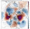
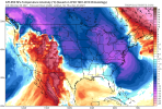
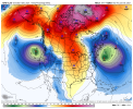
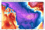
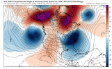
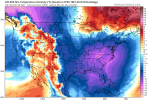
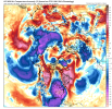
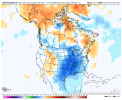
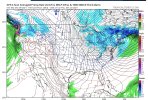
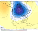
Eps alternates cool/warm through D8 then a short torch/SER followed by a quick brief cool off then it goes mega torch to end out the run. Might be a little more support for a -NAO/EPO as you get past D10 and really out to 2 weeks but meh noise and it still wasn't pretty

I looked at the mjo charts and one will be right one will be wrong. All it takes is one winter storm to get our averages here. Interesting model volatility still. All we have is optimism right now. Dont look anything will avoid us torching for a while, but the million dollar question is for how long? If the warm phases typically are 4-6, how can the mjo get to phase 7, which is usually cooler? We really don't want it stuck in warm phases all winter. SD, I guess we have a ways to go still? Lol
 
Last edited:
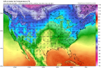
acttemp_1280x720.jpg
Just ridiculous....
 
I looked at the mjo charts and one will be right one will be wrong. All it takes is one winter storm to get our averages here. Interesting model volatility still. All we have is optimism right now. Dont look anything will avoid us torching for a while, but the million dollar question is for how long? If the warm phases typically are 4-6, how can the mjo get to phase 7, which is usually cooler? We really don't want it stuck in warm phases all winter. SD, I guess we have a ways to go still? Lol
P7 isn't bad as a NDJ phase it can get the SER a little excited in DEC but not much. This post by webb yesterday describes our issues with the mjo.
Destructive interference between the MJO and ENSO will make the favorable, cooler MJO phases harder to come by and less amplified for the time being, the one benefit of being in a neutral ENSO state or El Nino is that Pacific-W Hem MJO is more frequent + stronger. In the long run, we'll need to dislodge the MJO from the Maritime Continent-West Pacific to avoid getting consistently torched in mid-late winter, not entirely sure if that's going to happen this year.
 
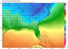
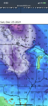
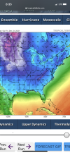
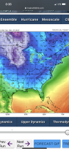
60s all the way into Montana close to the Canadian border.

The chinook/Foehn wind on the lee (eastern) side of the Rockies is mostly responsible for that. Even simply having just a strong westerly wind can cause temperatures to warm several tens of degrees in a matter of a few hours downwind of the Rockies from Alberta to Colorado. Compressional warming is mainly driving this phenomena and can also cause even the deepest snow pack to sublimate/melt rather quickly in those areas. For ex, it's not totally unheard of for places as far north as Calgary to not have snow on the ground in the middle of winter as result of this Foehn wind.
 
The chinook/Foehn wind on the lee (eastern) side of the Rockies is mostly responsible for that. Even simply having just a strong westerly wind can cause temperatures to warm several tens of degrees in a matter of a few hours downwind of the Rockies from Alberta to Colorado. Compressional warming is mainly driving this phenomena and can also cause even the deepest snow pack to sublimate/melt rather quickly in those areas. For ex, it's not totally unheard of for places as far north as Calgary to not have snow on the ground in the middle of winter as result of this Foehn wind.

Webber, how can we dislodge the mjo from the warm phases during mid-late winter so we dont blowtorch all winter? I think that's a viable question. Will it take a SSW event of epic proportions, pdo to weaken, nina to weaken? Just trying to get some clarity. Looks like we are already blowtorching for this time of year lol. Also, I believe we are in an east based niña currently and -qbo regime. If the winter is warm, we have to accept it but it takes one storm to make our winter, especially in the south?
 
The chinook/Foehn wind on the lee (eastern) side of the Rockies is mostly responsible for that. Even simply having just a strong westerly wind can cause temperatures to warm several tens of degrees in a matter of a few hours downwind of the Rockies from Alberta to Colorado. Compressional warming is mainly driving this phenomena and can also cause even the deepest snow pack to sublimate/melt rather quickly in those areas. For ex, it's not totally unheard of for places as far north as Calgary to not have snow on the ground in the middle of winter as result of this Foehn wind.
I’ve actually seen this happen first hand once on a trip Montana. Went from low 20s and an 8 inch snowpack to low 70s in the afternoon and snow cover gone by 5pm. It literally experiencing 3 seasons in one day.
 
Hour 324? May as well flip a coin. Heads trough west, tails ECT.

My, my such Debbie Downers for day one of winter.

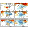
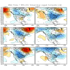
Not really a coin toss/guess in this case. Ensemble mean patterns are the only thing of value at this range and that's why it was worth posting over an operational run which has zero value beyond day 7-10. Also, as mentioned earlier, this pattern is entirely consistent with what you expect during West Pacific MJO events in December (usually very warm). These MJO events are one of the few phenomena that lend itself to some predictability this far out, because they evolve over periods of weeks, sometimes a month or two (not days as do synoptic weather systems).
 
Can kind of make out 2 quasi-distinct MJO waves in the Western Pacific in both the analysis + forecast fields through Dec 10 on the CFSv2. The first wave is north of the equator in the NW Pacific, having already developed a few days ago, whereas the second wave forms out of the South Pacific Convergence Zone (SPCZ) in a more classic manner for this time of the year, which is a big reason why you see models like the EPS showing the MJO completing a loop-de-loop in phase 6 through mid-month.

The GFS & CFS try to push the wave out into the Central pacific by the 3rd week of the month, but these models have a habit of progressing MJO waves far too quickly across the Maritime Continent & Western Pacific and I think they're a bit fast once again (& thus too fast w/ the pattern change away from the SE US ridge thereafter). Furthermore, the La Nina will help decelerate this MJO wave as the advection by the background flow (i.e. westerly jet stream) is weaker than usual, and enhanced convection underneath the ENSO standing wave over the Maritime continent will favor increasing amplitude of the MJO (again favoring even more warmth in the east-central US mid-month), which augments the downstream planetary wave pattern, also helping to slow the wave down (as those waves obtain higher amplitudes and tend to retrogress westward in the means). All of this points to an extended warm-up that could last through the 3rd week of the month (dec 14-21) and while we're talking pretty far out, confidence is higher than usual in the outlook during week 2 & may grow more w/ time for later week 2 outlooks once the models initialize a more amplified MJO wave. (which is supported by literature)

chi200.cfs.all.global.3.png
 
Back
Top